Flash flooding hits roads near Lake Alice in Jim Wells County
Water covered roads near Lake Alice as a flash flood warning sent heavy-rain alerts across northern Jim Wells County, with more rain possible through midday.

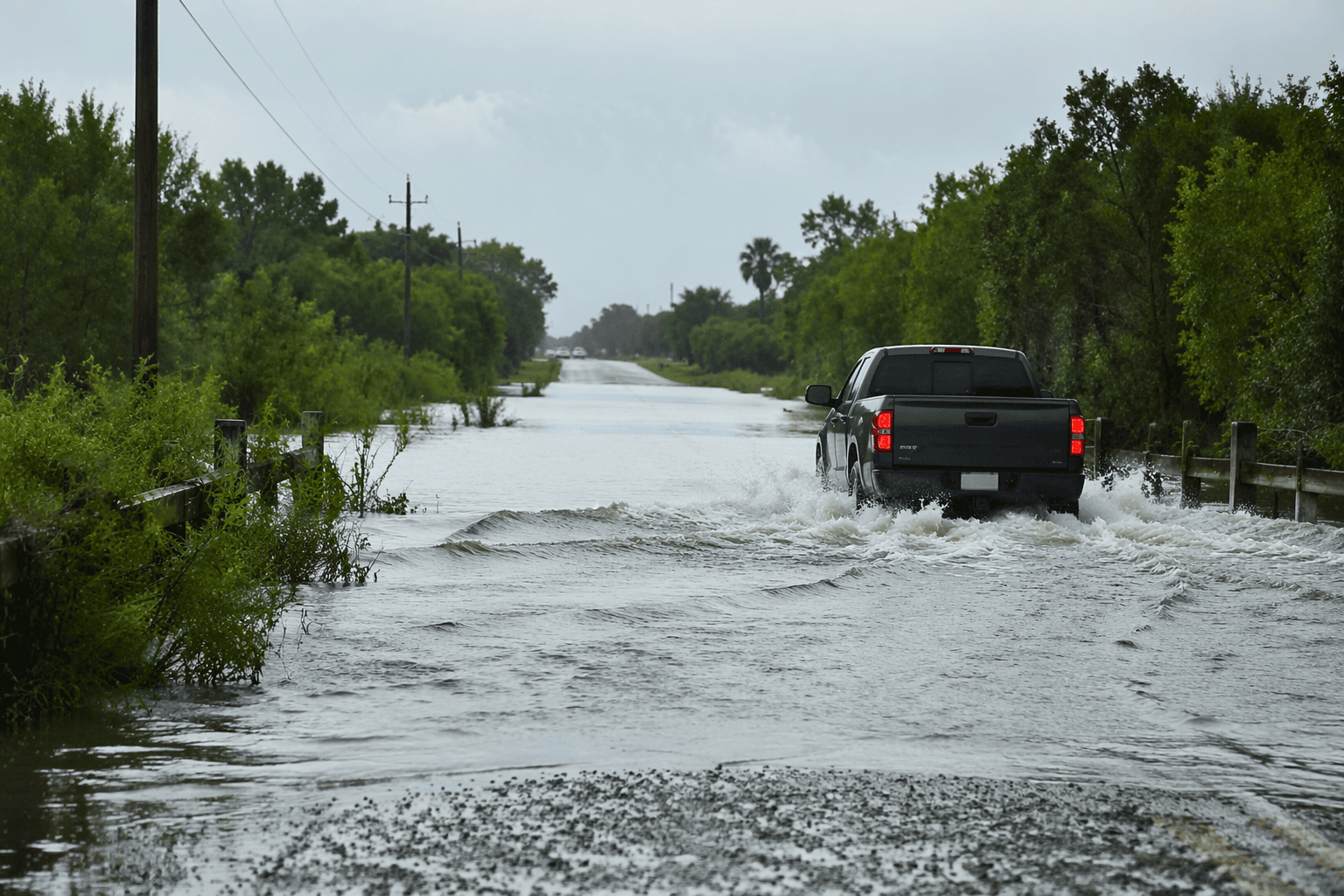
Water covered roads near Lake Alice before midmorning Tuesday as Jim Wells County law enforcement and weather monitors tracked a fast-moving flash flood threat across northern Jim Wells County. The National Weather Service in Corpus Christi warned that thunderstorms had already dropped 2 to 3 inches of rain in the area and could add 1 to 2 more inches before the warning expired at 12:30 p.m. The alert covered Lake Alice, Alice and nearby communities where low-lying streets, underpasses and small creeks could flood quickly.
The warning, issued at 9:27 a.m. CDT on June 16, extended across northern Jim Wells County, northwestern Kleberg County and northwestern Nueces County. The weather service said Doppler radar and automated rain gauges showed heavy rain falling over the warned area, with flash flooding possible along highways, streets and other poor-drainage spots in addition to small creeks and streams. Lake Alice, Orange Grove, Midway, Alfred, Alfred-South La Paloma, Tecalote, Westdale, Alice Acres, Ben Bolt and Sandia were all named as locations that could see flooding.
The broader forecast picture remained unsettled across South Texas. The Corpus Christi forecast office said the region stayed under a Flood Watch through Thursday morning because a moist tropical airmass, a stalling front, daily seabreeze circulations and low pressure over northeastern Mexico were combining to fuel repeated heavy rain. The office said rainfall totals of generally 1 to 2 inches were possible, with isolated pockets of 3 to 6 inches and rain rates of 2 to 4 inches per hour, and later identified a Moderate Risk of excessive rainfall for much of the Coastal Bend/Victoria Crossroads.
At Corpus Christi International Airport, observations showed repeated rain and thunderstorms overnight into the morning of June 16, with measurable precipitation continuing through the morning. That came after an especially wet June 15, when the airport recorded 1.79 inches of rain, far above the June 15 normal of 0.11 inch.
For Jim Wells County, the immediate concern was keeping roads near Lake Alice passable enough for work, deliveries and emergency access while the storm band remained parked over the area. The larger accountability test is whether county and drainage officials have done enough to reduce flooding on the same low-lying routes that flash flood warnings continue to target.
This article was produced by Prism’s automated news system from verified source data, official records, and press releases, then run through automated quality and moderation checks before publishing. The system is built and supervised by the people who set the standards it runs under. Read our full AI policy.
Know something we missed? Have a correction or additional information?
Submit a Tip
