Jim Wells County creeks reveal the landscape’s hidden map
Heavy rain in Jim Wells County follows creek lines from Orange Grove to Premont, showing where runoff, flood risk and drainage planning really start.
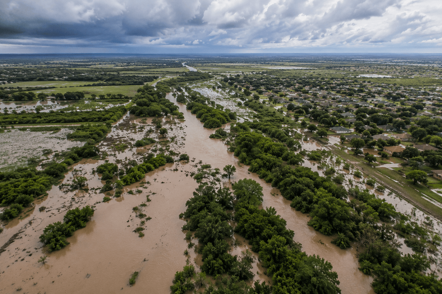
Named creeks rising near Orange Grove, Palito Blanco and Premont carry Jim Wells County runoff toward Nueces County and the lower Coastal Bend. For drivers, ranchers and planners, those channels mark where water moves first and where trouble can build fastest.
The county’s drainage pattern starts with named places
Quinta Creek gives the clearest local map. The creek rises three miles northwest of Orange Grove in northeastern Jim Wells County at 27°59' N, 97°58' W, then runs southeast for 16 miles until it reaches Agua Dulce Creek six miles northwest of Banquete in Nueces County. That path shows how water from the Orange Grove side of the county does not stay put, it drains outward through a defined route that can shape runoff, ditch flow and low-lying crossings.
Escondido Creek, also known as Sancito Creek, rises two miles south of Palito Blanco in western Jim Wells County. Paisano Creek rises four miles southeast of Premont in southeastern Jim Wells County and runs southeast toward Nueces County. Taken together, those creeks show that the county’s drainage is broken into distinct zones, each tied to a different community, different ranchland and different runoff direction.
Why these creeks matter when the rain comes hard
When the ground is saturated, water follows these channels. In May 2015, many places across Texas received well above-normal rainfall, and the Coastal Bend Disaster & Recovery Group’s report on the 2015 Jim Wells and Nueces flood states that saturated soil forced runoff directly into rivers, streams and flash-flood-prone areas in western Nueces and Jim Wells counties during Memorial Day weekend. That is the kind of pattern that turns a local shower into a countywide travel problem.
Homes, ranch roads and pastureland near these drainage lines face different exposure depending on whether water is moving toward Orange Grove, Palito Blanco or Premont, or draining onward into Nueces County. In a county where rain can funnel quickly into narrow channels, the distance between a safe fenceline and a flooded low-water crossing can be measured in a few miles, not a few towns.
San Fernando Creek shows how smaller channels combine
San Fernando Creek is formed by the confluence of Chiltipin and San Diego creeks one mile northeast of where those waters meet. Smaller channels merge into larger drainage systems, turning a set of local flows into a broader downstream corridor. When two creeks combine, runoff from different parts of the county can reach the same channel faster and with more force.
The Texas Almanac map of Jim Wells County places those water corridors beside the county’s communities, including Alice, Ben Bolt, Orange Grove, Palito Blanco, Premont, San Diego and Sandia. It shows the county as a network, not a blank field. Alice may be the county seat, but the water system reaches far beyond it, linking smaller settlements and ranch country through drainage lines that do not follow precinct lines or road names.
A practical planning issue, not just a historical one
Jim Wells County’s population was estimated at 38,886 by the U.S. Census Bureau on July 1, 2024, and that population depends on drainage systems that keep roads passable and land usable after heavy rain. The county’s Flood Damage Prevention Court Order cites Texas Water Code Section 16.315, which delegates responsibility to local governmental units to adopt regulations designed to minimize flood losses.
The county’s Safety Department lists Emede Gonzalez as OSSF DR/Safety Officer and gives the office address as 601 E. Main St., Ste. 275, Alice, Texas 78332. The Texas State Soil and Water Conservation Board lists Jim Wells County SWCD #355 at 711 E Main St in Alice.
What current spending says about the problem
Jim Wells County has already moved from map reading to repair work. The county broke ground on a flood recovery project to fix K-Bar drainage issues, a sign that flood control remains an active local task rather than a one-time emergency response. The Texas General Land Office also announced $29.7 million for historic disaster mitigation projects in Jim Wells County, reinforcing that drainage infrastructure is drawing state-level investment.
The creek names preserve Spanish and ranching heritage and serve as a working map for runoff, habitat and land use. Quinta Creek carries runoff southeast from Orange Grove, Escondido Creek drains the ground south of Palito Blanco, Paisano Creek pulls water away from the Premont side, and San Fernando Creek gathers smaller channels into one system.
This article was produced by Prism’s automated news system from verified source data, official records, and press releases, then run through automated quality and moderation checks before publishing. The system is built and supervised by the people who set the standards it runs under. Read our full AI policy.
Did this article answer your question?