Lake Corpus Christi State Park blends CCC history and brush country nature
Lake Corpus Christi State Park gives Jim Wells County families a close, low-barrier place to fish, camp, and bird-watch, while its CCC-era structures and reservoir history tie recreation to public infrastructure.
Lake Corpus Christi State Park is one of Jim Wells County’s most practical public assets because it gives families a place to fish, camp, paddle, and spend a day outdoors without leaving the county’s regional orbit. The park sits in a landscape shaped by New Deal labor, reservoir engineering, and South Texas brush country, so every visit carries both recreation and history. That mix matters most when water levels fall, upkeep lags, or state budget choices affect access, because the park is not just scenery. It is weekend space, wildlife habitat, and one of the few places where local residents can still touch the county’s waterfront identity.
A county park with New Deal roots
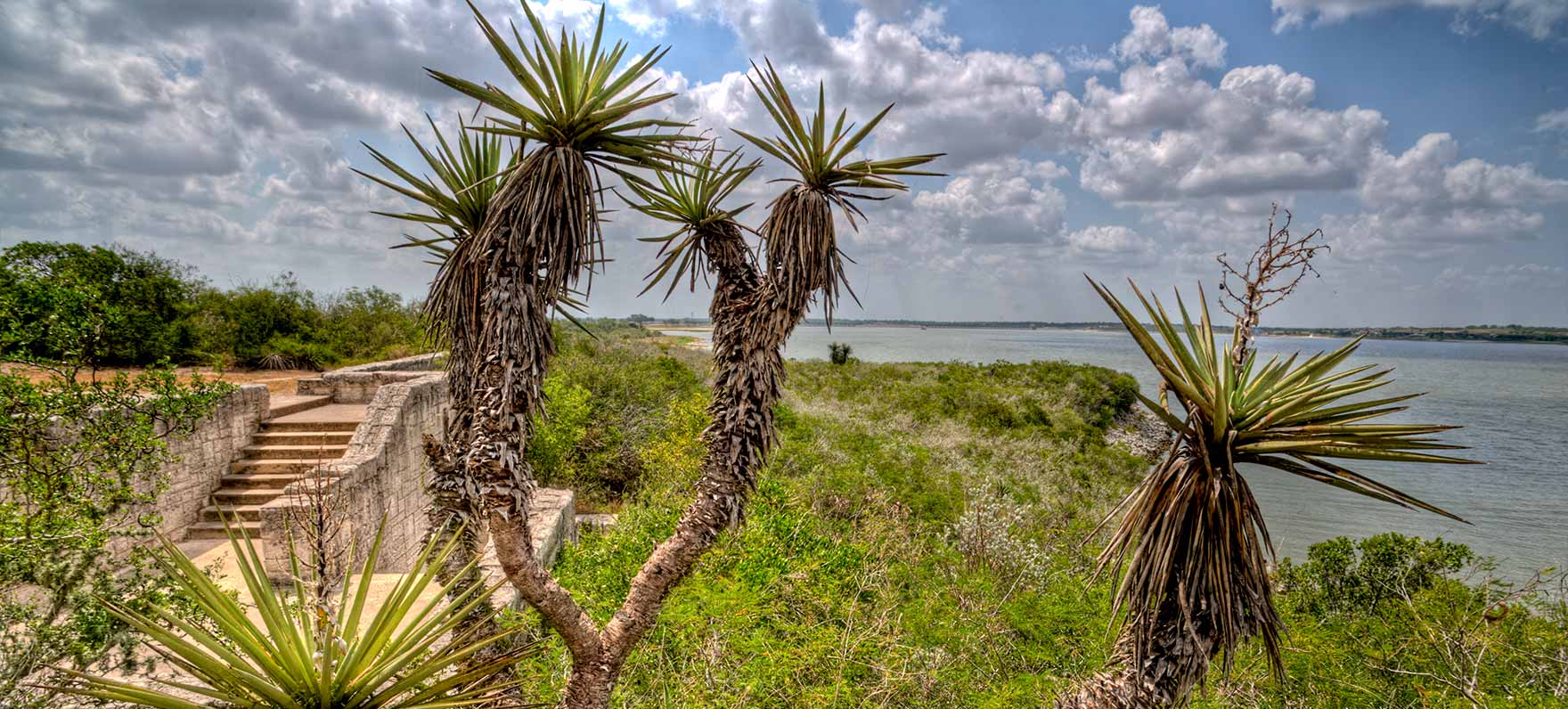
Lake Corpus Christi State Park covers 356 acres in San Patricio, Jim Wells, and Live Oak counties, southwest of Mathis. The state leased the property from the City of Corpus Christi in 1934 and opened the park later that same year, placing it squarely in the era when Texas was building public recreation with federal help. Civilian Conservation Corps Company 886 developed the park between 1934 and 1935, and the old CCC footprint still shapes what visitors see today.
The original CCC buildings included a bathhouse, a park residence, and a refectory. Only the refectory remains, which gives the site a direct architectural link to the New Deal era and to the young men who built parks across Texas while working under President Franklin D. Roosevelt’s program. More than 50,000 CCC enrollees served in Texas, and the corps developed 56 parks in the state between 1933 and 1942. That broader history places Lake Corpus Christi State Park within a statewide public-works legacy, not just a local fishing spot.
The lake behind the park tells its own story
The reservoir is known locally as Lake Corpus Christi and historically as Lake Lovenskiold. It sits on the Nueces River at the county-line meeting point of Live Oak, San Patricio, and Jim Wells counties, which helps explain why the lake has long mattered to more than one community at a time. Its backstory is tied to repeated attempts to control water in a dry region, and that history still shapes the park’s relevance when drought or sediment changes the shoreline.
The original La Fruita Dam created Lake Lovenskiold in January 1929, but the dam failed in November of that same year. Franklin D. Roosevelt’s New Deal paid to rebuild the dam in 1935, and severe siltation was already cutting into storage capacity by the 1940s. The present Wesley E. Seale Dam was completed in 1958 after years of lawsuits and delays, giving the reservoir the form local users know now.
Local and state sources describe the lake as covering about 21,000 acres with a capacity of about 300,000 acre-feet at spillway elevation. Texas Almanac lists a conservation surface area of 19,336 acres, a reminder that different sources are using different measurements or time frames. However the water is counted, the reservoir is large enough to define the park’s use patterns and to influence how much shoreline, boating room, and fishing access remain available in dry years.
What people use here day to day
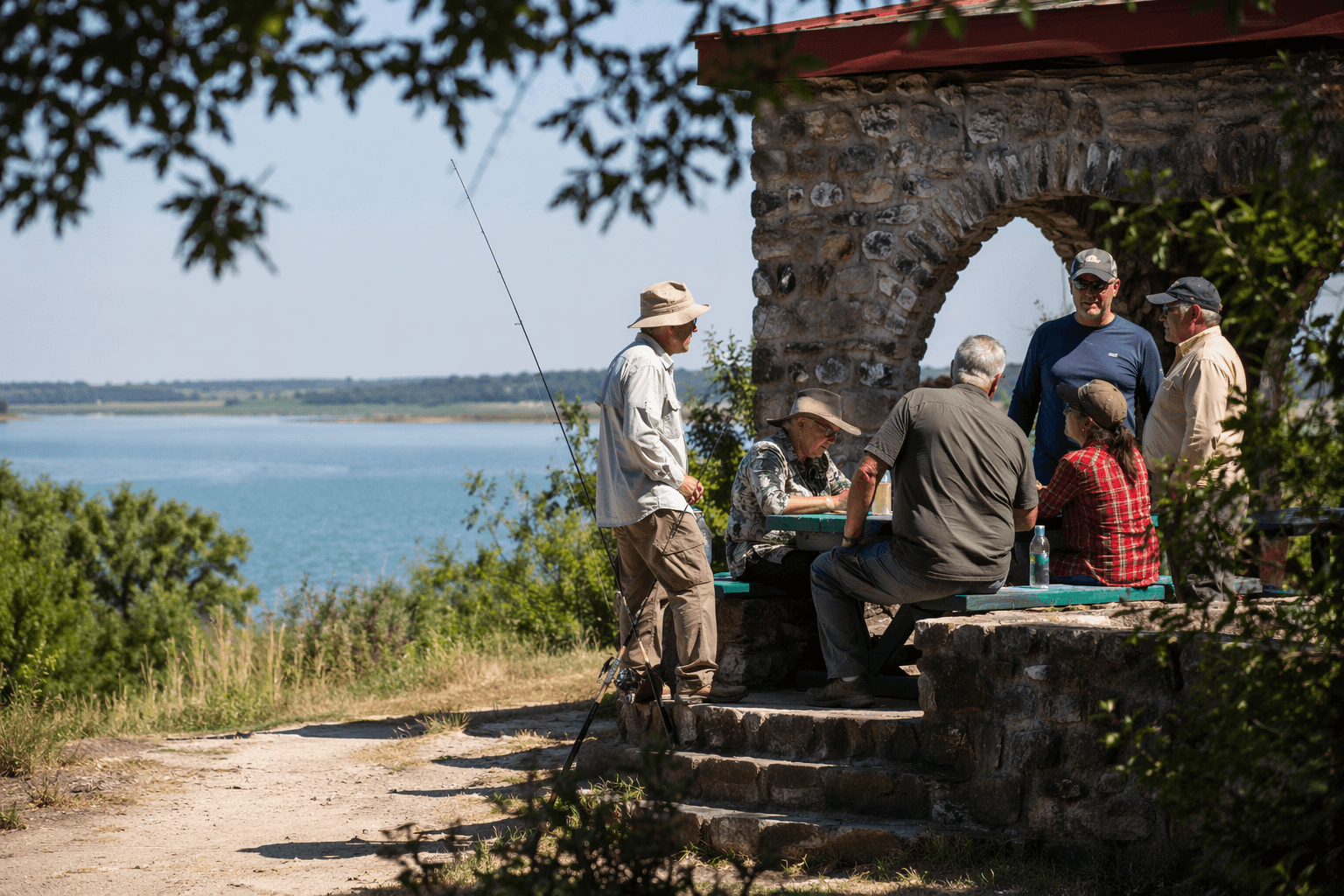
For most visitors, the park’s value is straightforward: it gives them a place to spend time outside without having to build a trip around expensive equipment or distant travel. Texas Parks & Wildlife Department lists swimming, paddling, fishing, boating, water-skiing, camping, hiking, biking, geocaching, and bird-watching among the main activities. It also offers campsites, screened shelters, cabins, pavilions, and a Junior Ranger program, making the park usable for families, school-age children, anglers, and overnight campers alike.
The fishing setup is especially important for local access. The park has two lighted fishing piers, including one that is 400 feet long and ADA-accessible. Shoreline fishing is allowed, and Texas Parks & Wildlife says no fishing license is needed to fish from shore or pier inside a state park. That detail lowers the barrier for first-time anglers, grandparents bringing children, and families who want a simple outing rather than a full boat trip.
The park also has two boat ramps, which gives boat owners a practical launch point, but it does not make boating the only way to use the lake. That matters in a county where not every household has the means to tow a trailer, maintain a boat, or spend a full day traveling for recreation. The park’s 59 campsites with water, with eight people allowed per site in the Catfish Cove and Mesquite Camping Areas, make overnight stays possible without turning the trip into a major financial commitment.
Why the ecology matters as much as the amenities
Texas Parks & Wildlife describes the park as sitting amid one of the last remaining stands of South Texas brush country, and that landscape is part of the park’s identity. The site and nearby natural areas help conserve native mesquite grassland species, so the park is doing more than hosting recreation. It is also protecting a diminishing ecosystem that supports birds, mammals, and the kind of habitat people rarely see intact once land is heavily developed.
Birding is one of the park’s strongest draws. More than 200 bird species have been recorded there, and Texas Parks & Wildlife identifies it as an important landfall for Neotropical migrant birds. Common species include pyrrhuloxia and black-throated sparrow, alongside broader wildlife such as javelina, white-tailed deer, and alligators. That mix makes the park unusually useful for wildlife viewing, but it also means families need to stay alert around water and shoreline habitat.
What Jim Wells County stands to lose if access shrinks
When the lake is healthy and the park is maintained, Jim Wells County gets more than recreation. It gets a reason for families to stay local on weekends, a destination that brings visitors through Mathis, and a public shoreline where kids can fish without a license from the bank or pier. It also gives the county a place where New Deal infrastructure and living ecology still overlap in a way that can be used, not just remembered.
If drought, maintenance shortfalls, or state funding decisions reduce fishing, camping, or day-use access, the loss will be felt in ordinary routines first. Fewer campers mean fewer people using the piers, the boat ramps, the campsites, and the nearby bait stores that serve anglers headed to the water. Fewer birds, less shoreline, and less usable public space would also weaken one of the few places where Jim Wells County families can still get a close, affordable, and historically rooted outdoor experience.
This article was produced by Prism’s automated news system from verified source data, official records, and press releases, then run through automated quality and moderation checks before publishing. The system is built and supervised by the people who set the standards it runs under. Read our full AI policy.
Did this article answer your question?