Hawaii monitors tsunami threat after 7.4 quake off Japan
Kauaʻi had no confirmed tsunami threat, but officials kept watching after a 7.4 quake sent a brief Pacific warning and minor tide changes could linger.
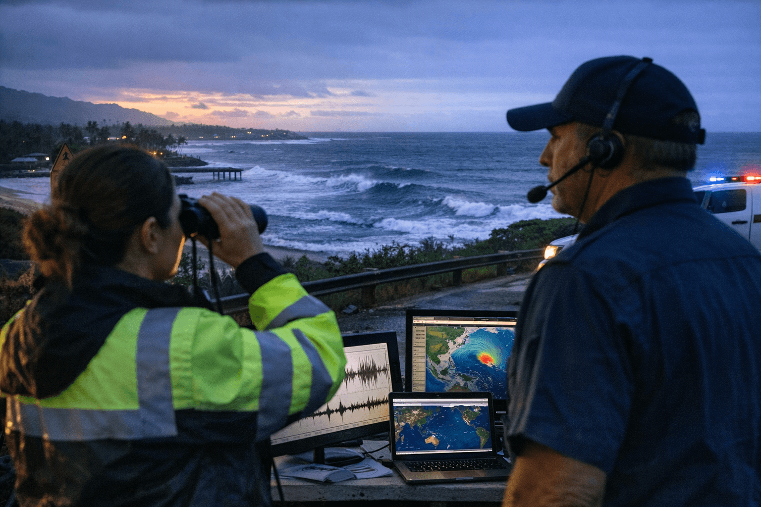
Kauaʻi had no confirmed tsunami threat, but the National Weather Service and Pacific Tsunami Warning Center kept watching after a magnitude 7.4 earthquake in the Molucca Sea triggered a Pacific threat message and briefly raised concern across the region. The final message said the threat had largely passed, though minor sea-level fluctuations of up to 0.3 meters above and below normal tide could continue for a few hours.
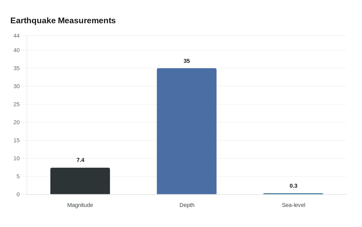
The earthquake struck at 2248 UTC on April 1, 2026, at 1.2 north, 126.3 east, with a depth of 35 kilometers, or 22 miles. In its threat message, the Pacific Tsunami Warning Center said tsunami waves had been observed and hazardous waves were forecast for some coasts. It said 0.3 to 1 meter waves were possible for parts of Indonesia, while less than 0.3 meter waves were forecast for Japan and several other Pacific locations, including Guam, Malaysia, the Northern Marianas, Palau, Papua New Guinea, the Philippines, Taiwan and Yap.
For Hawaii, the key point was not a direct strike but the monitoring network that tracks these events around the clock. NOAA says the U.S. Tsunami Warning Centers in Alaska and Hawaii monitor earthquakes around the globe and issue guidance based on the first seismic information available, often before tsunami waves are detected. In Hawaii, the National Weather Service says the Pacific Tsunami Warning Center in Honolulu has responsibility for tsunami monitoring and for issuing watches or warnings, and the state also is home to the International Tsunami Information Center.
Kauaʻi residents have local tools to follow those alerts. County emergency information shows the island has mapped tsunami evacuation zones and designated evacuation areas, and the county’s siren system is part of Hawaii’s statewide all-hazard siren network. Kauaʻi also has NOAA Weather Radio service on station WZ2557 at 162.450 MHz. County evacuation maps say the zone line is a minimum safe evacuation distance, not a boundary to wait at.
The guidance is especially relevant during Hawaiʻi Tsunami Awareness Month in April 2026, when officials are again pushing residents and visitors to know whether they live, work or stay in a tsunami evacuation zone. If you feel shaking, move inland immediately. For a state built on coastlines, the difference between a watch, a warning and a passed threat can mean whether families in places like Hanalei, Poʻipū and Kapaʻa spend a night on alert or carry on with the next tide.
This article was produced by Prism’s automated news system from verified source data, official records, and press releases, then run through automated quality and moderation checks before publishing. The system is built and supervised by the people who set the standards it runs under. Read our full AI policy.
Did this article answer your question?