Heavy rains close sections of Kokeʻe Contour Road on Kauai
Washouts cut two stretches of Kōkeʻe Contour Road, blocking access toward Kōkeʻe State Park as officials warn of flash flooding, falling trees and delayed rescues.
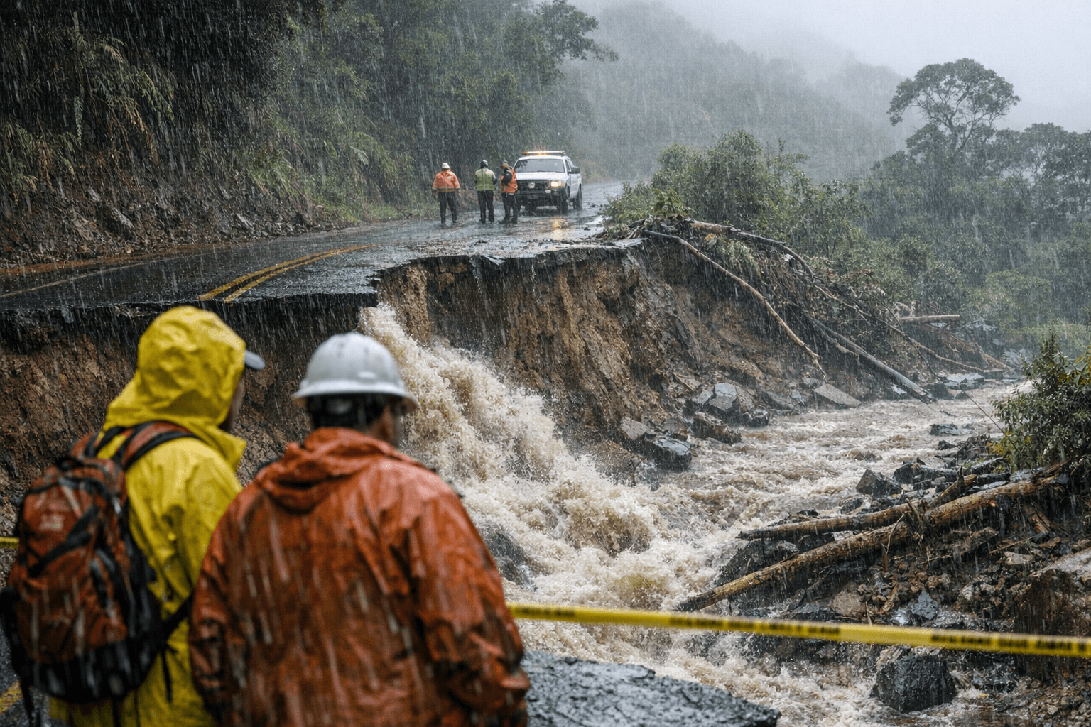
Washouts shut two stretches of Kōkeʻe Contour Road, cutting off access between Haʻeleʻele Ridge Road, Trail 3, and Kaʻaweiki Ridge Road, Trail 5. The closures also cover the segment between Polihale Ridge Road, Trail 4, and Kaʻaweiki Ridge Road, Trail 5, leaving only Unit A open while crews and visitors face an active storm threat.
The Hawaiʻi Department of Land and Natural Resources Division of Forestry and Wildlife said the closures went into effect at 3 p.m. Friday, April 10, and will remain in place “until further notice.” County officials said the road damage came from erosion during heavy rain tied to the “April Severe Weather Event,” and they urged drivers to stay out of the area. Anyone headed into the uplands, including workers, hikers, hunters and tour vans, should not plan on a through trip across the closed sections.
DLNR warned people to avoid forested and coastal areas because rising streams, flash flooding, falling trees, storm surge and high surf could make conditions dangerous, and emergency response or rescue may be delayed. The County of Kauaʻi said a Flood Watch remained in effect through 6 p.m. Monday, April 13, 2026, as heavy rain, strong winds and isolated thunderstorms continued to affect the island. Other storm-related disruptions also remained in place, including the closure of the Kalalau Trail and Polihale State Park, the suspension of the Hā‘ena Shuttle and the closure of the Wailua River to all vessels.
For anyone planning a trip to Kōkeʻe State Park, the safest move is to postpone nonessential travel until the road is assessed and reopened. Kōkeʻe is one of Kauaʻi’s main upland recreation areas, used for camping, hiking, hunting and wildlife viewing, so the closure is not just a roadway issue; it cuts into access for a large share of the island’s backcountry use. If travel is unavoidable, turn around before the closed segments and do not try to cross washed-out pavement or shoulder damage.
Kōkeʻe Contour Road itself reflects how often this upland route has had to adapt to weather and fire risk. The road was developed in the mid-1980s as a firebreak and later widened and renovated after Hurricane Iniki in 1992. With more heavy rain still in the forecast, the current closures underscore how quickly the route can become unsafe and how limited upland access remains during a severe weather event.
This article was produced by Prism’s automated news system from verified source data, official records, and press releases, then run through automated quality and moderation checks before publishing. The system is built and supervised by the people who set the standards it runs under. Read our full AI policy.
Did this article answer your question?