Kootenai County Seeks Resident Input on 20-Year Growth, Parks Plans
Kootenai County's first-ever Parks & Waterways Plan is now open for public input, alongside a 20-year growth blueprint update at keepingkootenai.com.
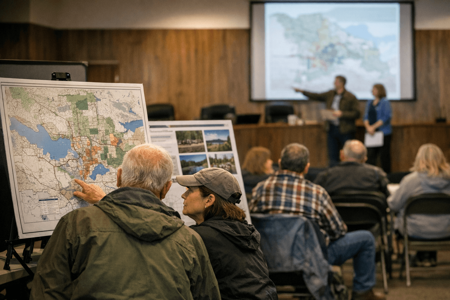
For the first time in Kootenai County's history, residents have a formal channel to shape where hiking trails get built, which boat launches get upgraded, and how the county's shoreline stays accessible — and that opportunity opened Monday alongside one of the most consequential planning exercises the county undertakes.
Kootenai County launched an online public survey April 7 at keepingkootenai.com, beginning a parallel effort to update the county's Comprehensive Plan and produce a brand-new Parks & Waterways Plan, the first such document the county has ever formally undertaken.
The Comprehensive Plan update is required under the Idaho Local Land Use Planning Act, known as LLUPA, and covers all unincorporated areas of the county. The document spans 17 state-mandated elements, including housing, transportation, natural resources and community facilities, and will serve as the foundational policy guide for land use decisions through the mid-2040s. Survey results will feed into draft policy choices, public workshops and capital improvement lists as the process runs toward its April 2027 completion target.
The Parks & Waterways Plan carries separate significance: no such document has previously existed for Kootenai County. It will formally inventory existing recreational assets, identify gaps in trail networks, boat launches, parks and shoreline access points, and set long-term investment priorities. That documentation also carries a practical benefit — jurisdictions that adopt an approved comprehensive or hazard mitigation plan remain eligible for federal mitigation funds and other grant programs tied to growth and recreation planning, a distinction county officials have cited as motivation for keeping the multi-jurisdictional process on track.
Supporting the effort are the Kootenai County Office of Emergency Management and the All-Hazard Mitigation Plan steering groups, both of which have participated in similar countywide planning processes.
The decisions these documents will shape are wide-ranging: where new subdivisions get approved, where conservation easements may be pursued, how transportation infrastructure gets prioritized, and which projects land on capital improvement lists all flow from policies embedded in the Comprehensive Plan.
County planners intend to hold multiple public workshops before the April 2027 deadline, but the survey now live at keepingkootenai.com is the first and most direct entry point into a process that will set land use and recreation priorities across unincorporated Kootenai County for the next two decades.
This article was produced by Prism’s automated news system from verified source data, official records, and press releases, then run through automated quality and moderation checks before publishing. The system is built and supervised by the people who set the standards it runs under. Read our full AI policy.
Did this article answer your question?
