Harquahala Mountain observatory marks La Paz County's forgotten science landmark
Harquahala Peak's Smithsonian observatory is a National Register science landmark, but the steep backcountry drive is part of the story. Access, upkeep and preservation will decide how long La Paz County can sell the site as a destination.
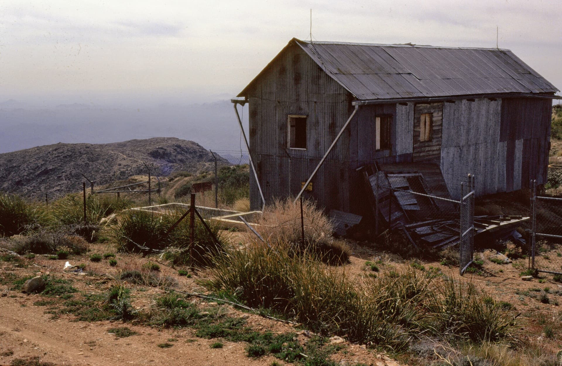
Harquahala Peak's Smithsonian solar observatory is one of La Paz County's rare National Register science sites, but reaching it still means committing to a steep, narrow backcountry road. The historic district, listed as National Register reference number 97000346 and tagged to the 1920s, sits on a mountain that once drew astronomers for its elevation and clear air. For visitors, the real test is whether the drive, the isolation and the preservation needs are worth the history waiting at the top.
What the observatory is
The Harquahala Mountain Smithsonian Solar Observatory Historic District is listed in the National Register of Historic Places in La Paz County, and the National Park Service metadata places it squarely in the science theme. The listing date is May 1, 1997, which means the site has already been recognized for decades as more than an abandoned mountaintop structure.
The observatory itself was built by the Smithsonian Astrophysical Observatory and was in use from 1920 to 1926. A Bureau of Land Management monograph, Harqua Hala Letters: The story of Arizona’s forgotten Smithsonian Observatory, frames it as Arizona's forgotten 1920's Smithsonian Institution Observatory and says the account is drawn from letters written by the scientists who worked there. That gives the site a different kind of local significance than the more familiar stories of mines, ranches and river towns: this was a remote scientific outpost, not just a lonely ruin.
A Smithsonian archival record adds another layer. It identifies residents at the observatory and points to about a dozen people associated with making solar observations there. In other words, this was not a one-person lookout or a short-lived survey camp. It was a working station, occupied long enough to create a small community around the daily task of recording the sun.
Why Harquahala Peak mattered to science
Harquahala Peak rises to 5,681 feet, making it the highest point in southwestern Arizona. It sits about 90 miles west of Phoenix, far enough from the metro area to feel isolated even today, and its height and clean air helped persuade the Smithsonian to place a solar facility there in 1920. From the summit, the view reaches across Arizona's desert edge to California, Nevada and Mexico, which helps explain why the site was attractive for observations that depended on clear horizons and stable skies.
That geography mattered because early solar science depended on conditions that are difficult to manufacture in a lab. Higher elevation reduced some of the haze and atmospheric interference that can blur celestial observation, while the remote setting limited the kinds of local distractions that come with more populated places. For La Paz County, that makes Harquahala a reminder that the county's landscape was not only a transportation corridor or recreation backdrop, but also a place that supported national research.
The observatory's historical value is also tied to the story of field science itself. The letters behind the BLM monograph and the Smithsonian records about residents show a place where people lived and worked far from towns like Wenden or the Phoenix basin, while carrying out a highly specialized task. That is part of what makes the district unusual: it captures the intersection of desert geography, scientific ambition and temporary mountain living.
What the road demands today
Getting to Harquahala Peak is not the same as pulling off a paved highway and walking a few feet to a scenic overlook. The Bureau of Land Management says Harquahala Peak can be reached by the Harquahala Mountain Backcountry Byway, a 10.5-mile road that is steep, winding and narrow, and that requires four-wheel drive and high clearance. That is the core access fact that matters for anyone thinking about making the trip from La Paz County or passing through from the Phoenix side.
The road description changes the practical calculation. A site with national scientific importance can still be hard to visit because the last miles are rugged enough to rule out ordinary passenger cars, and the mountain setting makes weather and road wear a bigger issue than they would be on flat ground. A visitor who treats it like a casual roadside stop is likely to be disappointed before reaching the summit.
- use a four-wheel-drive vehicle with high clearance
- expect a steep, winding, narrow ascent
- plan for a remote trip, not a quick detour
- make sure the vehicle and fuel situation are ready for a backcountry drive
Before heading out, the minimum expectations are simple:
Those basics are what separate Harquahala from more accessible county attractions. The mountain may be a landmark, but it is still a backcountry landmark.
Preservation and access will shape its future
The observatory sits at the point where heritage tourism and land stewardship meet. Because it is a National Register historic district, the site is recognized as a cultural resource worth preserving, not just a relic left behind in the desert. At the same time, the broader BLM management framework for the Harquahala area has to balance recreation with scenic, scientific and cultural values, which is exactly the tension that remote places like this create.
That balance will determine whether the observatory remains a viable destination for visitors interested in history, geology and astronomy, or whether access becomes so rough and upkeep so limited that the place is known mostly through records and photographs. Preservation is not only about stabilizing old buildings. It is also about keeping the road usable enough for responsible access without turning a fragile desert site into a damaged one.
For La Paz County, Harquahala is valuable because it widens the county's identity. It is not just a place of river recreation, winter traffic and highway stops. It also holds a federally recognized science landmark that links the county to a six-year chapter of early 20th-century solar research, and the future of that landmark depends on whether the road, the wilderness setting and the historic district can all be maintained together.
Harquahala is worth the trip if the goal is a serious backcountry experience with real historical weight. It is not worth it if the expectation is an easy stop. The site's future will rest on whether La Paz County and the land managers around it can keep that distinction intact.
This article was produced by Prism’s automated news system from verified source data, official records, and press releases, then run through automated quality and moderation checks before publishing. The system is built and supervised by the people who set the standards it runs under. Read our full AI policy.
Did this article answer your question?