Harquahala Peak Observatory blends solar science history and rugged desert access
A 1920 solar observatory atop La Paz County's highest mountain pairs a stark history lesson with a rough byway, seasonal access, and serious desert hazards.

Harquahala Peak Observatory sits at the center of one of La Paz County’s most demanding day trips: a 1920 solar observatory on the county’s highest mountain, reached by a rugged backcountry byway or a steep trail. The site offers history, wide desert views, and a clear sense of how scientists once used this summit for solar research, but it also demands respect for heat, storms, wildlife, and old mining hazards.
A summit built for solar science
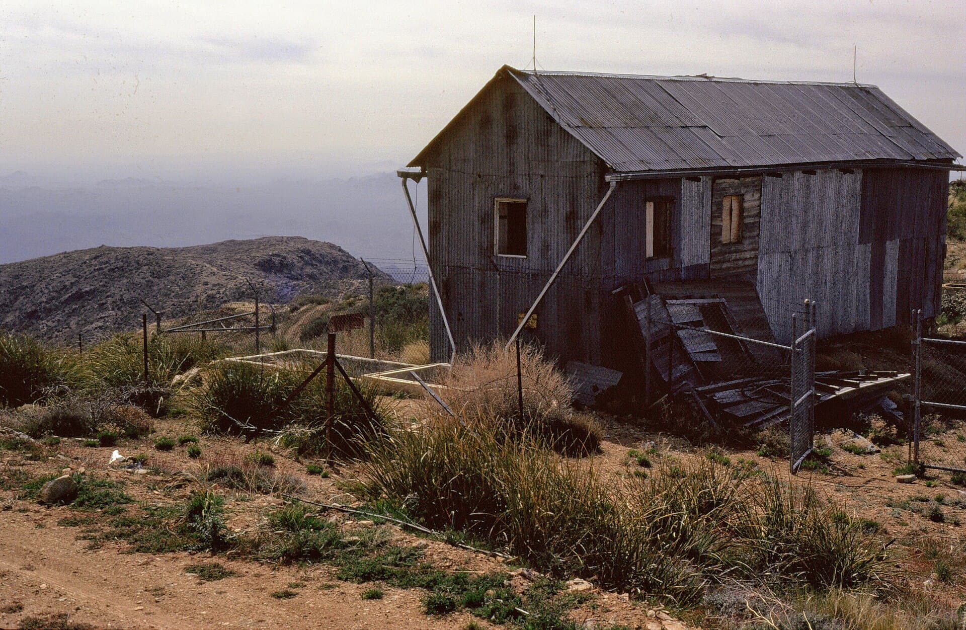
The observatory was built in 1920 by the Smithsonian Astrophysical Observatory to measure and record solar activity. A small group of scientists lived and worked there from 1920 to 1925, and Smithsonian Institution Archives places the observatory in use through 1926. That narrow window gives the site its character: it was not a grand campus, but a remote working station chosen for the quality of its sky.
Harquahala was attractive because of clear skies and low humidity, two conditions that mattered in the broader scientific effort to measure the solar constant. The project also had money and institutional backing behind it: donor John A. Roebling helped fund it, and Smithsonian scientist C. G. Abbott moved the solar observatory to Harquahala Peak from another site. The observatory was listed on the National Register of Historic Places in 1975.
What the mountain is, and why the numbers matter
Harquahala Peak is the highest mountain in southwestern Arizona. Bureau of Land Management materials list the summit elevation two ways, as 5,681 feet on one page and 5,691 feet on another. This is a high, exposed mountain in open desert, and the summit setting shaped the observatory’s purpose and today’s visitor experience.

The Harquahala Mountains Wilderness adds another layer of protection to the landscape. It was designated in the Arizona Desert Wilderness Act of 1990, and the peak offers broad views across surrounding desert and distant ranges. At the top, visitors get a 360-degree panorama rather than a developed attraction.
Getting there starts at the staging area
Access begins at the Harquahala Byway Staging Area, which serves as the gateway to both the 10.5-mile Harquahala Mountain Back Country Byway and the Harquahala Mountains Wilderness. It marks the point where visitors must stay on the designated route or continue on foot into the wilderness, where motorized travel is not allowed.
The byway is the most direct way to experience the site’s working landscape. It runs through terrain marked by old mining debris, shafts, and stone houses from earlier miners, reminders that Harquahala was used for more than astronomy. The road also leads toward the summit and opens views of the Eagletail Mountains even before the observatory comes into view.
Road conditions and seasonal timing
The Bureau of Land Management recommends the Harquahala Mountain Back Country Byway for travel from November through April. This is high-desert country, where weather can swing hard, and the agency specifically warns about violent thunderstorms on the peak.
The same caution applies to the route itself. The byway is rugged rather than casual, and the landscape includes abandoned mining features that can be dangerous if you leave the route or wander near unstable ground. Rattlesnakes and other venomous creatures are also part of the risk picture, which is another reason to stay alert on the ground and pay close attention to where you step and where you stop.
- Use the byway only within its designated corridor.
- Stay away from mine shafts and old debris fields.
- Build the trip around the cooler November-to-April travel window.
- Be prepared for exposed weather, especially thunderstorms.
A practical visit means planning around the mountain’s conditions:
Hiking versus driving
Visitors can reach the observatory area by the backcountry byway or by hiking the steep 5.4-mile Harquahala Pack Trail from the basecamp trailhead. The trail option asks for more effort and more commitment, while the byway offers a longer but more gradual approach to the same historic high point. Either way, the setting remains remote, and neither route should be treated like a casual park road or a short town trail.
The Bureau of Land Management manages the area, and limits on where vehicles can go are part of preserving the wilderness and historic structures.
This article was produced by Prism’s automated news system from verified source data, official records, and press releases, then run through automated quality and moderation checks before publishing. The system is built and supervised by the people who set the standards it runs under. Read our full AI policy.
Did this article answer your question?