National Weather Service seeks Lafayette County storm damage reports after severe weather
Lafayette County residents are being asked to send in storm damage photos, times and locations so forecasters can verify what hit Oxford and sharpen future warnings.
Lafayette County and Oxford residents who saw damage from Monday and Tuesday’s severe weather are being asked to send it to the National Weather Service Memphis now, with photos, locations and times if they have them.
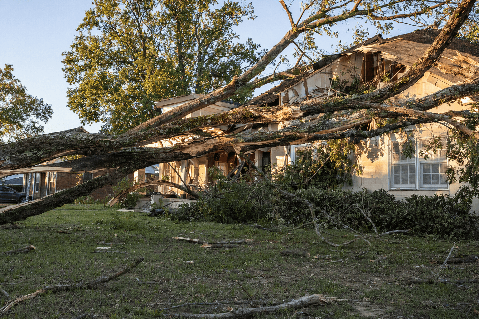
The request is aimed at building a clearer picture of what the storms did across north Mississippi. National Weather Service Memphis said it wants reports of downed trees, power lines, roof damage, structural damage and hail size, including smaller signs of impact such as a broken limb, a downed fence or a brief burst of hail. Those details help meteorologists verify storm data when damage is scattered rather than packed into one obvious path.
The storm-report form asks for the event time, location, event type and optional additional details. It includes categories for hail, wind damage, tornado or funnel cloud, flooding, snow, sleet and freezing rain. Residents can submit information through a direct message or comment on social media, or by email to the contact listed in the report. The submission tool is intended only for relaying storm information to the National Weather Service.
That kind of community evidence can influence how a storm is classified and how forecasters understand what happened on the ground. It also matters for emergency managers, who rely on verified damage to judge risk, improve response planning and refine future warnings. In fast-moving weather systems, a few careful reports can fill in the gaps left by radar and spotty visibility.

The Memphis office keeps a local weather events archive that shows how seriously it treats those reports. The archive lists a March 15, 2026 severe weather event and a 2025 severe weather outbreak, along with earlier winter storms and flooding. It also includes one of the most severe events in Lafayette County’s recent history: the April 27, 2011 tornado that the office rated EF-3, with estimated peak winds of 140 mph, a 13.6-mile path, a maximum width of one-quarter mile, two injuries and damage to homes and mobile homes.
A more recent regional survey, covering April 2 to 5, 2025, found EF2 tornado damage near Skaggs and Corning, Arkansas, with estimated winds of 125 mph and extensive roof damage, destroyed outbuildings, uprooted trees and structural damage. For Lafayette County, that history is why even a single photo of shingles torn loose or a tree across a driveway can matter. Each report adds one more piece to the official record of what the storm left behind, and it helps shape the next warning before the next line of severe weather moves through.
This article was produced by Prism’s automated news system from verified source data, official records, and press releases, then run through automated quality and moderation checks before publishing. The system is built and supervised by the people who set the standards it runs under. Read our full AI policy.
Did this article answer your question?