Lake County boasts Minnesota's most waterfalls this spring melt
Lake County’s waterfall count rises above every other Minnesota county, and spring melt turns the North Shore into a route of roaring cascades, short hikes, and roadside pull-offs.
Lake County’s waterfall identity is not a marketing slogan, it is geography. With more than 12 waterfalls, the county has the most of any county in Minnesota, and spring melt is when many of them run at full force, driven by fast snowmelt and the heavy volume that sends North Shore streams thundering toward Lake Superior.
A county shaped by falling water
That concentration of waterfalls explains why Lake County feels different from much of the state. The North Shore’s steep drop toward the lake, its river gorges, and its short, powerful watersheds create the kind of terrain that turns snowmelt into spectacle rather than runoff. In spring, the county’s falls are not isolated scenic stops scattered across the map. They are a linked landscape, from big park anchors to quick roadside views and short trail walks.
The result is a local story with civic pride built into it. Lake County does not just have one famous waterfall complex. It has a cluster of named places that give residents and visitors multiple ways to see the same seasonal surge, whether they want a long hike, a family stop, or a quick look from Highway 61.
The parks that define the route
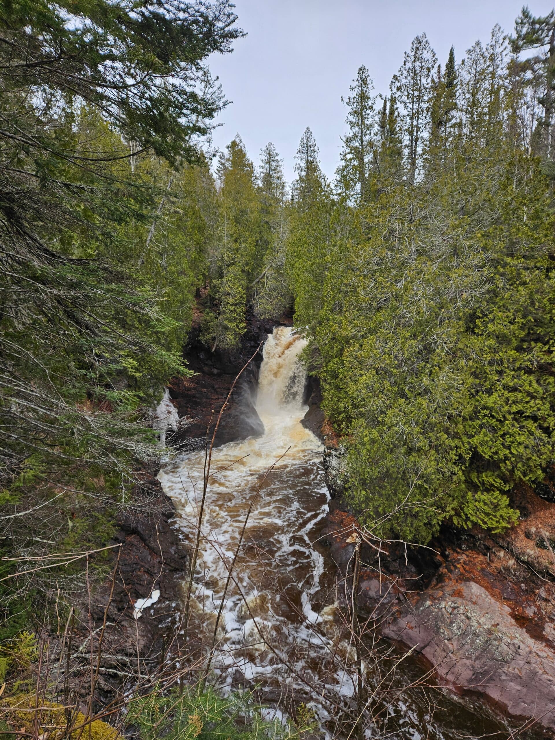
Gooseberry Falls State Park in Two Harbors is the classic starting point. The park’s Upper, Middle, Lower, and Fifth Falls create a layered waterfall system along Gooseberry River, and the setting includes the river gorge, Lake Superior shoreline, and Civilian Conservation Corps log-and-stone structures that give the park its distinctive look. The park was the first of eight state parks developed along Lake Superior’s North Shore, and nearly all of its buildings were constructed by Civilian Conservation Corps workers between 1934 and 1941.
That history matters because Gooseberry is more than a scenic overlook. The stone-and-log architecture, the gorge, and the river corridor make the park feel like a full destination, especially when the melt is pushing more water through the falls. For a spring visit, Gooseberry delivers the county’s most complete introduction to why this stretch of shoreline has become Minnesota’s waterfall capital.
Split Rock Lighthouse State Park offers a different kind of waterfall stop. The Split Rock River Loop leads to Split Rock River Falls, a roughly 20-foot waterfall reached from the Superior Hiking Trail side, where a wooden bridge and a forested descent create a quieter approach than the roadside view most people picture when they think of the North Shore. The park’s trail system also includes a river overlook, which ties the falls into the broader landscape of the bluff and shoreline.
Tettegouche State Park raises the scale again. High Falls of the Baptism River is listed at 60 feet in the park description and 63 feet in a recent DNR feature, and the department calls it the second-tallest waterfall within Minnesota’s state border. The park also includes Shovel Point, historic Tettegouche Camp, and Two Step Falls on the trail to High Falls, which gives visitors more than one waterfall feature to see on the same outing.
The lesser-known stops that make Lake County special
Lake County’s identity as a waterfall county depends just as much on the places outside the marquee park entrances. Beaver River Falls in Beaver Bay can be seen from Highway 61 or from the Lax Lake Road wayside, where a pedestrian path, picnic shelter, and restrooms make it an easy spring stop. The falls are set where the Beaver River flows into Lake Superior, a classic North Shore meeting of river and lake that makes even a brief pause feel substantial.
Glen Avon Falls in Beaver Bay Township adds another layer to the county’s waterfall map. The drop is described as a hidden North Shore gem, and the Beaver River widens into a dramatic fall over more than 100 tumbling yards. That longer, stretched-out profile gives the county variety, from plunges to broad cascades, and it helps explain why a single county can offer so many distinct waterfall experiences.
Caribou Falls in Silver Bay rounds out the loop with a site that is as practical as it is scenic. Caribou Falls State Wayside is seasonal, open from May until mid-November, and the trail is 3/4 mile long to the base of the 35-foot falls. The wayside also connects to the Superior Hiking Trail, which makes it useful both for a quick family stop and for hikers building a longer North Shore day.
Why spring changes the experience
Spring is the season when these places show their full force. The North Shore waterfall itinerary frames the area as a weekend trip built around melting rivers, and that is exactly the point for Lake County in late spring: the same falls that are handsome in summer become louder, fuller, and more dramatic when snowmelt is feeding every river channel at once.
That timing also shapes access. Beaver River Falls is easiest when you can use the Highway 61 pull-off or the Lax Lake Road wayside. Caribou Falls is open only from May through mid-November, so the spring melt lines up with the start of the trail season there. At Split Rock and Tettegouche, trail choices matter just as much as the destination, because the Split Rock River Loop, the overlook, the wooden bridge, and the trail to High Falls all give visitors different ways to experience the water without crowding a single viewpoint.
What to watch before you go
Peak melt is also the time to treat waterfall visits as trail trips, not just scenic drives. Water levels are high, river edges are slick, and the best views often come from designated paths, overlooks, and waysides rather than improvised scrambling. In Lake County, that means following the pedestrian path at Beaver River Falls, sticking to the marked trail to Caribou Falls, and using the established routes at Gooseberry, Split Rock, and Tettegouche to reach the best vantage points.
For local readers, that is part of the appeal. The county’s waterfalls are not an abstract list of attractions. They are a living spring system, powered by snowmelt, anchored by state parks, and spread across places like Two Harbors, Beaver Bay, Beaver Bay Township, and Silver Bay. When the melt is strong, Lake County looks like what it is: Minnesota’s most waterfall-rich county, and one of the clearest places in the state to watch the season change in real time.
This article was produced by Prism’s automated news system from verified source data, official records, and press releases, then run through automated quality and moderation checks before publishing. The system is built and supervised by the people who set the standards it runs under. Read our full AI policy.
Did this article answer your question?