Lake County links to North Shore State Trail's rugged recreation corridor
Lake County’s slice of the North Shore State Trail is a rugged, multi-use route, with Finland the clearest gateway for hikers, riders, and winter travelers.
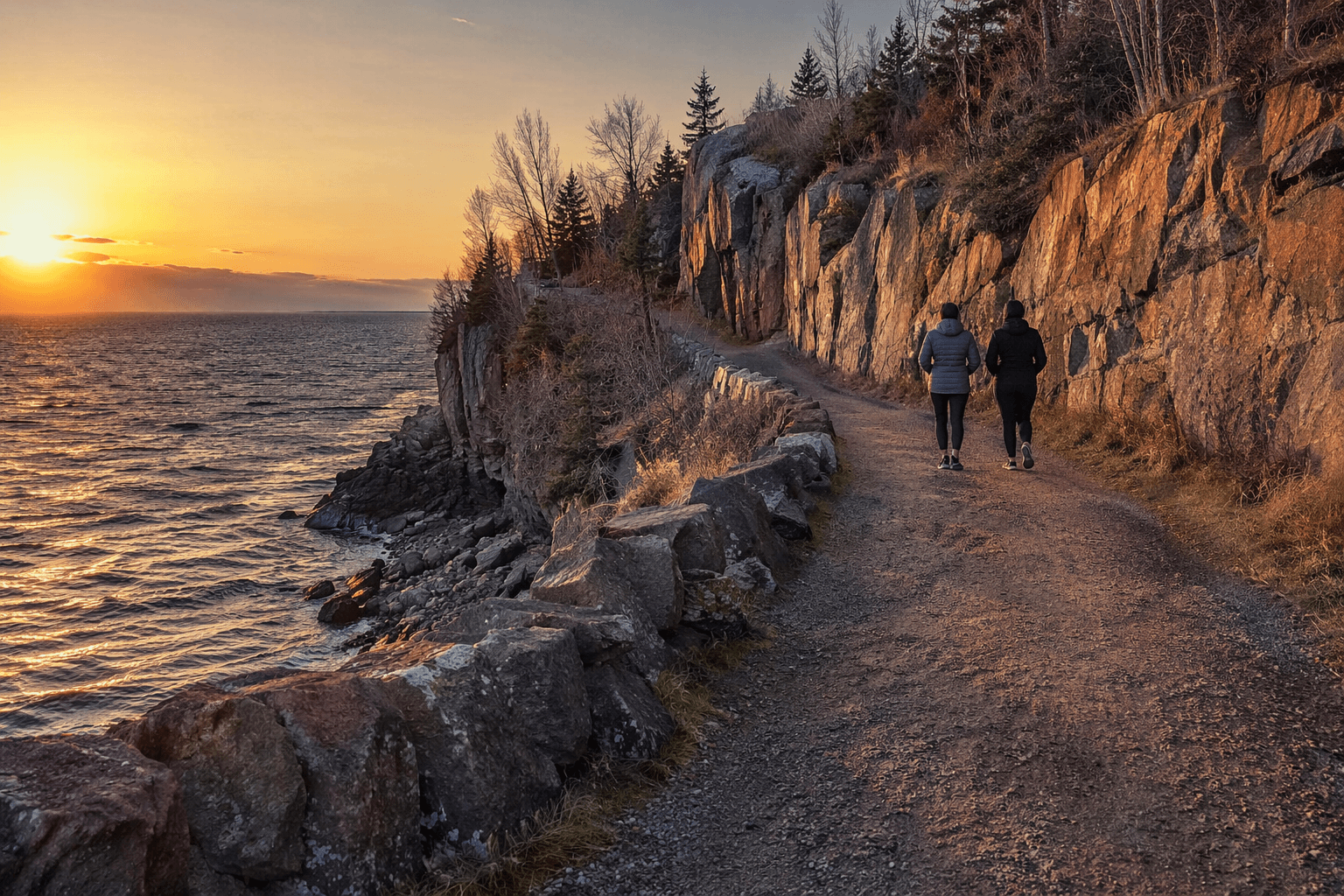
Lake County’s most practical link to the C.J. Ramstad/North Shore State Trail is not a postcard stop, but a long, natural-surface corridor residents can actually use for winter travel, summer hiking, and horseback riding. The trail runs 146 miles from Duluth to Grand Marais, and Lake County is one of the three counties it crosses as it follows the forested ridgeline above Lake Superior.
Lake County’s place on the corridor
The North Shore State Trail was authorized by the Minnesota Legislature in 1975 as a multi-use trail, and early planning documents imagined something even longer, stretching northeast from Duluth toward the Canadian border. It later took the name of C.J. Ramstad, a reminder that this route was built as part of a larger public recreation system, not as a single local trailhead. In Lake County, that history matters because the route ties the county into a connected backcountry corridor with St. Louis and Cook counties, rather than leaving it as an isolated recreational spur.
That connection shapes how people experience the trail today. The DNR describes it as a multi-purpose, natural-surface trail, which means the Lake County section is closer to working forest ground than to a manicured park path. The route moves through an active landscape of ridges, woods, and changing weather, so the trail is useful precisely because it stays rough and connected across county lines.
Where to enter and what each stretch is best for
For Lake County users, Finland is the clearest gateway. The trail segment from Finland to Cook County Road 6, north of Grand Marais, is the part the DNR identifies as best for horseback riding and summer hiking, covering roughly 70 miles. That makes the Finland area a logical place to start if you want a long nonmotorized trip that still feels like real North Shore backcountry rather than a short out-and-back walk.
The Finland-to-Duluth stretch is also hikeable, but the DNR warns that it can be wet seasonally. That is a practical detail, not a minor footnote: this is not a paved multi-use path where footing stays the same from month to month. A wet forest floor changes speed, traction, and route choice, especially on a long route that crosses uneven ground and working forest land.
Motorized use is more limited and more specific. ATVs are allowed only where designated, and one mapped ATV segment is 6.6 miles long. That piece connects with 60 miles of grant-in-aid ATV trails, which turns the Lake County side of the corridor into part of a larger network rather than a stand-alone ride. In Finland State Forest, parts of the C.J. Ramstad North Shore ATV Trail, the Wild Country ATV Trail, and the Prospector ATV Trail all run through the same broad recreation landscape, so trail choice depends on the route you intend to use, not just where you park.
Season changes everything on the same trail
Winter and summer offer very different versions of the North Shore State Trail. Snowmobiling is the primary winter use, and that makes the corridor a major cold-weather route for people moving through the county by machine rather than on foot. In that season, the trail functions as transportation infrastructure for recreation, connecting local riders and visitors to a maintained system that depends on grooming, brushing, and constant attention.
When the snow is gone, the same route becomes slower and more exposed. Hikers and horseback riders need to plan for a natural surface that can be muddy, wet, or uneven, especially on the Finland-to-Duluth stretch. The DNR’s guidance is straightforward: carry a map, GPS or compass, a cell phone, extra food, clothing, and water, and tell someone your route and return time before heading out.
Camping can also be part of the experience. The DNR says shelters along the trail and adjacent public land can be used where camping is not prohibited, which gives Lake County travelers a way to turn a day trip into an overnight route. That option only works if the conditions, route length, and weather all line up, so it is best treated as part of the planning process rather than a spontaneous add-on.
How to plan for changing conditions
The biggest mistake people make with this corridor is assuming it behaves like a simple local trail. The DNR says current conditions can change quickly, and temporary trail closures are updated Thursdays after 2 p.m. That matters in Lake County because weather, snow cover, wet ground, and maintenance can alter what is passable from one week to the next.
A careful outing starts with checking current trail pages or calling the DNR Information Center before you go. Once you are on the ground, the route’s forest setting means you should plan for longer response times, more isolation, and fewer easy bailout points than you would find on a town trail or a paved bike route. The trail is usable for families, riders, and winter travelers, but only if it is approached as a backcountry corridor with real distance between access points.
The local labor that keeps it open
The trail also depends on volunteer work, and that is where Two Harbors comes into the picture. The Two Harbors Voyageur Snowmobile Club was founded in 1985 and now has about 115 members. Its volunteers handle brushing, grooming, bridge work, and repairs, the kind of maintenance that keeps a winter trail open long after the first snow falls.
That local labor matters because the corridor is only as reliable as the people maintaining it. Grooming and repairs are what turn a long, forested route into something residents can plan around in January, while brushing and bridge work help keep the corridor usable after storms, thaw, and heavy use. For Lake County, the trail is not just scenery above Lake Superior. It is a shared public route held together by state planning, county geography, and volunteer upkeep, and it remains one of the clearest ways to move through the North Shore landscape on purpose.
This article was produced by Prism’s automated news system from verified source data, official records, and press releases, then run through automated quality and moderation checks before publishing. The system is built and supervised by the people who set the standards it runs under. Read our full AI policy.
Did this article answer your question?