Lake County Volunteers Track Rainfall to Improve Flood and Drought Forecasting
Official rain gauges are spaced one per 625 sq. miles; Lake County volunteers can close that gap and sharpen flood forecasts along the North Shore.

Official precipitation monitoring across the United States relies on cooperative observer stations placed roughly one per 625 square miles, a spacing standard set by a 1953 Iowa State University study that still governs the network today. On Lake County's North Shore, where lake-effect precipitation and shoreline microclimates can produce dramatically different rainfall totals within a few miles of each other, that gap between official gauges matters — and it is exactly the gap that backyard volunteers are being recruited to fill.
The Community Collaborative Rain, Hail and Snow network, known as CoCoRaHS, is a nationwide program that channels daily observations from volunteer-owned rain gauges into the hands of the National Weather Service, state agencies, university researchers and local emergency managers. Each submission feeds real-time flood forecasting models, local precipitation maps, radar verification and the U.S. Drought Monitor, which in turn shapes decisions about reservoir management and road maintenance across the region.
The stakes are not abstract this spring. The National Weather Service Duluth office has flagged above-normal flood risk around Lake Superior, citing elevated snowpack water content and deep frost that could drive efficient runoff if heavy rains arrive while the ground remains frozen. Accurate, localized rainfall data during those events would directly sharpen river forecasts for Lake County waterways.
The North Shore's geography makes volunteer coverage especially critical. Remote, forested and higher-elevation pockets inland from the lake sit well beyond the reach of official monitoring stations. A single report from a campground, a roadside observer or a watershed headwater area can change a hydrologist's understanding of how much water entered a drainage system during a storm. Boreal Community Media has highlighted the value of these volunteer networks for North Shore communities, noting that long-term local observers provide the continuity that makes the dataset reliable enough for scientific use.
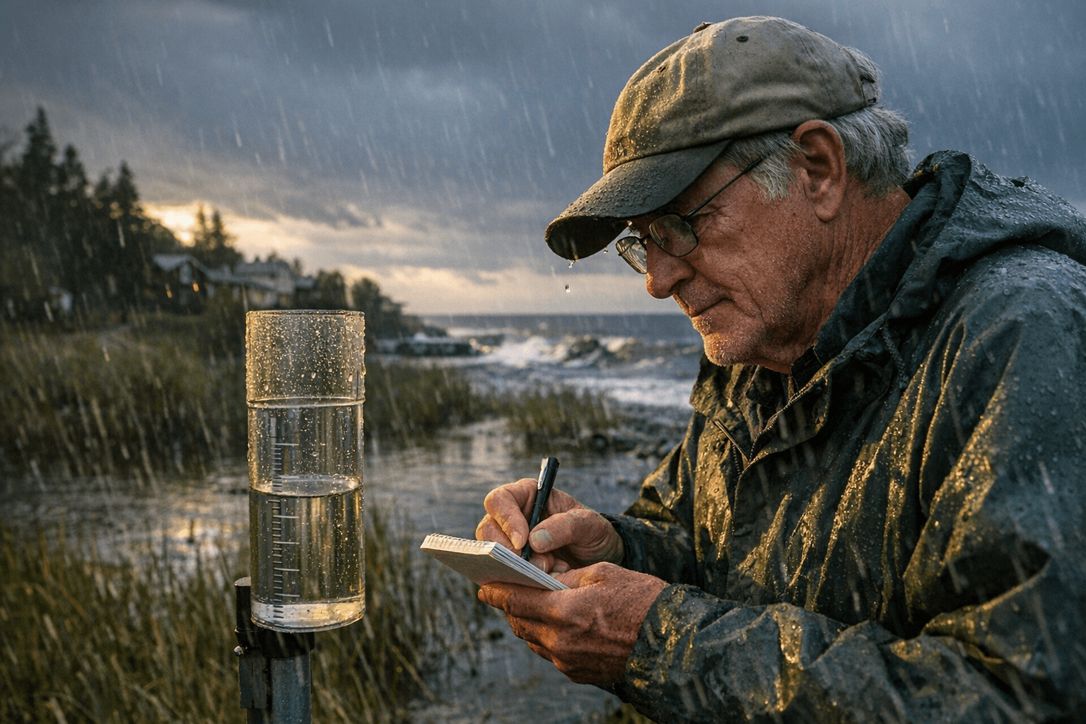
The Minnesota DNR State Climate Office and the National Weather Service have an active recruitment drive, particularly targeting areas outside the Twin Cities metro. Joining requires no technical background. Volunteers sign up through the CoCoRaHS website, receive a standard 4-inch diameter rain gauge along with online training materials and then install it in an open location away from buildings and trees. Readings taken daily, or after any measurable event, are submitted through an online form and appear immediately on CoCoRaHS maps and contributor dashboards.
For anyone uncertain where their gauge would be most useful, Lake County emergency management and the local Soil and Water Conservation District can advise on priority locations. Both offices sometimes coordinate gauge placement to maximize informational value for specific flood-prone roads or watershed areas.
Schools, civic organizations and conservation groups in Lake County have also used CoCoRaHS enrollment as a low-barrier entry point into community science, pairing the measurement routine with broader environmental education. The cost to participate is minimal; the standard gauge is inexpensive and the program's training materials are free.
Every daily entry from a Lake County backyard becomes a permanent part of official forecasting and climate records, building the kind of granular, long-term local dataset that hydrologists increasingly depend on as precipitation patterns along the North Shore grow harder to predict.
This article was produced by Prism’s automated news system from verified source data, official records, and press releases, then run through automated quality and moderation checks before publishing. The system is built and supervised by the people who set the standards it runs under. Read our full AI policy.
Did this article answer your question?