Lake County's Tettegouche State Park draws winter hikers to High Falls
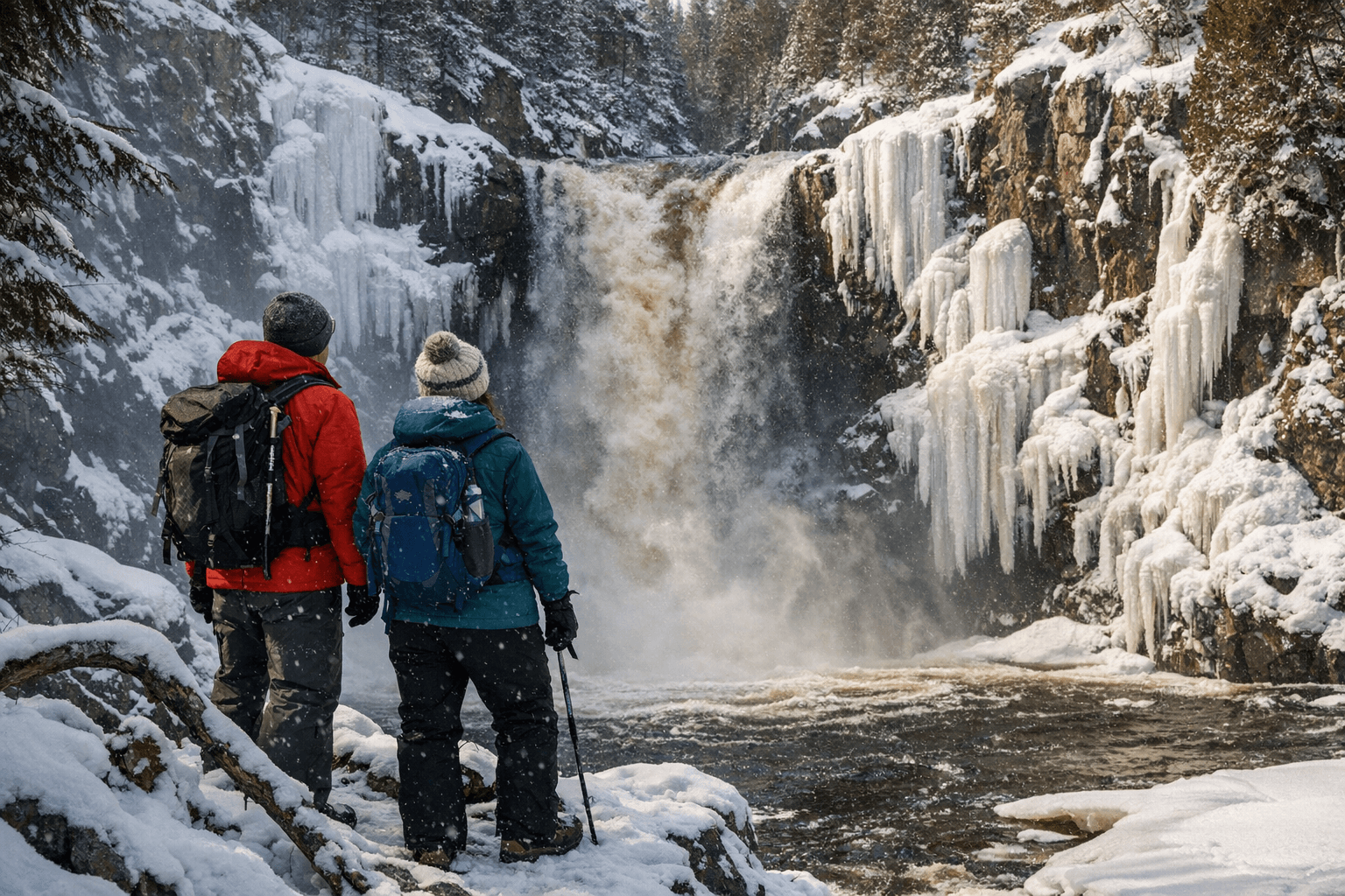
Winter hikers are visiting the 60-foot High Falls at Tettegouche State Park, drawn by reopened trails and dramatic ice formations; safety, gear and access matter for Lake County residents.
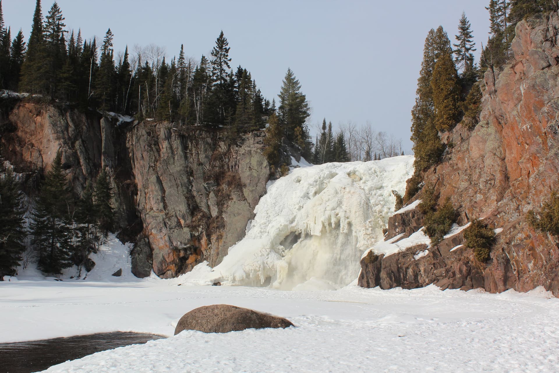
High Falls on the Baptism River has become a winter destination in Lake County as hikers follow icy trails and newly restored connections to the waterfall. The falls are reported as a 60-foot drop and are highlighted alongside Shovel Point overlooks and inland lakes in the state park’s rugged North Shore terrain. A replacement bridge that reopened the trail in November 2025 has renewed access for winter hikers, but conditions and route descriptions vary among local guides.
Route accounts differ. HelloStranger, a personal travel column, says the hike from the Tettegouche visitor center is “about four miles round trip” and calls the path “super icy,” adding that “microspikes are pretty much a must.” A local trail guide, NorthShoreExplorerMN, offers a shorter measurement, describing the visitor center route as 1.5 miles to High Falls and noting a separate Mt. Trudee loop completed in January 2026 that was “just over 4 miles, with an elevation gain of 475ft.” MadelineMarquardt highlights the Shovel Point Trail as a 1.2 mile shore hike that is “especially beautiful in the winter,” and also points readers to the longer, popular 7-8 mile Bean & Bear Lakes loop outside the park.
Safety and signage are central concerns for residents and visitors. NatureImpactsUS warns emphatically: “Do not walk across the Baptism River in places other than the bridge. There is fast moving water under the ice, which creates ice that is thin.” That account also notes unmarked sections and a short road to a rentable cabin with a small parking lot reserved for renters, which can complicate winter navigation. NorthShoreExplorerMN acknowledged the loss of a swinging bridge in earlier seasons, writing, “I am still mourning the loss of this swinging bridge… I’m not sure how many times I’ve crossed it, at least 20,” while reporting that the new replacement bridge restored access.
For Lake County the surge in winter hiking has public health and equity implications. Winter recreation supports physical activity and mental health in a season of limited outdoor options, but icy, ungroomed trails and varied route lengths increase the risk of slips, hypothermia and search and rescue calls in a rural region with finite emergency resources. Gear such as microspikes and basic winter navigation skills make hikes safer, yet access to such equipment is uneven across households and visitors. The Minnesota DNR maintains park maps and winter-use guidance; local officials and community organizations might consider expanding equipment loan programs, clearer signage and targeted outreach to reduce preventable injuries.
Respect for land and Leave No Trace practices are part of the winter story. As MadelineMarquardt reminds readers, “The North Shore of Minnesota is the ancestral homeland of the Anshinaabe Indigenous People, and we are all guests on their land.” Verify current trail maps and conditions with park authorities before heading out, bring appropriate traction and layers, and treat seasonal infrastructure and river ice with caution. The reopened bridge and wide trail network make High Falls an accessible winter spectacle, but the next season calls for coordinated attention to safety, signage and equitable access for all Lake County residents.
This article was produced by Prism’s automated news system from verified source data, official records, and press releases, then run through automated quality and moderation checks before publishing. The system is built and supervised by the people who set the standards it runs under. Read our full AI policy.
Did this article answer your question?