Split Rock Lighthouse rose from Lake Superior shipping dangers
A 1905 Lake Superior storm pushed Congress to fund Split Rock Lighthouse, turning a deadly shipping stretch into Lake County's best-known landmark.
Split Rock Lighthouse stands on the North Shore because Lake Superior shipping became dangerous enough that one storm changed policy, engineering, and the shoreline itself. In Lake County, it is more than a scenic perch above the water. It is the clearest reminder that iron ore, weather, and commerce once collided here with lethal force, and that public infrastructure followed only after the wrecks made the risk impossible to ignore.
Built for a shipping problem, not for a postcard
By 1901, Lake Superior was already carrying 112 steel freighters, a sign of the growing iron ore trade moving through the Great Lakes. Then came the storm of Nov. 28, 1905, which damaged 29 ships and left two carriers foundered along this rocky coast. That disaster helped trigger a federal response, as U.S. Steel leaders pushed Washington for a new light station at Split Rock.
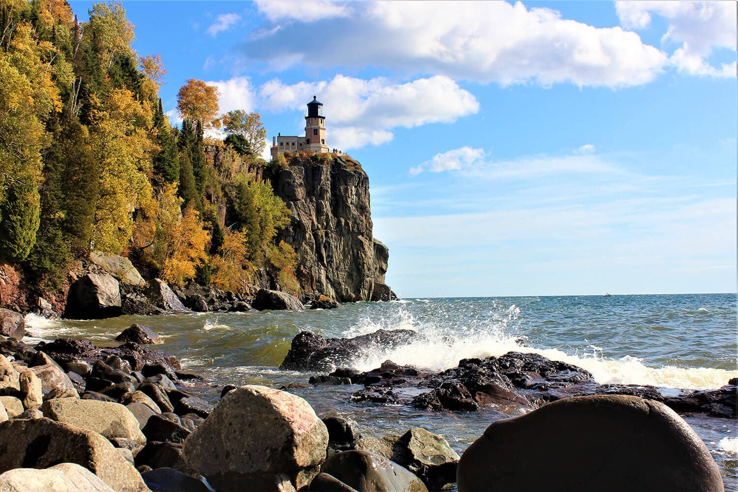
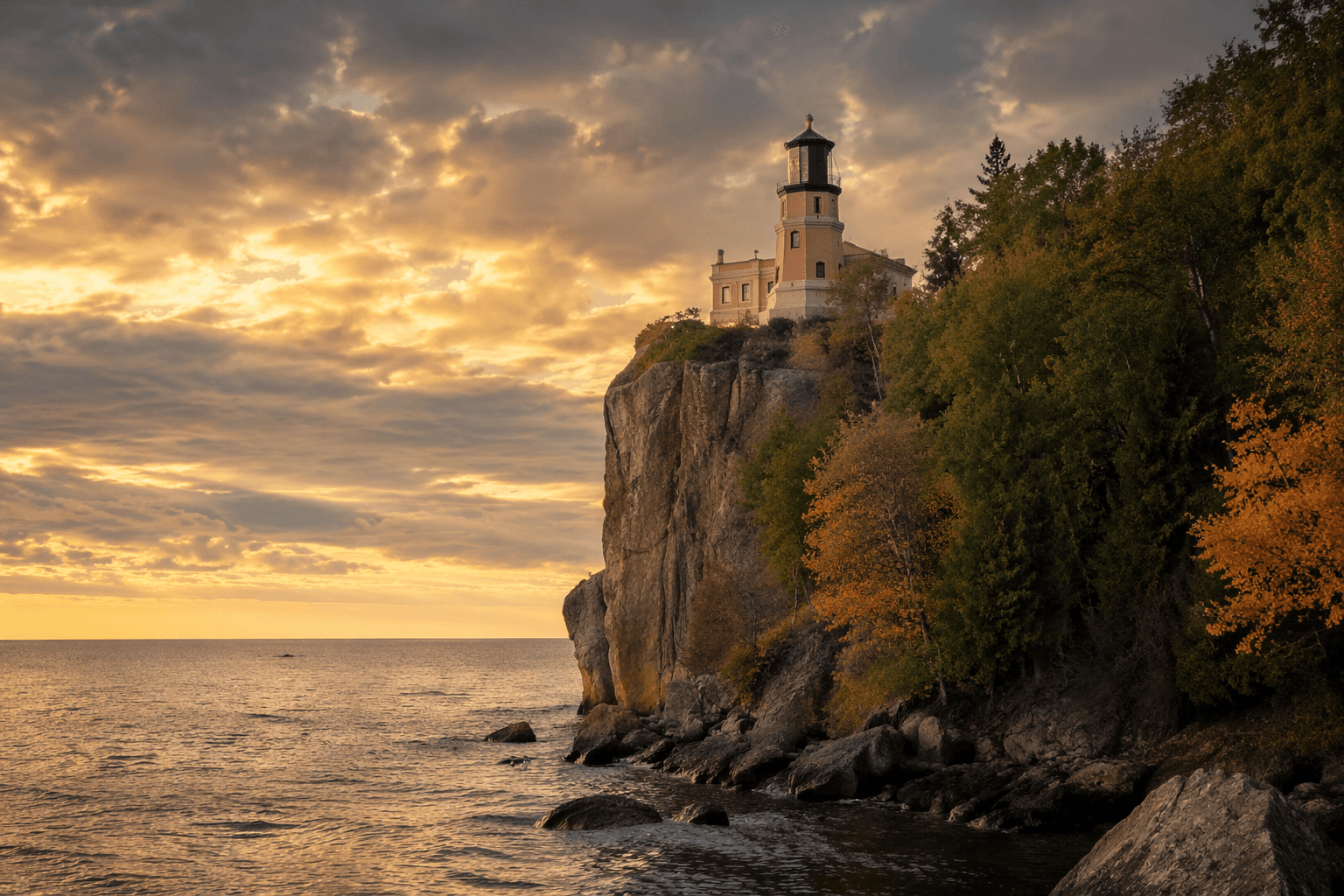
Congress approved $75,000 in 1907 for a fog and light station at or near the site, and the U.S. Lighthouse Service completed the 7.6-acre station in 1910. The lighthouse is generally credited to lighthouse engineer Ralph Russell Tinkham. It was built on a cliff about 130 feet above Lake Superior near Beaver Bay, with an official range of 22 miles. The surrounding rock face rises about 133 feet, a detail that explains both its value to mariners and the danger that made the location notorious.
Why this spot mattered so much
The North Shore’s geography made Split Rock essential. High cliffs gave keepers a commanding view of shipping lanes, but they also gave freighters almost no margin for error in bad weather. Minnesota Historical Society history notes that the lighthouse guided freighters safely across the stormy waters of Lake Superior for half a century, a reminder that the station’s purpose was practical before it ever became iconic.
The 1905 wreck tied most closely to Split Rock was the Madeira. It struck Gold Rock north of the present lighthouse at about 5:30 a.m. on Nov. 28, 1905, while the Edenborn grounded and broke in two nearby. The Madeira shipwreck later earned a place on the National Register of Historic Places in 1992. Those wrecks gave the site its lasting historical weight: Split Rock did not appear because the shoreline was beautiful. It appeared because the shoreline was deadly.
From working light to North Shore destination
For nearly 15 years, Split Rock could be reached only by water. That changed in 1924 when the Lake Superior International Highway opened, bringing land access for the first time. The road altered the lighthouse’s future in two ways at once: keepers could be supplied more easily, and visitors could finally reach the site without a boat.
By the early 1930s, about 5,000 people a year were visiting. By 1938, keeper Franklin Covell estimated nearly 100,000 annual visitors, about five times as many as any other station in the service. Coast Guard publicity later called it “probably the most visited lighthouse in the United States.” Those numbers help explain why Split Rock became part working aid, part public landmark long before its decommissioning.
In 1939, the U.S. Lighthouse Service became part of the Coast Guard, which still operates lighted aids to navigation today. Split Rock itself was decommissioned in 1969, the same year it was listed on the National Register of Historic Places. Two years later, in 1971, it became part of Split Rock Lighthouse State Park. The Minnesota Historical Society began administering the 25-acre historic site in 1976.
What visitors find today
The site today sits on Highway 61, about 20 miles northeast of Two Harbors, within Split Rock Lighthouse State Park. Minnesota Historical Society interprets it as both a maritime landmark and a window into the industrial history of the North Shore. Guided tours, exhibits, and a visitor center film connect the lighthouse’s engineering to the larger story of Lake Superior shipping and the weather that made the route so unforgiving.
That combination matters for Lake County because Split Rock is one of the county’s few places where geography, labor, and public policy are all visible in a single view. The 130-foot cliff is not just a dramatic overlook. It is evidence of how the lake forced builders to think in terms of line of sight, storm exposure, and distance. The 22-mile range was not abstract either. It was the difference between a freighter getting help in time and another name joining the lake’s long roll of wrecks.
A landmark shaped by loss and adaptation
Split Rock’s story is inseparable from the economic scale of Lake Superior shipping. The 112 steel freighters already moving ore in 1901 show how quickly the traffic was expanding, and the 1905 storm shows how fragile that system remained when weather turned violent. The lighthouse was an infrastructure response to a transportation bottleneck, much like a modern port improvement or highway project, except here the consequence was measured in shipwrecks and lives.
That is why Split Rock remains Lake County’s signature landmark. It carries the memory of the Madeira, the Edenborn, and the wider Mataafa Storm, but it also reflects the practical decisions that followed, from congressional funding to road access to historic preservation. A place that began as a warning light now serves as one of the North Shore’s most recognizable public sites, and it still tells the same story in plain view: on Lake Superior, danger came first, and the landscape changed because of it.
This article was produced by Prism’s automated news system from verified source data, official records, and press releases, then run through automated quality and moderation checks before publishing. The system is built and supervised by the people who set the standards it runs under. Read our full AI policy.
Did this article answer your question?


