Trinidad Welcome Center guides visitors to parks, trails, and history
Trinidad’s Welcome Center is more than a roadside stop, linking I-25 travelers and locals to downtown, the Riverwalk, and the city’s outdoor core.
A gateway on Nevada Avenue
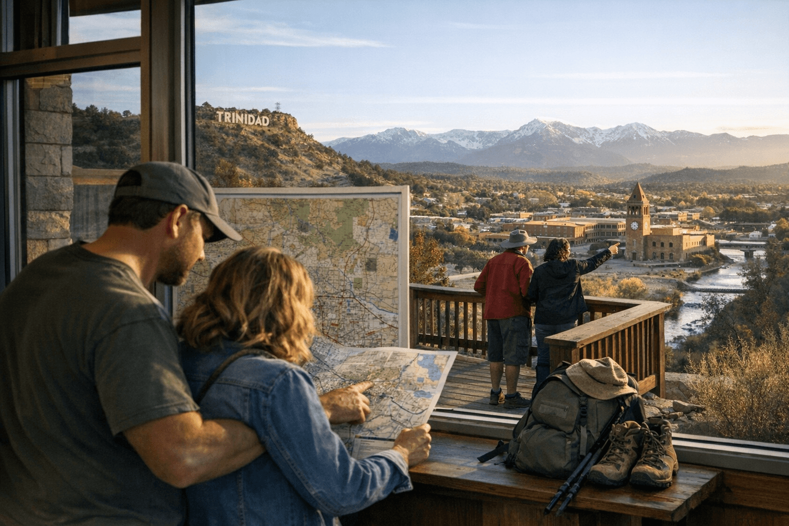
The Trinidad Welcome Center is the place where the city’s first impression becomes a practical one. Built in 1986 and sitting at 6,480 feet above sea level, it is located just off Interstate 25 at 309 Nevada Avenue, where northbound travelers get their first official look at Colorado through Trinidad. The state describes it as Colorado’s first official welcome center, and that status still matters because it gives the city a front door for visitors heading toward parks, trails, history, and downtown.
The center is built for more than a quick pause. It offers outdoor picnic space, internet access, clean rest rooms, limited RV parking, a children’s play area, and a Travel Shoppe. Volunteers provide free maps, local and state brochures, state visitor guides, Colorado Parks and Wildlife information, and state park information, which makes the stop function like a practical orientation desk for anyone trying to understand Trinidad and the region around it.
What the Welcome Center actually does
For people passing through Las Animas County, the Welcome Center is the handoff point between highway travel and the city core. It helps visitors sort out where to go next, whether the destination is a trail, a park, the historic downtown, or a state park farther out. That role is especially important in Trinidad, where the visitor experience is built around short distances and connected places rather than one isolated attraction.
The center also helps define how the city presents itself to people who may only have a few hours to explore. Free maps and state park materials make it easier to move from an arrival on I-25 to a walk downtown or an outing along the river, and the free summer Trinidad Trolley, which departs from the Welcome Center, adds another layer of access. For travelers and residents alike, the building works as a transit point, an information source, and a launch pad.
The Riverwalk as Trinidad’s daily route
If the Welcome Center is the doorway, the Riverwalk is the line that pulls people deeper into Trinidad. The Riverwalk follows the Purgatoire River for 3.5 miles through town, giving the city a visible public corridor where walking, fishing, and tubing can all happen in the same stretch of landscape. Access points near City Hall, Jay Cimino Downtown Park, and Waggin’ Tails Dog Park make the route easy to enter from several parts of the city.
That matters because the Riverwalk is not just a recreational feature for out-of-town visitors. It is one of the places where daily routines meet public space, whether someone is taking a walk near City Hall, stopping by the downtown park, or heading out with a dog at Waggin’ Tails. Steam Engine 638 near City Hall adds a historic marker to the route, tying the river corridor to Trinidad’s larger identity as a heritage town.
Parks, trails, and the city’s recreation network
Trinidad’s parks system gives the Welcome Center and Riverwalk a wider context. The city says it has about 80 acres of park space, two trails, a community center, an aquatic center, and access to the Riverwalk, which shows how much of Trinidad’s public life is organized around connected open spaces. The city’s recreation footprint is not large in acreage alone, but it is dense in access points and uses.
That network is still growing. The Boulevard Addition Nature Park was created to extend the Trinidad Riverwalk and eventually help connect the city to Trinidad Lake State Park, showing that the trail system is being built as a larger recreation spine rather than a single finished path. For a local reader, that means the city’s outdoor identity is not static; it is being shaped by links between downtown, river access, neighborhood parks, and the lake.
History is part of the route
Trinidad’s visitor materials make clear that the city wants people to see more than scenery. They emphasize the Santa Fe Trail, the historic downtown district, and the city’s frontier and coal-mining roots, which places the Welcome Center and Riverwalk inside a broader story about movement, settlement, and industry. The city is not presenting history as something sealed off in museums alone; it is tying that history to streets, trails, and public gathering places.
That approach gives the Welcome Center added weight. A traveler stopping there is not only getting a map to a park or trail, but also getting an entry point into Trinidad’s identity as a place where transportation, heritage, and outdoor access overlap. The city’s tourism materials use that mix to explain why the downtown core, the river corridor, and the highway-facing welcome center are all part of the same civic story.
How to use Trinidad’s visitor-friendly core
A simple way to move through Trinidad starts at the Welcome Center and radiates outward. Visitors can pick up maps and brochures, use the rest rooms, check state park information, and decide whether to stay downtown, ride the trolley, or head for the Riverwalk. From there, the city’s access points near City Hall, Jay Cimino Downtown Park, and Waggin’ Tails Dog Park make it easy to connect on foot to the Purgatoire River corridor.
- Stop at 309 Nevada Avenue for maps, brochures, and visitor guides.
- Use the free summer Trinidad Trolley if downtown sightseeing is next.
- Enter the Riverwalk near City Hall, Jay Cimino Downtown Park, or Waggin’ Tails Dog Park.
- Look for Steam Engine 638 near City Hall as part of the walk.
- Use the trail system as a link to broader recreation, including Trinidad Lake State Park.
Taken together, the Welcome Center, Riverwalk, and park system show a city that has built its public face around access, history, and movement. Trinidad’s value is not only in what visitors see first, but in how easily that first stop opens into the rest of the city.
This article was produced by Prism’s automated news system from verified source data, official records, and press releases, then run through automated quality and moderation checks before publishing. The system is built and supervised by the people who set the standards it runs under. Read our full AI policy.
Did this article answer your question?