Canyon Ferry Reservoir shapes boating, camping and fishing near Helena
Canyon Ferry is Helena’s closest big-water system, with ramps, marinas, campgrounds and fishing rules that shape weekend access, crowding and spending.
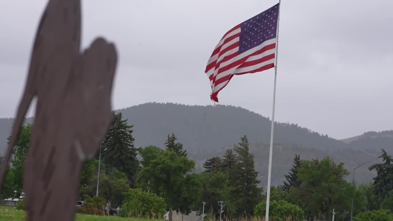
Canyon Ferry Reservoir spans 33,500 surface acres and 96 shoreline miles east of Helena, with a network of ramps, campgrounds, day-use areas and marinas. It pulls Helena-area boaters, campers and anglers east of town and shapes where local families launch, sleep and fish, and where they run into crowds, wakes and access rules.
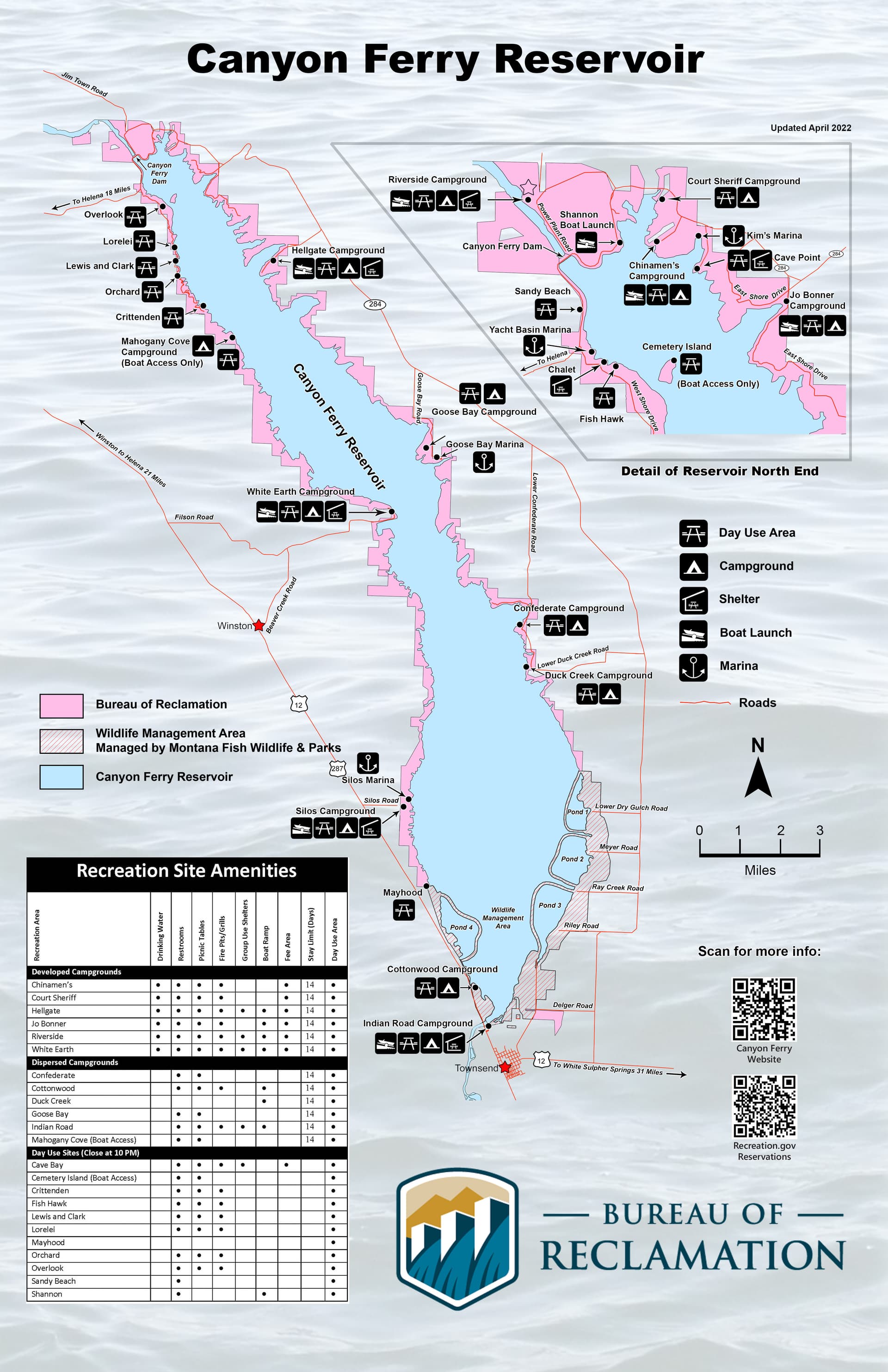
The public recreation map
Canyon Ferry sits about 20 miles east of Helena, where the shoreline spreads into 23 recreation areas, 12 campgrounds and 11 day-use areas. The Bureau of Reclamation’s recreation map also shows four marinas and boat-only destinations such as Mahogany Cove and Cemetery Island, which makes the reservoir feel much larger than the few spots most visitors know by name.
Concrete boat ramps, shelters, swimming access and campground facilities concentrate people in a handful of places. Group-use shelters and certain campsites operate under a reservation system, a detail that matters when family reunions, club outings or holiday weekends collide with high demand.
Canyon Ferry draws visitors from both the Helena side and the Townsend side, so the reservoir functions as a regional outdoor corridor rather than a single local park. That steady pull turns launches, campsites and marinas into a year-round access network, with the spillover benefits showing up in fuel stops, groceries, bait counters and marina traffic around the county.
Fishing is the anchor, but not the only draw
Canyon Ferry is known for rainbow trout, perch, ling and walleye, and those species give the reservoir a use case that stretches well beyond summer boating. The Upper Missouri River Reservoir Fisheries Management Plan covers Canyon Ferry, Hauser and Holter reservoirs, plus the Missouri River from Toston to Canyon Ferry, with a goal of maintaining quality multi-species fisheries throughout the system.
The Missouri River reach from Toston Dam to Canyon Ferry Reservoir has been managed for wild trout since 1973, and the principal game fish there include rainbow trout, brown trout and walleye. That gives anglers two connected fisheries to think about: the reservoir itself, where boat access and shoreline access matter, and the river reach upstream, where a long-running wild-trout management strategy shapes expectations for catch and release and seasonal conditions.
Ice, wind, water levels and species behavior all change the fishing pattern across the year, which is why the reservoir keeps drawing local anglers after the camping crowd thins out.
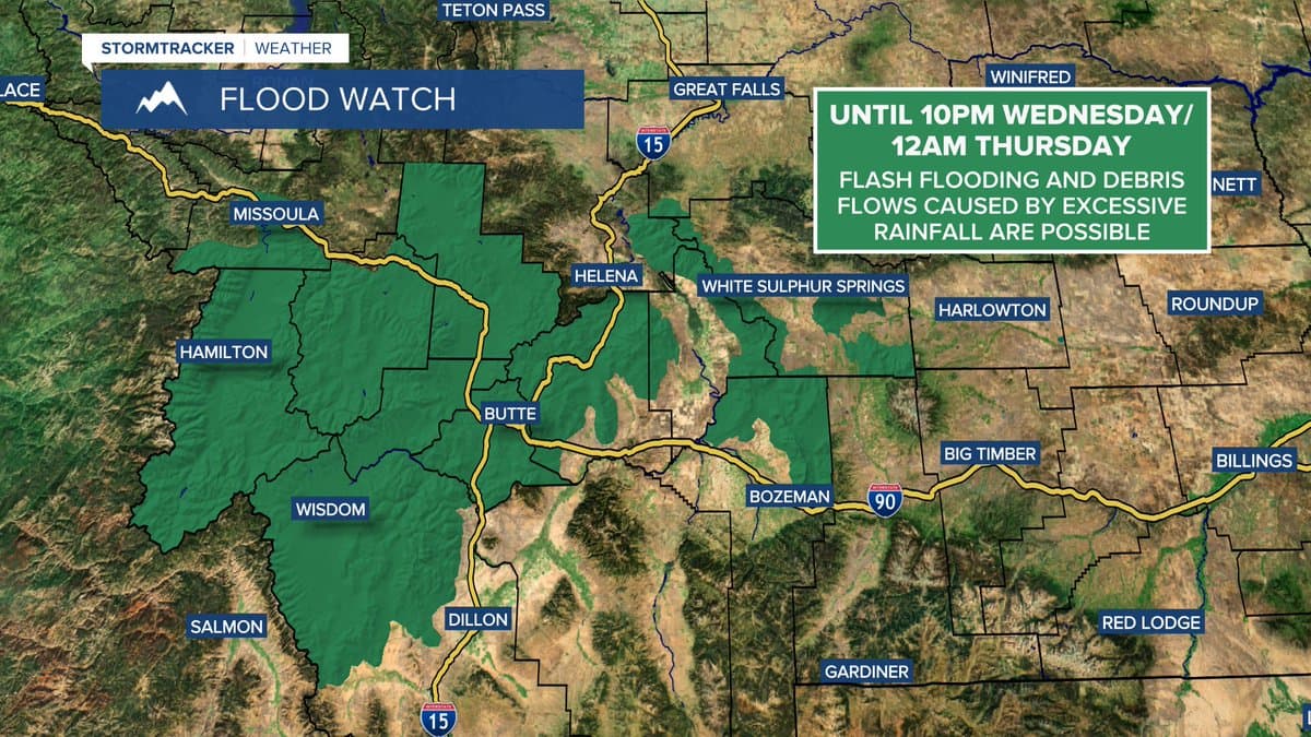
Why the rules matter on crowded water
Canyon Ferry is a federal recreation site, not an open stretch of water with no formal oversight. Public conduct regulations are posted under 43 CFR Part 423, the rule set that governs how visitors use the site and helps explain why the reservoir has defined recreation areas, managed access and boating expectations.
That framework becomes especially visible when congestion builds in the bays and near the docks. Montana Fish, Wildlife & Parks documents from 2018 and 2019 specifically cite controlled no-wake areas in Chinaman’s Bay, Cave Bay, Little Hellgate Bay, Magpie Bay, Shannon Boat Launch and White Earth, and public comments raised concerns about boat traffic, large wakes, dock damage and safety. The comments also pushed for 200- to 300-foot buffers near shore and docks.
Cave Bay, home to Kim’s Marina, shows how commercial access and public access intersect on the same water. Boaters, dock owners, marina operators and campers use the same water.
A reservoir built for more than recreation
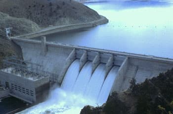
Canyon Ferry exists because the site was designed as a managed system with competing uses. The broader Canyon Ferry Unit integrates the dam, powerplant, reservoir and recreation functions into flood prevention, hydropower generation, irrigation, fish and wildlife habitat and public recreation.
The modern reservoir took shape through a long buildout. Construction on Canyon Ferry Dam began in May 1948 and finished in June 1954, the first power unit began operating in December 1953, and the first reservoir filling came in 1955.

The site’s earlier history runs even deeper. Canyon Ferry began as a ferry crossing in 1865, and a first dam was started there in 1896 by Samuel Hauser and Thomas Marlow to generate hydroelectric power for Helena. The original ferry business ended after that dam was built and a bridge was completed in 1899.
How locals get the most out of it
Different access points suit different kinds of days at Canyon Ferry. Boat ramps and marinas suit anglers and trailered boats, day-use areas work for quick swims and picnics, and campgrounds make the reservoir useful for weekends when a one-day trip is not enough. Boat-only spots such as Mahogany Cove and Cemetery Island also give regular users quieter water if they are willing to plan around access.
The same system that makes Canyon Ferry useful also concentrates pressure in a few high-demand places. On busy weekends, marinas, ramps and campsites draw people in, but they also create the wake conflicts, dock strain and crowding that trigger formal management.
This article was produced by Prism’s automated news system from verified source data, official records, and press releases, then run through automated quality and moderation checks before publishing. The system is built and supervised by the people who set the standards it runs under. Read our full AI policy.
Did this article answer your question?