Central Montana Records Windiest Start to a Year, Forecasters Say
Helena has averaged wind gusts above 30 mph since New Year's Day, the windiest start to a year on record, while Great Falls logged 13 high-wind events, a figure never before recorded.
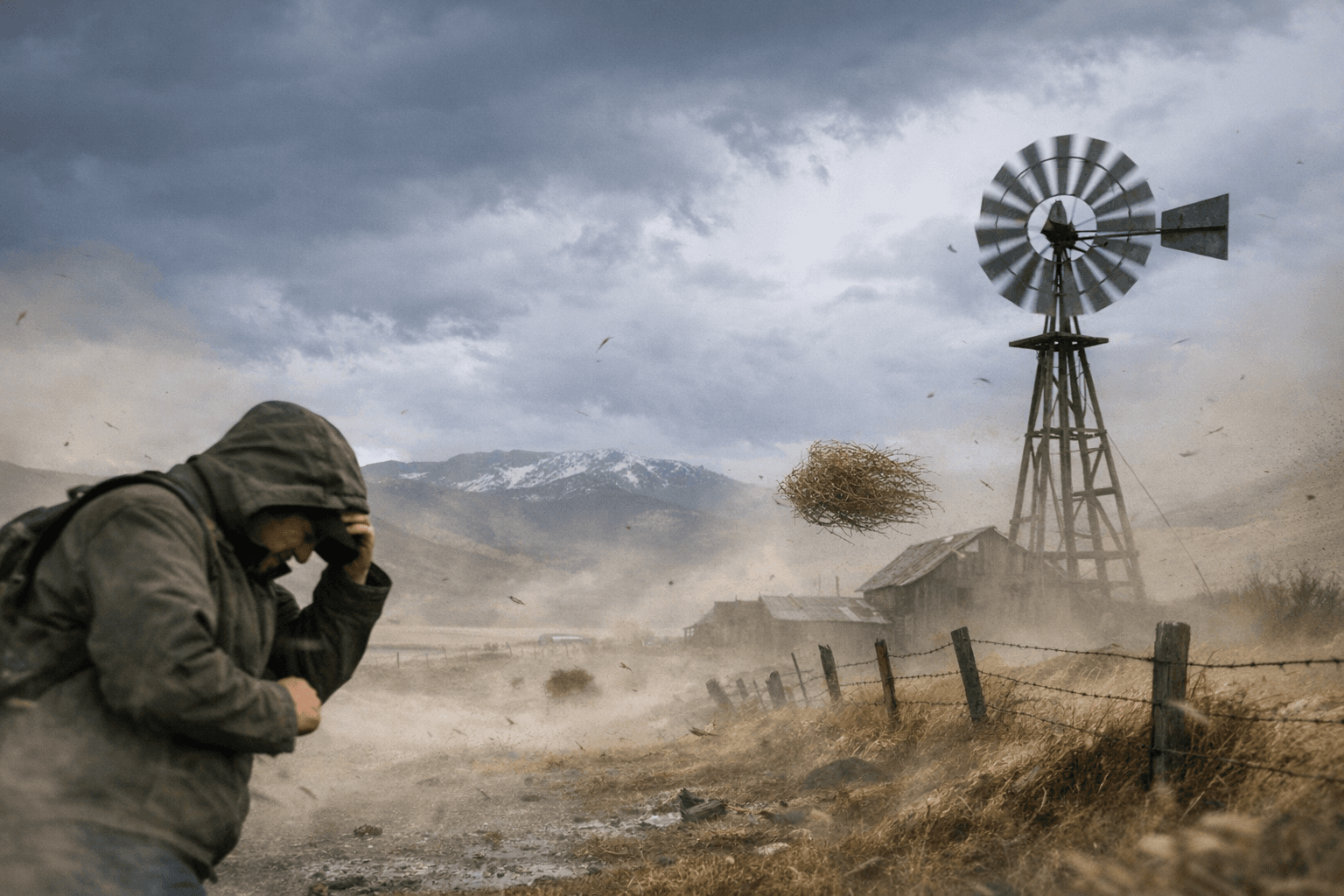
Three major wind events have rolled through central Montana since late 2025, driving Great Falls to an average gust speed exceeding 37 mph since January 1 and leaving Helena, typically cushioned by surrounding terrain, averaging more than 30 mph over the same stretch. Both figures represent the windiest start to a calendar year on record, according to National Weather Service data from the agency's Great Falls office.
The numbers tell a story beyond averages. Great Falls has logged 13 official high wind events this year, defined as gusts reaching 58 mph or greater, the highest total ever recorded for the January-to-March period. On March 19, the Salmond Ranch weather station, positioned roughly 25 miles west of Chouteau near the Rocky Mountain Front, registered a 106 mph gust, the strongest wind ever measured in Montana during March. Events of that severity typically strike the plains of central and north-central Montana only once every five to ten years. "The one thing that's been different about this year is we've had three major wind events," said Moldan, the lead meteorologist at the National Weather Service's Great Falls office.
The physics driving 2026 differs from a typical Montana wind season. A stagnant high-pressure ridge parked over the West has steepened pressure gradients as incoming Pacific storms arrive. An unusually active jet stream positioned directly over the state has channeled stronger gusts to ground level, and a depleted snowpack has increased surface heating, amplifying the effect. The transition to spring has not resolved the pattern. "There's light on the horizon. We're slowly starting to warm up. With warmth, spring still brings wind, so be prepared for more of it," Moldan said.
In Lewis and Clark County, the season's toll has been tangible. One storm knocked out power to thousands of Helena residents, brought trees down across the city, and generated an estimated $25,000 to $30,000 in tree-removal costs. Bill Roberts Golf Course sustained more than $10,000 of that total. Helena city urban forestry supervisor Chris Daly cautioned residents after that event to assess any fallen trees carefully, particularly those that may have come down near live power lines before approaching them.
On the roads, sustained gusts along exposed stretches of Interstate 15 create genuine blowover risk for semis, empty trailers, and RVs. The National Weather Service has issued repeated advisories targeting high-profile vehicles throughout the season. Checking the current NWS advisory board before traveling the corridor, especially during frontal passages, remains the most direct way for drivers to avoid getting caught in a sudden gust event.
The fire calendar adds urgency as the season shifts. Reduced snowpack and wind-driven surface heating are a combination that can push grass fire behavior beyond what initial attack crews can contain quickly. NorthWestern Energy activates its Public Safety Power Shutoff protocol when fire danger and wind reach critical thresholds, notifying affected customers by automated call, text, or email in advance. Homeowners should treat branch trimming near power lines and securing outdoor objects, from patio furniture to garbage bins, as a recurring task rather than a one-time spring chore. Renters should confirm with their landlords that the utility account holder's contact information is current, so shutoff notifications actually reach someone who can act.
Whether the record-setting pace levels off in April or extends further, Lewis and Clark County's infrastructure planners and fire officials are on notice that a stronger-than-average wind baseline may require adjusting seasonal response plans before next winter.
Know something we missed? Have a correction or additional information?
Submit a Tip