Helena Faces Breezy, Cloudy Wednesday With Mixed Snow and Rain Showers
Rain flips to snow over Helena by noon Wednesday, with National Weather Service gusts up to 31 mph timed squarely to the afternoon school pickup window.
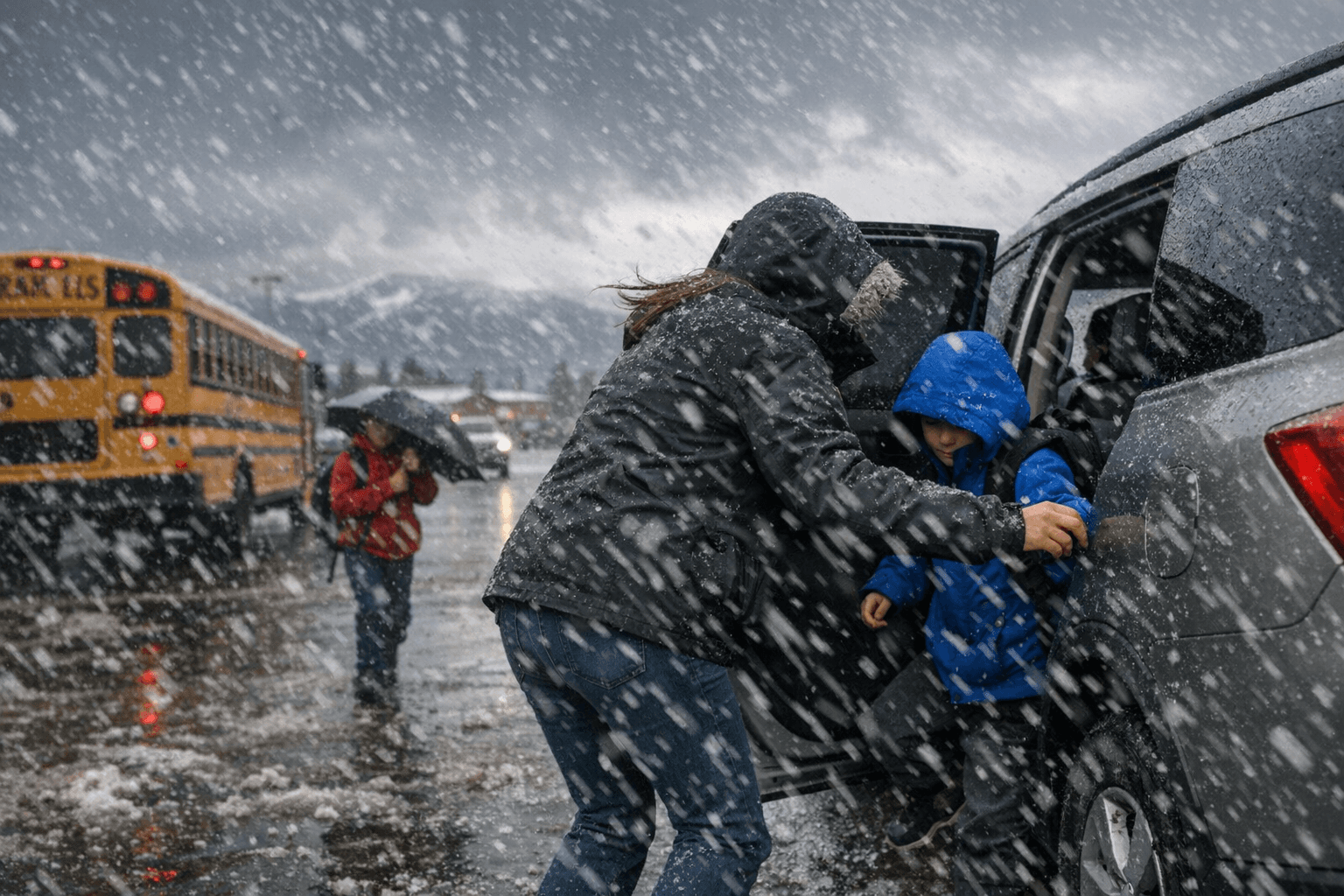
Rain will give way to snow over Helena by noon Wednesday, with National Weather Service forecasts putting the full transition directly on top of the afternoon school pickup window across Lewis and Clark County.
The sequence is precise: rain before 9 a.m., a mixed rain-and-snow window from 9 a.m. to noon, then snow through the afternoon. Temperatures are expected to hold steady around 38 degrees, just cold enough for precipitation to stick on untreated surfaces and bridge decks once the rain gives way. The NWS puts the chance of precipitation at 100 percent, though valley accumulation is expected to stay at little to no measurable snow. The hazard is less about accumulation than about the combination of wet roads and rising winds hitting their peak at the same time afternoon traffic builds.
Winds will start light and variable before shifting west at 10 to 15 mph through mid-morning, with gusts reaching up to 31 mph by afternoon. Those gusts are enough to push vehicles on open stretches and significantly cut visibility on higher-elevation routes. MacDonald Pass on U.S. Highway 12 will bear the worst of it, sitting several hundred feet above the Helena Valley with exposure to the full force of the westerly flow. Travelers heading toward Missoula should anticipate icier pavement, lower visibility, and a sharper wind chill above the pass compared to city streets below.
Canyon Ferry Road is similarly exposed during the transition window, particularly on north-facing stretches that drain heat quickly once skies stay overcast and precipitation shifts from rain to snow. The single most consequential hour to watch is between noon and 1 p.m., when roads that were merely wet from morning rain can tighten up fast as temperatures hold at 38 and snowflakes replace raindrops.
North-central Montana is expected to stay mostly dry, keeping Wednesday's moisture concentrated on the Helena area and the Continental Divide terrain immediately to the west. Conditions in the valley are forecast to ease by evening as precipitation tapers.
Know something we missed? Have a correction or additional information?
Submit a Tip