High Winds, Dry Conditions Raise Wildfire Threat Across Lewis and Clark County Wednesday
A cold front is pushing wind gusts up to 65 mph through the Helena area Wednesday, threatening to reignite dry fuels already scorched by multiple fires that burned across Lewis and Clark County last week.
A cold front sweeping through Montana on Wednesday brought with it one of the most dangerous fire weather setups Lewis and Clark County has seen this spring, with forecasters warning of gusts reaching 60 to 65 mph between Bozeman and Helena during the midday and afternoon hours.
The cold front moved through Montana on Wednesday, pushing the worst gusts to near 60 to 65 mph, with the peak of the wind and fire danger concentrated through the middle of the day into the afternoon. The timing was particularly alarming given the state of the landscape: relative humidity dropped below 15 percent, with sustained winds at 20 to 30 mph and gusts well above that, across dry fuels that never recovered meaningful moisture after a lean snowpack year.
A Fire Weather Watch was issued covering the East Beaverhead and Helena and Townsend Ranger Districts of the Helena National Forest below the snow line, with west winds of 20 to 35 mph and gusts of 50 to 60 mph expected alongside relative humidity values as low as 18 percent.
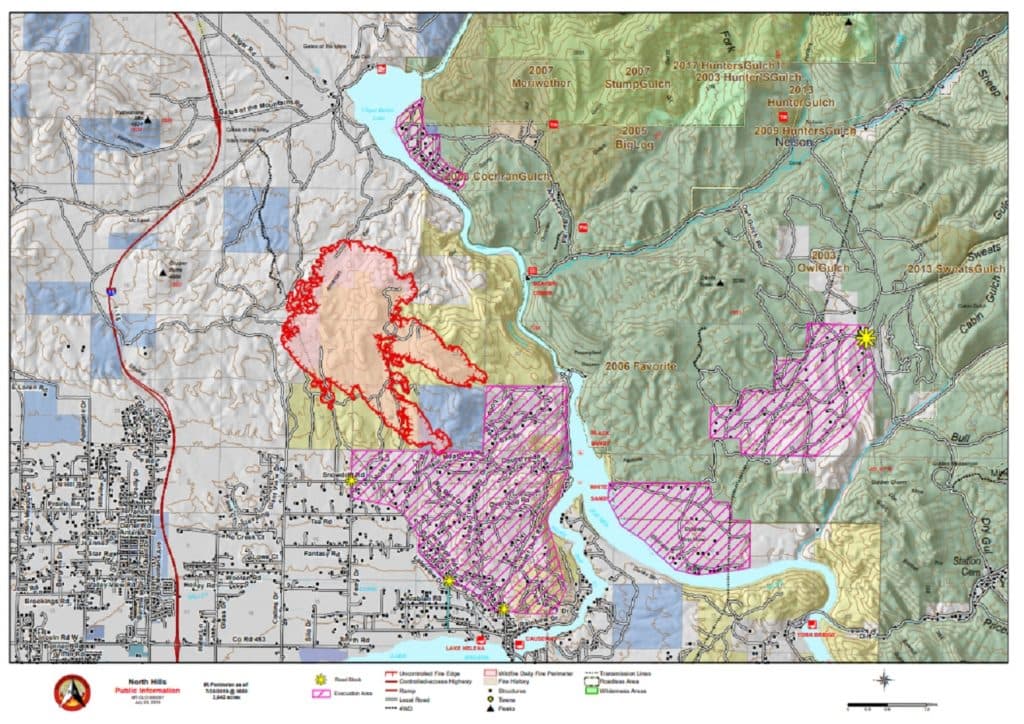
The warning arrived as Lewis and Clark County was already managing the aftermath of a destructive fire week. Two wildfires sparked on Friday, March 20, burning along and near Interstate 15 between Great Falls and Helena. The Rattlesnake Fire, located west of I-15 near the Gates of the Mountains exit, reached 80 percent containment after starting from an escaped debris burn and burning 47 acres. The Ordway Fire, northeast of Craig, grew to 185 acres with 50 percent containment; nine engines, one tender, one Type 1 helicopter, and two hand crews were working the fire as of Sunday.
March might seem early for fire season in Big Sky Country, but wildfires can happen at any point of the year in Montana. In late March, a Fire Weather Watch is unusual. Most years, residual snowpack keeps western valleys and eastern Front country tamped down well into April. But 2026 has been a different story: grass that cured out hard last fall never got the insulating snowpack it needed, and the region has already seen wind events that would have been remarkable in June.
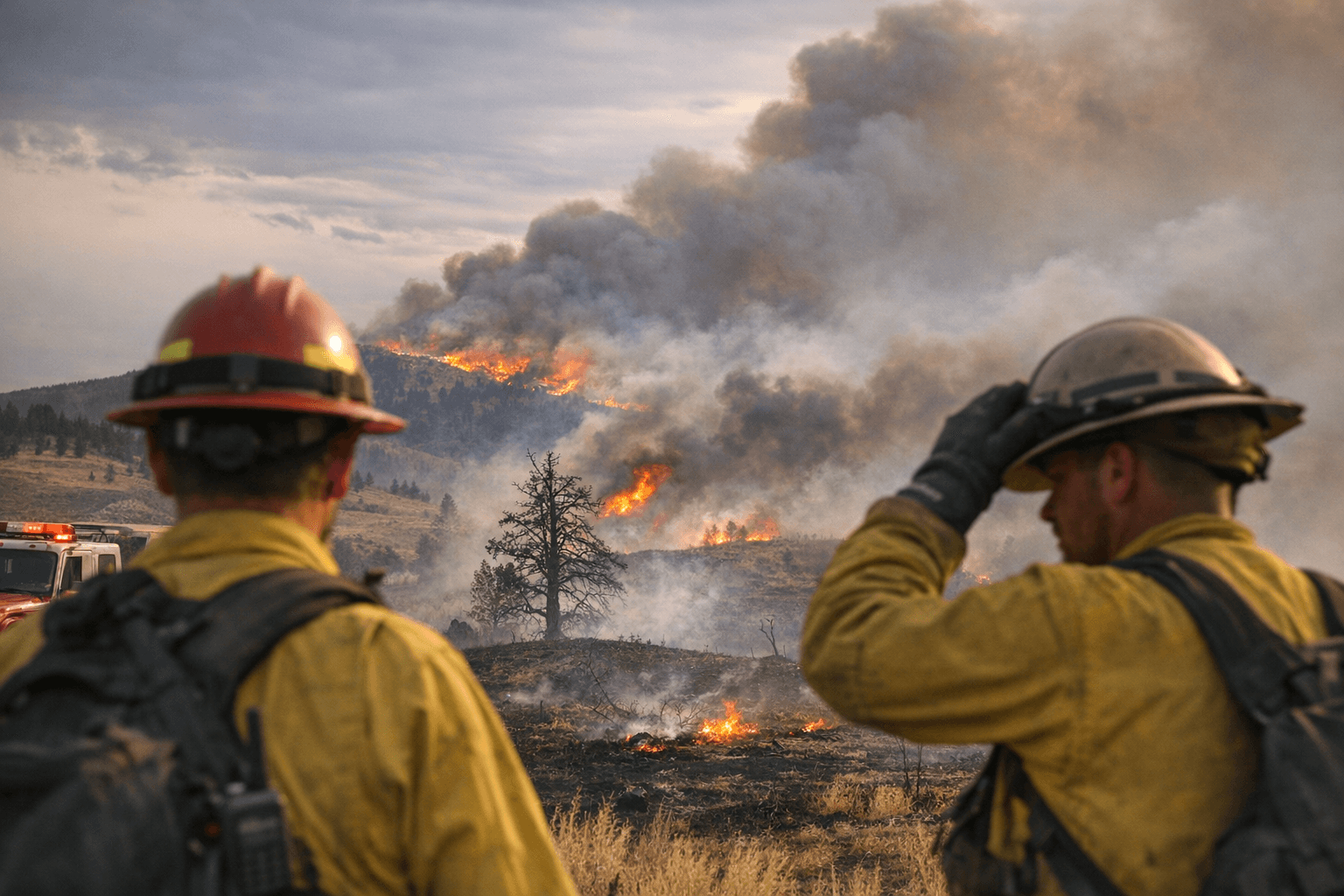
Open burning was closed in Lewis and Clark County following the recent fires. Wolf Creek/Craig Fire Rescue Chief Rocky Infanger, whose crews battled the Ordway Fire over the weekend, offered a stark assessment of the conditions. "We had the potential for catastrophic fire," Infanger said.
As temperatures cooled and humidity rebounded through the afternoon and evening Wednesday, fire danger was expected to decrease. Thursday was forecast to be a chilly day with some wind, but not as dangerous. Frontal passage was forecast to bring an end to the gusty conditions Wednesday evening, shifting winds from the west to the north-northeast.
For now, the concern centers on whether Wednesday's peak gusts could reignite smoldering fuels still burning in the Ordway and Rattlesnake fire areas, or push a new start into terrain that has no moisture buffer left to slow it.
Know something we missed? Have a correction or additional information?
Submit a Tip