Mount Helena City Park offers quick downtown access to trails
Mount Helena City Park puts more than 700 acres of trails above downtown, linking hikers, bikers and dog walkers to Helena’s busy trail system.

Mount Helena at the city’s edge
Mount Helena City Park is one of the clearest reasons Helena stands out as a trail town. From the Last Chance Gulch Mall, the mountain rises about 1,300 feet to a peak of 5,468 feet, placing a major outdoor escape within walking distance of downtown.
That access matters because the park is not just scenic open space. Visit Helena describes Mount Helena as part of the city’s downtown outdoor experience, where hiking, biking and mountain views sit beside the Walking Mall, historic buildings, restaurants, galleries and museums. In a city shaped by both gold-rush history and modern recreation, the park functions like an extension of downtown rather than a separate destination.
What the park offers on the ground
Mount Helena City Park is listed by Visit Helena as having six trails and more than 600 acres to explore, and the same tourism material says the park is more than 700 acres in size according to Prickly Pear Land Trust. That places it among the largest city parks in the country and, by Visit Helena’s account, the second-largest city park in the United States behind Central Park’s 840 acres.
The trailhead includes an information kiosk that lays out the park’s many routes, which helps if you are deciding between a summit push or a shorter outing. The 1906 Trail is one of the most popular ways to reach the top, while the Powerline trail is known for being short and steep. That mix gives the park real flexibility: you can turn it into a quick workout, a longer hill climb or a family hike with a summit payoff.
A working trail system, not a single park
Mount Helena is best understood as part of Helena’s broader South Hills Trail System. Visit Helena says that system includes Mount Helena, Mount Ascension, the 1906 Trail to Prairie Trail and other multiuse routes used by hikers, bikers, trail runners and dog owners.
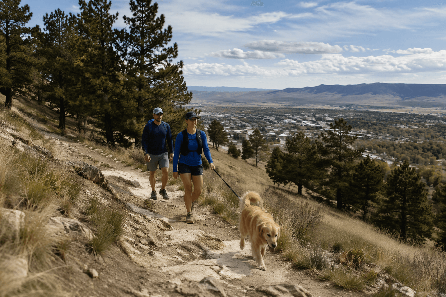
The scale is what makes the system so important to everyday life in Helena and Lewis and Clark County. Visit Helena says Helena has over 150 miles of trails surrounding the city, including 75-plus miles of singletrack in the South Hills, 50-plus miles in the North Valley, the Continental Divide Trail west of town and countless trails in York. Another tourism feature says the South Hills alone offers more than 80 miles of trails accessible from downtown. For people who want a trail run before work, a walk after dinner or a weekend climb without a long drive, that kind of access is the point.
Who uses Mount Helena
Mount Helena draws a broad mix of users, and that shared use is part of its identity. Walkers, trail runners, cyclists, families and dog owners all use the system, along with climbers headed to the park’s rock features. Visit Helena also notes that some trails connect to the national forest, which expands the park’s role beyond a city boundary and into the larger foothill landscape around Helena.
Dog owners should pay attention to the rules. Visit Helena says dogs are allowed on the trails, but leash rules apply near trailheads and dogs must be on a leash or under voice control on the trails. The same guide says dogs need to be kept on leash within 100 yards of the trailhead. That detail matters on a route that attracts a lot of traffic, especially where hikers, runners and bikes all share the same corridor.
Trail choices, from summit views to steeper climbs
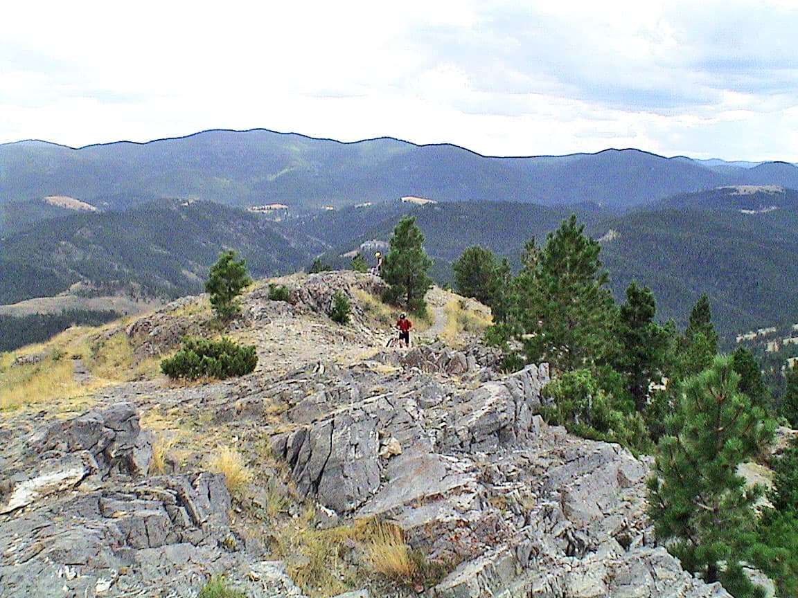
If you want the classic Mount Helena experience, the 1906 Trail is the route Visit Helena highlights for summit access and panoramic views. The park’s summit gives a strong reward for the climb, with views that look out over Helena and the valleys beyond. For something shorter and more demanding, Powerline delivers a steep effort in a compact format.
The trails also connect to one another in ways that let you tailor a visit to your time and energy. You can go up one route and come down another, including the Hogback Trail and Prospects Shaft Trail mentioned in Visit Helena’s adventure-town guide. That kind of variety is one reason the mountain serves both casual users and locals who want a repeatable workout close to home.
Beyond hiking: climbing, bikes and multiuse terrain
Mount Helena is not limited to foot travel. Visit Helena says the climbing walls are about a mile from the parking area above Reeder’s Village on the 1906 Trail, giving the mountain another layer of outdoor use. The site identifies Red Slab, Sunset Slab, Vigilante Wall and Whit’s Wall, with wall heights ranging from about 60 to 120 feet.
Those climbing areas sit inside the same larger recreation network that supports biking and trail running. Helena’s reputation as a Silver-level Ride Center by the International Mountain Bicycling Association, along with its status as a Continental Divide Trail Gateway Community, helps explain why the city markets trail access as part of its identity. Mount Helena is one of the places where that reputation becomes tangible on the ground.
Why this trail access keeps drawing support
Helena’s park system has grown into a major civic asset. Visit Helena says the city has one of the largest city park systems in the United States, with a combined 1,000 acres, and Mount Helena sits at the center of that story. The city’s history also feeds the appeal: Helena was born in the gold rush of 1864 and declared Montana’s territorial capital in 1875, leaving it with a downtown that blends old architecture and active public space.
That mix helps explain why trail fundraising remains active. Helena Ales for Trails raised $56,414.07 for the trail system in 2025, up from $20,000 in 2024. Those numbers show that the trails are not simply a scenic amenity; they are a community-backed infrastructure system that needs ongoing support to stay open, connected and usable for the people who rely on them.
For Helena, Mount Helena City Park is more than a pretty hill above town. It is a downtown-accessible trail system, a dog-friendly and multiuse recreation corridor, and a visible piece of the city’s identity. As the South Hills and the broader trail network continue to carry walkers, bikers, runners and families, the mountain remains one of the most practical ways Helena lives up to its reputation as a place where the outdoors begins close to Main Street.
Know something we missed? Have a correction or additional information?
Submit a Tip