Spring snow blankets Sterling’s edge, reduces visibility in Logan County
Big snowflakes and low visibility hit Sterling’s edge as a spring storm spread across Colorado, while road conditions improved west of Logan County.
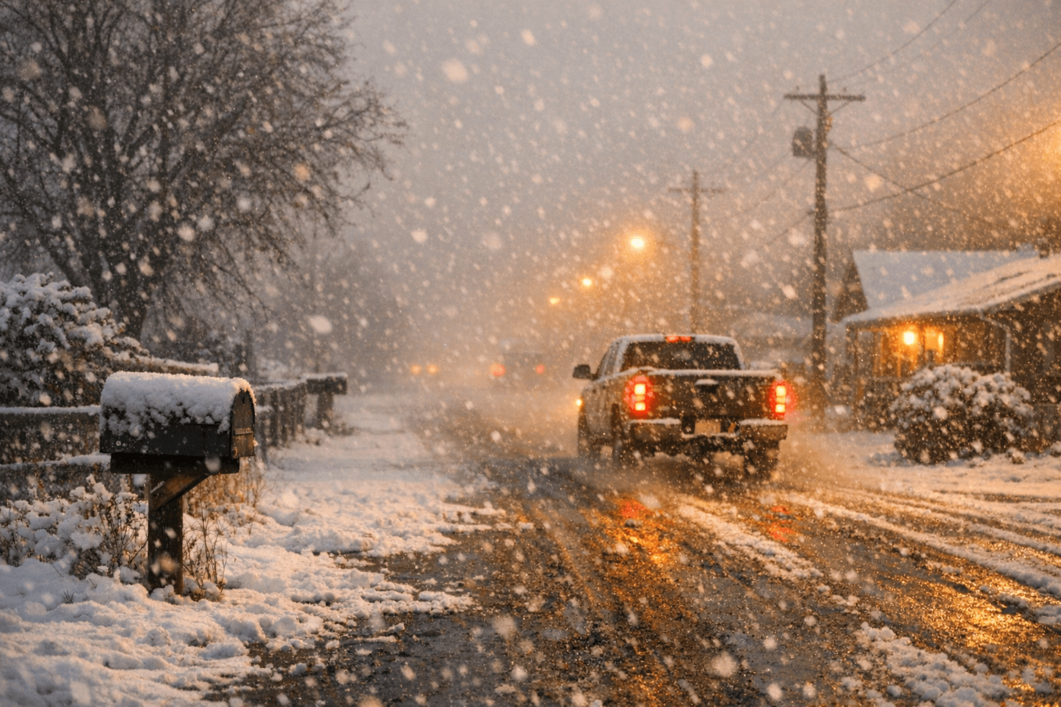
Big snowflakes cut visibility at Sterling’s edge Friday as a fast-moving spring storm pushed across northeastern Colorado, turning travel on Logan County roads into a low-visibility, wet-snow drive for a stretch of the afternoon. The immediate concern for drivers was not deep accumulation in town, but the sudden drop in visibility and the slick, slushy conditions that came with it.
The National Weather Service Denver/Boulder office was tracking winter-weather impacts in Logan County and surrounding areas as the system moved east, using its Northeast Colorado Winter Weather Decision Support page and Logan County weather page to monitor hazards, radar and advisories. The broader storm brought snow, wet slushy roads and cold conditions across Colorado, with Denver7 reporting that totals ranged from 6 inches in Roxborough Park to 3.5 inches at Denver International Airport and less than an inch in Littleton.
By 4:14 p.m. MDT on April 17, the weather service said the Winter Weather Advisory for Jefferson and West Douglas counties above 6,000 feet, and Gilpin, Clear Creek and Northeast Park counties below 9,000 feet, was canceled. The agency said snow had mainly moved out of the advisory area and road conditions were improving, though a few lingering light snow showers were still possible. For travelers on the eastern plains, including Sterling and the highways that feed Logan County, the message was clear: the band had moved on, but the late-day commute still carried the effects of a spring system that had not finished with the region.
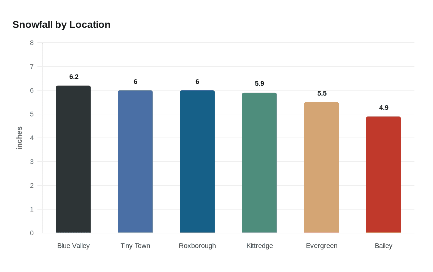
Storm reports collected April 17 and 18 showed how substantial the system was west of the plains. The National Weather Service logged 6.2 inches near Blue Valley, 6.0 inches near Tiny Town, 6.0 inches near Roxborough Park, 5.9 inches near Kittredge, 5.5 inches south of Evergreen and 4.9 inches near Bailey. Those totals underscored how much snow the Front Range and foothills absorbed even as Sterling sat on the outer edge of the band.
The April snow came after what Colorado weather coverage described as one of the warmest, driest winters on record, making the sudden change feel sharper for drivers and farm-country commuters alike. In Logan County, the storm was less about a major snowfall total than about a quick reminder that spring on the plains can still interrupt the day with reduced visibility, slick pavement and a sudden need to slow down.
This article was produced by Prism’s automated news system from verified source data, official records, and press releases, then run through automated quality and moderation checks before publishing. The system is built and supervised by the people who set the standards it runs under. Read our full AI policy.
Did this article answer your question?