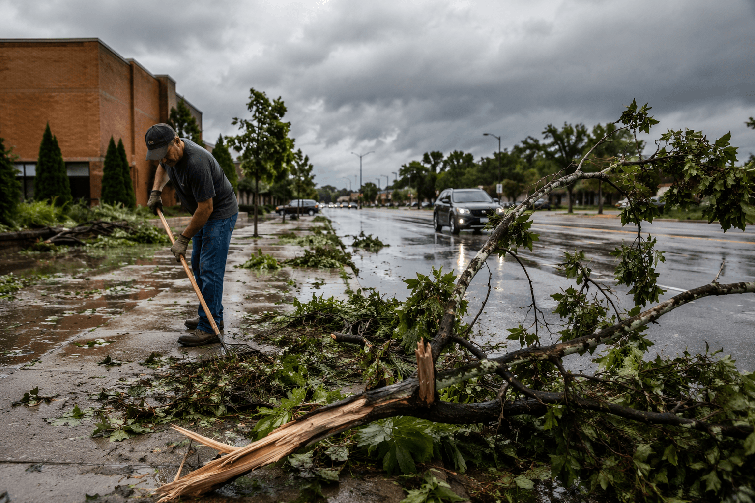
Sterling cleans up after hailstorm as more severe weather looms
Sterling residents were clearing branches and shattered glass Tuesday as forecasters warned of another round of storms capable of baseball-size hail and flash flooding.

Sterling spent Tuesday morning cleaning up broken glass, downed branches and roof damage after a hailstorm moved through Monday evening, while National Weather Service forecasters warned that another round of severe weather could arrive before the day was done. The damage already visible in town and around Logan County turned the forecast into a public-safety problem, not just a summer weather alert, with roads, power, farm work and cleanup crews all facing another round of disruption.
At 5:34 a.m. Wednesday, the National Weather Service in Denver and Boulder said the eastern plains were still holding onto a moist, unstable air mass with ample shear. Forecasters said scattered to widespread thunderstorms could develop by late afternoon and early evening, and the strongest storms could produce hail larger than 2 to 3 inches in diameter. A separate hazardous weather outlook issued at 6:38 a.m. said strong storms were likely again from Wednesday afternoon into the evening across much of south-central and southeastern Colorado, with the main threats listed as large destructive hail, severe winds and a slight tornado risk.
The timing window stretched from about 1 p.m. MDT until as late as 5 a.m. MDT if conditions lined up, leaving little room for residents, ranchers and commuters to assume the skies would stay calm through the evening. Forecasters also warned of localized flash-flooding concerns Wednesday and Thursday because of antecedent precipitation, a problem that can quickly turn county roads, low-water crossings and drainage ditches into hazards just as families are trying to finish cleanup from the earlier storm.
The urgency was not theoretical. Preliminary storm reports from Tuesday night showed hail estimated at 3.00 inches in Wiggins, in Morgan County, at 8:56 p.m., followed by 2.75-inch hail a minute later. The same report noted that a law enforcement vehicle and a camper were destroyed by large hail in the Kiowa Park subdivision, underscoring the damage potential across northeastern Colorado when storms intensify.

The region has seen this before. A National Weather Service event summary for June 8-9, 2020, documented severe thunderstorms that moved through northeast Colorado and produced 1-inch hail in Sterling, and another summary from June 28, 2023, recorded very large hail over portions of Logan and Phillips counties. For Sterling and the eastern plains, that history makes the current round of storms a continuation of an active severe-weather pattern that can hit homes, vehicles, crops and emergency operations in a matter of minutes.
This article was produced by Prism’s automated news system from verified source data, official records, and press releases, then run through automated quality and moderation checks before publishing. The system is built and supervised by the people who set the standards it runs under. Read our full AI policy.
Know something we missed? Have a correction or additional information?
Submit a Tip