Menominee County explains permits for work near lakes and rivers
Before you build near a lake or river, Menominee County says to check permits first. The 75-foot shoreline rule and 300-foot zone can stop costly rework.
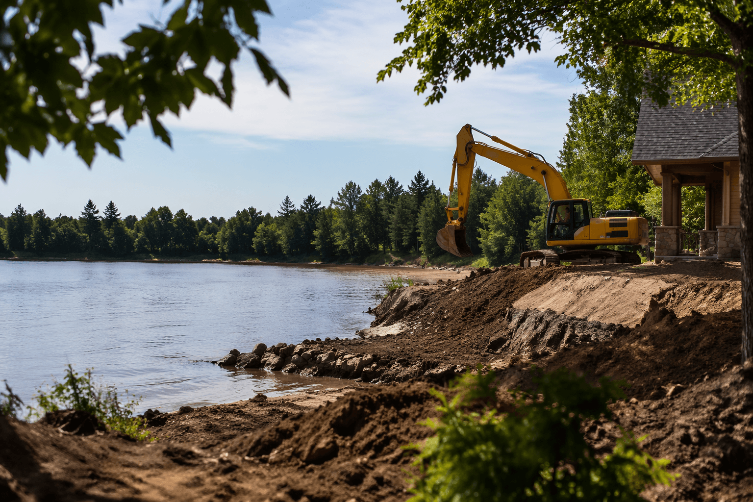
Most work within 75 feet of a Menominee County lake or river requires a permit or is not allowed. The first call before any dock, shoreline repair, grading job or small building project near county water is the Land Conservation/Zoning Department, because work near lakes and rivers can fall under the county zoning ordinance, the shoreland protection rules, or both.
Start with the 75-foot line
Inside that 75-foot strip, common site changes such as fill, grading, excavating, vegetation removal and other clearing require a permit or are not allowed.
That 75-foot strip is where many waterfront plans go sideways. A property owner may think a project is too small to matter, but the county treats the shoreline as a regulated edge, not an open work zone. If the project changes ground level, removes roots and cover, or clears space near the water, it belongs in the permit conversation before a shovel goes in the ground.
Check the 300-foot zone before you harden the site
Impervious surfaces and related land uses within 300 feet of surface waters need permits. The shoreland review is not limited to the narrow area right at the bank. It reaches well back from the water and covers the hard surfaces that keep rain from soaking into the ground.
For waterfront owners, that means a project can trigger review even when it feels inland. A new hard surface, an expanded driveway, a patio, a pad, or another change that adds runoff risk may need a permit if it falls within that 300-foot zone.
Know which county rule applies to your land
All lands within Menominee County's jurisdiction, including taxable or fee lands, are zoned and governed by the Menominee County Zoning Ordinance adopted on April 15, 1999. For non-tribal lands near surface waters, County Ordinance No. 68, Shoreland Protection, also applies.
On parcels where property lines, water access and land status can be easy to misunderstand, the right first step is to identify not only what you want to build, but also what rule set covers the parcel. The county works with the Legend Lake Protection and Rehabilitation District, the LaMotte Lake Association, the Legend Lake Property Owners Association, the Moshawquit Lake Association and the Menominee Indian Tribe to protect water resources, so shoreline work can affect more than one local interest even when the project is private.
Call the Land Conservation/Zoning Department before you clear anything
The most useful local habit is also the simplest: contact the Land Conservation/Zoning Department before you start clearing, digging or reshaping the site. Activities such as fill, grading, excavating, vegetation removal and other clearing inside the shoreland setback area require that contact.
That early call helps sort out whether the project needs a county permit, whether the work is allowed as planned, and whether the layout should be changed before any expense is locked in. It also helps avoid the most common delay on waterfront jobs: starting construction as if the shoreline were ordinary upland, then learning the setback, impervious surface or clearing rules after the work is already underway.
Typical mistakes that slow waterfront projects
The projects that stall most often are the ones that begin with assumptions. Property owners may assume the work is too close to the water to matter only for big structures, when the county rules also cover grading, excavation, vegetation removal and other clearing. Others focus on the building itself and forget that impervious surfaces within 300 feet can also trigger permits.
Another common mistake is waiting until after design or contractor scheduling to check the shoreland rules. In a shoreline setting, that can mean redesigning a driveway, moving a retaining feature, or reducing the amount of disturbed ground after money has already been spent. The better approach is to treat the permit review as part of the first sketch, especially on lots where the water line, slope and access area all compete for space.
Shoreline stabilization may also bring in state permits
Not every waterfront project is only a county matter. Shoreline stabilization may also involve Wisconsin Department of Natural Resources permits. That means a project designed to stop erosion or protect the bank can still face a second layer of review, especially when the work changes the shoreline itself.
A plan that protects the bank, limits disturbance and keeps runoff under control has a better chance of moving through review cleanly than one that is built around bare soil, wider hard surfaces or repeated clearing. Wells also deserve attention when a project changes the ground close to the water, because shoreline grading and excavation can affect the same area where homeowners rely on clean, stable land use.
Cost-share can reduce the out-of-pocket burden
Menominee County's Land and Water Resource Management Plan gives waterfront owners another practical reason to ask early questions. The plan was first developed in 2001, updated in 2004, 2007 and 2010, approved by the state board and county board in 2017, and implemented for 2018 through 2027. Under that plan, cost-share money is available for eligible projects, and some practices can receive up to 70% of eligible costs.
The county's cost-share structure can soften the hit when a project needs better stabilization, erosion control or other approved work that protects the shoreline instead of fighting it. It is not automatic, and it does not cover every project.
This article was produced by Prism’s automated news system from verified source data, official records, and press releases, then run through automated quality and moderation checks before publishing. The system is built and supervised by the people who set the standards it runs under. Read our full AI policy.
Know something we missed? Have a correction or additional information?
Submit a Tip