Menominee County spans several communities, not one central town
Menominee County works like five connected communities, with each place handling a different part of daily life, from government in Keshena to outreach in Neopit.
Menominee County makes more sense as a network of places than as a single town-centered map. The county shares its borders tightly with the Menominee Indian Reservation and the Town of Menominee, and the reservation itself is laid out around five main communities, Keshena, Neopit, Middle Village, Zoar and South Branch. That geography shapes where people go for government, school, archives, services and work, and it explains why the county’s daily life is spread across several anchors instead of concentrated in one downtown.
How the county fits together
The county sits between Langlade, Oconto and Shawano counties, but its internal map is more important for everyday use than its external edges. Menominee County’s 2020 Census population was 4,255, and 78.5% of residents identified as American Indian and Alaska Native alone. The median household income was $62,108, and 18.1% of adults had a bachelor’s degree or higher, figures that help show a small county with a strong tribal presence and a local economy shaped heavily by tribal institutions.
That local structure also explains why county materials and tribal history do not describe the same place in exactly the same way. The county identifies four main communities, Keshena, Neopit, Zoar and the more scattered South Branch, while the tribe’s own history adds Middle Village to that list. In practice, those names are not competing labels so much as different ways of describing where people live, where offices are located and how services move across the reservation and county.
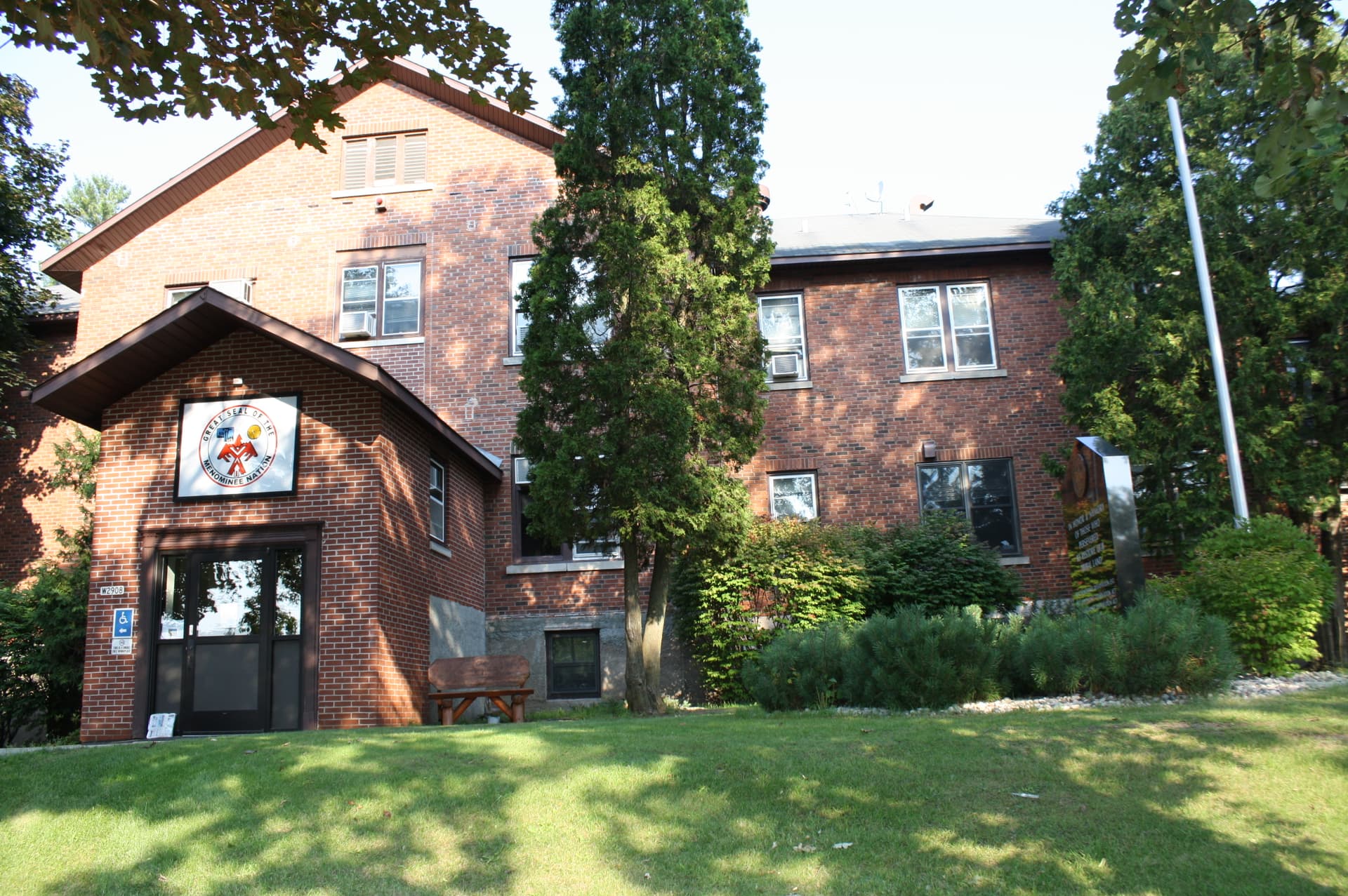
Keshena is the county’s clearest center of gravity
If you need one place to start, it is Keshena. The Menominee Tribe says its seat of government is there, about 45 miles northwest of Green Bay, and Keshena is also the county seat of Menominee County. The community had a 2020 Census population of 1,257, making it the largest named population center in this county-sized geography.
Keshena also concentrates education and public access in a way the rest of the county does not. The College of Menominee Nation has its main campus there, and the S. Verna Fowler Academic Library/Menominee Public Library is a joint effort of the college, the tribe and the county. The building opened in 2008 and merged with the public library in 2012, bringing together a reading room, a youth area and a Special Collections Archive that holds unique documents and records on tribal and regional history.
That mix matters because Keshena is not just an administrative stop. It is where local decision-making, higher education, library access and historical records come together in one place, which is why residents often think of it as the county’s practical hub.
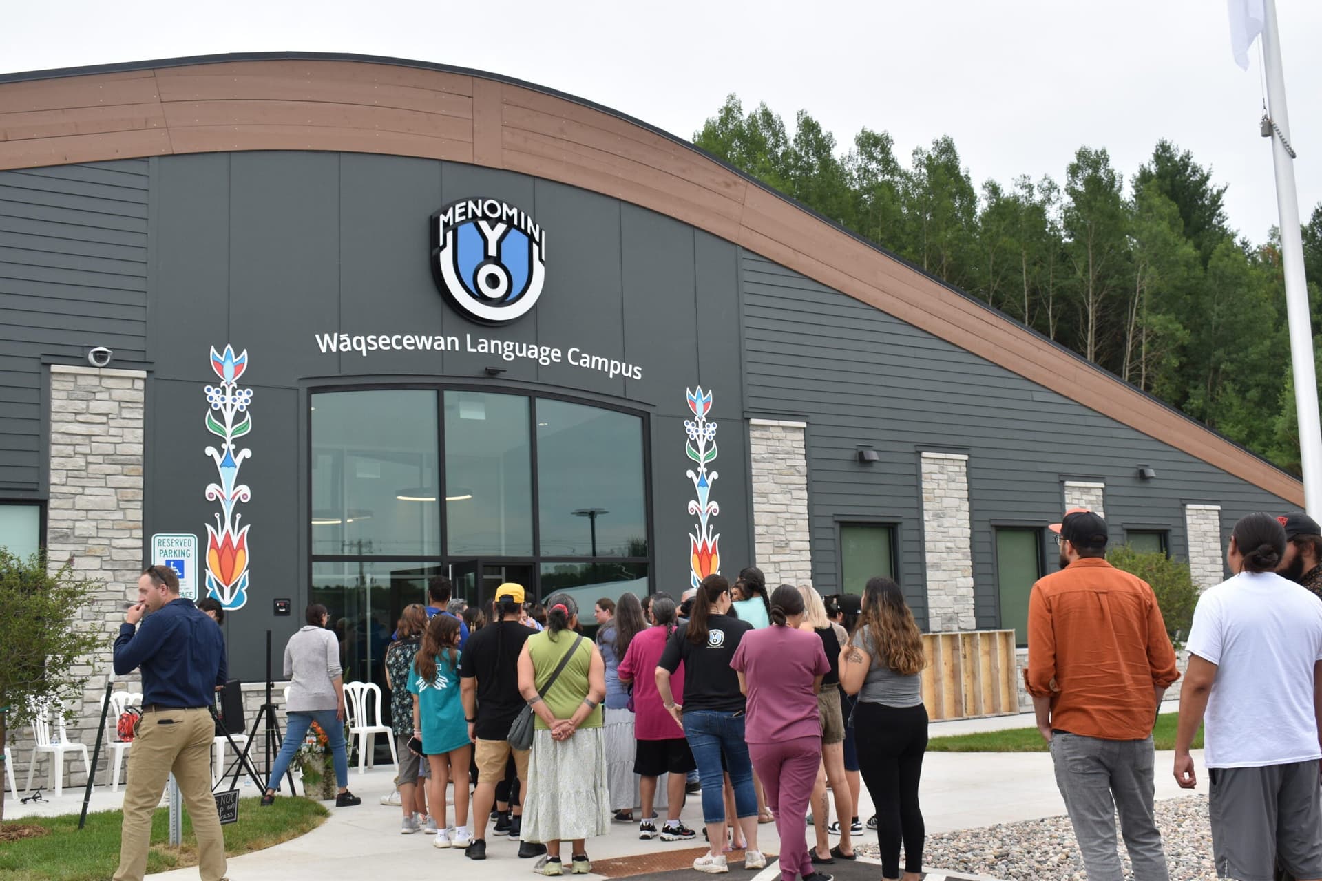
Neopit is where outreach is taking shape
Neopit has emerged as a different kind of center, one built around access and expansion rather than classic downtown functions. The College of Menominee Nation announced plans in 2024 to purchase the former Menominee Tribal Enterprises office building in Neopit, a 10,500-square-foot wood-log structure that had long been used for administrative purposes. The college said the project would expand capacity for community members in Neopit and nearby Zoar and Middle Village.
The timeline shows how the work has moved from planning into implementation. CMN has engaged with the Neopit community since 2022, held listening sessions in late December 2024 with the architectural firm EUA, and on January 14, 2026, announced progress on the Neopit Outreach Center remodel along with the hiring of a coordinator to lead local programming. Neopit’s 2020 Census population was 616, which gives the outreach effort a clear local scale: it is designed for a community large enough to need dedicated access, but small enough that a single building can change how services are delivered.
For residents, that means Neopit is becoming a place where training, programming and support can land closer to where people actually live. It is a reminder that in Menominee County, service delivery is not an abstract countywide concept. It is a building, a coordinator and a set of listening sessions tied to a specific community.
Zoar, Middle Village and South Branch keep the county connected
Zoar, Middle Village and South Branch round out the county’s lived geography, even when they do not command the same concentration of offices as Keshena. Zoar is the easiest of the three to locate on a map: it had a 2020 population of 107 and sits about 3 miles northwest of Neopit along Wisconsin Highway 47. That makes it a small but important point of reference for travel, errands and daily movement between communities.
Middle Village and South Branch work differently. They are part of the tribe’s five-community framework, and South Branch is described in county materials as more scattered. That spread is exactly why a town-centered mental map can be misleading here. People often move through several communities in a single day for work, school, health care, library access or tribal business, rather than staying inside one central business district.
The county’s own economic footprint reinforces that pattern. Menominee Nation is the largest employer in Menominee County, so tribal government, tribal enterprises, education and related services shape both where people work and where they go for help. The tribe’s public-service reach also includes law enforcement, courts, healthcare and social services, which makes its institutions central to daily life in a way that goes well beyond cultural identity.
The history behind today’s map
Menominee County’s geography is inseparable from the tribe’s legal history. The Menominee Tribe says its story begins at the mouth of the Menominee River, about 60 miles east of the present reservation, and its historical materials point to treaties from 1836, 1848, 1854 and 1856 as part of the record that shaped the region. That history runs through termination and restoration, not just through land and place names.
Federal recognition was terminated and then restored by the Menominee Restoration Act, Public Law 93-197, signed on December 22, 1973. The tribe’s historical materials also point to the 1992 gaming compact as part of the modern legal framework. The reservation is on the ancestral homelands of the tribe’s 8,551 members, and that continuity helps explain why county lines, reservation lines and tribal governance overlap so closely.
Seen that way, Menominee County is not one town waiting for a main street to define it. It is a connected set of communities, each with its own role, linked by tribal government, county services, education and a shared history that still determines where local power, access and identity flow today.
This article was produced by Prism’s automated news system from verified source data, official records, and press releases, then run through automated quality and moderation checks before publishing. The system is built and supervised by the people who set the standards it runs under. Read our full AI policy.
Did this article answer your question?