Flood warning issued for Illinois River at Meredosia, minor flooding expected
Flood warning posted for the Illinois River at Meredosia as the river rose to 15.9 feet, with minor flooding expected and storm sewer impacts at 18 feet.
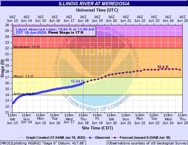
Rising water on the Illinois River pushed National Weather Service St. Louis to issue a flood warning for Meredosia in Morgan County, where the river was already at 15.9 feet and rising Thursday morning and minor flooding was forecast. The warning was set to take effect at 9 p.m. CDT on June 19 and remain in place until further notice.
The alert placed Meredosia alongside other Illinois River points under warning, including La Grange Lock and Dam, Valley City and Hardin. NWS forecast products said river stages were being watched closely and that the forecasts were based on observed precipitation and forecast precipitation for the next 24 hours, a sign that conditions could change as more runoff moves downstream.
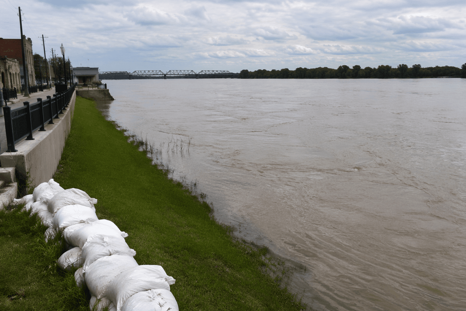
For Meredosia, the first practical impact is likely to show up in the village’s drainage and low-lying river-adjacent areas. The NWS flood product said that at 18.0 feet, the City of Meredosia plugs storm sewer outlets. That makes the stormwater system one of the earliest pressure points as the river continues to rise.
The gauge tied to the warning is the Illinois River at Meredosia, station MROI2, listed by the National Oceanic and Atmospheric Administration’s National Water Prediction Service. The gauge page was last updated June 18, underscoring active monitoring along the river corridor as water levels moved upward through the day.
Riverweather data for June 18 put Meredosia around 16.0 to 16.12 feet, close to the site’s minor flood stage of 17 feet. That same reference lists moderate flooding at 22 feet and major flooding at 24 feet, with a record crest of 28.86 feet for comparison.
The Meredosia gage is also identified by the U.S. Geological Survey as station 05585500, operated in cooperation with the U.S. Army Corps of Engineers St. Louis District. That multi-agency setup reflects how closely the Illinois River is being tracked as it approaches flood stage in Morgan County, where even a minor rise can quickly shift drainage, access and riverfront conditions.
This article was produced by Prism’s automated news system from verified source data, official records, and press releases, then run through automated quality and moderation checks before publishing. The system is built and supervised by the people who set the standards it runs under. Read our full AI policy.
Did this article answer your question?