Flooding threat lingers as Illinois River stays above stage
The Illinois River stayed above flood stage at Beardstown and other gauges Saturday, keeping low-lying roads, fields and riverfront property under threat.
Rivers across west central Illinois stayed elevated Saturday morning, when the National Weather Service Central Illinois hydrologic summary at 8:43 a.m. CDT put the Illinois River at Beardstown at 21.4 feet, Henry at 23.6 feet, Peoria at 20.4 feet, Havana at 19.8 feet, Kingston Mines at 18.9 feet and Copperas Creek at 18.0 feet after repeated heavy rain.
That level of water keeps Morgan County in a watchful posture even without a local gauge on every bend of the river. When the Illinois River stays above flood stage, travel near the water, farm access, and low-lying property all become more vulnerable, and river-adjacent businesses can be forced to work around water that does not recede quickly.
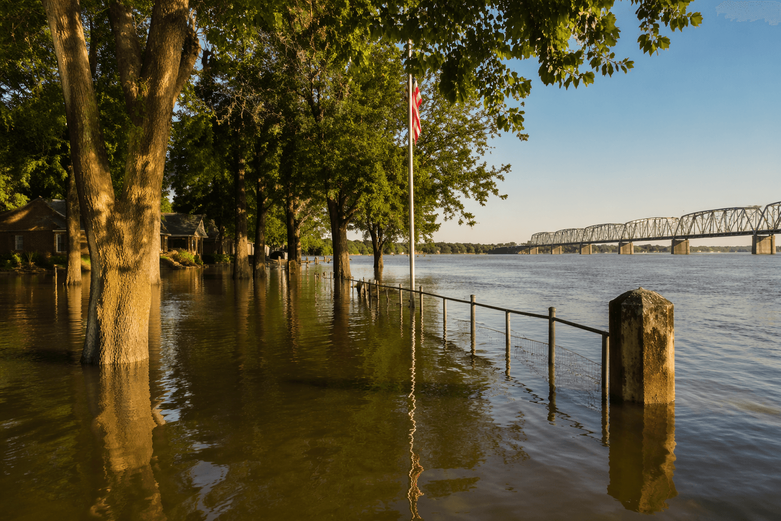
The National Weather Service flood monitor uses a color system that marks growing risk: yellow means a point will exceed action stage, orange means above minor flood stage, red means above moderate flood stage and purple means above major flood stage. By that measure, Beardstown was in moderate flood stage at 21.42 feet, while La Grange Lock & Dam, Valley City, Meredosia and Hardin were in minor flood stage. In the same river corridor, some low-lying roads in Pike County were closed and riverfront areas were underwater, showing the impacts were already moving beyond the gauge readings and into daily travel.
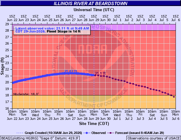
Beardstown’s normal river stage is 9.2 feet, and flood stage is 14.0 feet, according to the Illinois State Museum’s flood chart. The same chart records a crest of 29.78 feet on April 30, 1943, and 29.35 feet in 2013, a reminder that even a moderate flood stage can sit within a long record of serious river events.

For Morgan County, the practical takeaway is not abstract. Effective flood insurance rate maps and flood-hazard data for the county are available through FEMA and the Illinois State Water Survey, and those products matter for anyone living, farming or traveling near the waterways. With the river still above stage across the region, the safest assumption is that high water remains part of the landscape until gauges fall back into normal range.
This article was produced by Prism’s automated news system from verified source data, official records, and press releases, then run through automated quality and moderation checks before publishing. The system is built and supervised by the people who set the standards it runs under. Read our full AI policy.
Did this article answer your question?