KY 11 survey in Owsley County checks for buried artifacts before roadwork
KY 11 and KY 30 roadwork in Owsley County starts with archaeology, a step that can shape schedules before crews move dirt and uncover the county's deeper past.
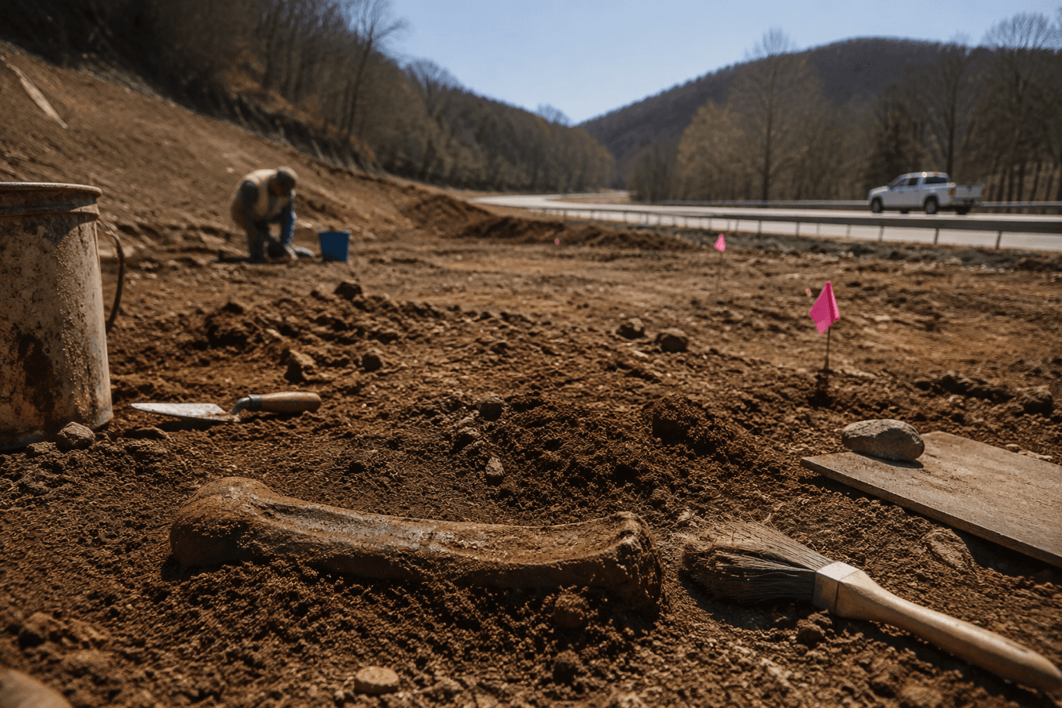
Before any grader reaches a hillside or a lane closure is posted on KY 11, the Kentucky Transportation Cabinet has to see what is buried below the surface. In Owsley County, that means roadwork begins with a Phase I archaeological survey, a quiet step that can affect project timing, traffic patterns, and the public cost of rebuilding a corridor that runs through land with a long human footprint.
What the KY 11 survey covers
The KY 11 report is titled Phase I Archaeological Survey along KY 11, between Mile Points 0/14.343 - 1.082/17.44, Lee and Owsley Counties, Kentucky, KYTC Item # 10-292.1. It lists Robert W. Ball and Dona R. Daugherty as authors, was submitted by CDM Smith to the Kentucky Transportation Cabinet, and carries Kentucky Office of State Archaeology Project Number FY17-9052.
That title matters because it shows how tightly roadwork planning is tracked in Kentucky. The state is not just looking at a strip of pavement in the abstract. It is mapping a specific corridor, mile point by mile point, and checking whether construction could disturb buried artifacts, occupation layers, or other traces of earlier use before reconstruction advances.
Why survey first, then construction
A Phase I survey is the first screen in the process, not the last word. KYTC describes Phase I work as shovel probing in search of artifacts, while the Kentucky Archaeological Survey says some projects are done in advance of construction by state agencies so they can be better stewards of the land they manage.
For drivers in Owsley County, that can mean the road project is not ready to shift from planning to dirt work until the archaeology is done. If the survey finds a sensitive area, crews may need extra documentation, design changes, or additional review before work can move ahead. That can affect when detours begin, how long a work zone stays in place, and how much a reconstruction costs before a single truckload of gravel is placed.
KY 30 shows this is part of a broader pattern
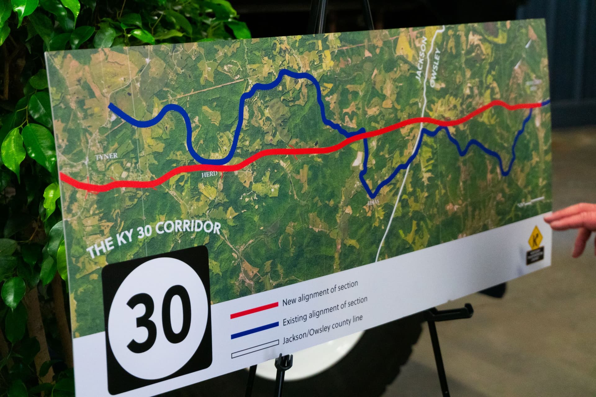
KY 11 is not the only Owsley County road to go through this kind of review. A companion report is titled Phase I Archaeological Survey for Reconstruction of KY 30 between KY 847 and KY 11 in Owsley County, Kentucky. In the search results, it is identified as Contract Publication Series 15-012 and KYTC item no. 10-279.51.
That report snippet says it covered archaeological survey of the United States Army Corps of Engineers jurisdictional areas and excess fill material areas for the proposed reconstruction of KY 30 between KY 847 and KY 11. H. William Goodman is named in the search result snippet. The connection to the Corps of Engineers shows that road projects can involve more than a county highway crew and a paving schedule. They can also touch federal oversight, fill placement, and the ground beyond the travel lane itself.
For Owsley County motorists, that kind of layered review can mean the difference between a straightforward rebuild and a project that has to pause while the roadbed is checked, documented, or redesigned. It is one of the reasons even familiar stretches of county highway can take longer and cost more than they appear to from the shoulder.
What the archaeology can reveal
This work is not only about delaying a project until paperwork is complete. In a county like Owsley, where roads cut through valleys, hollows, and ridges that have been used for generations, the archaeology can reveal where people lived, traveled, farmed, and left behind evidence of daily life long before modern survey crews arrived.
The Kentucky Organization of Professional Archaeologists notes that Kentucky has more than 20,000 recorded archaeological sites and probably far more that have never been recorded. It also defines an archaeological site broadly as any location where people have lived that is at least fifty years old. That makes the ground under a road more than fill and stone. It can be part of a long record of settlement, movement, and work that predates the present transportation network.
In practice, a Phase I survey can help identify whether a corridor contains buried material worth protecting or studying before construction pushes forward. For a county whose roads often follow older paths of travel, that kind of review turns road planning into a form of local history work.
How the state handles this work
KYTC maintains an archaeology program page and an archaeology reports repository, which makes clear that this is a routine part of state transportation work rather than a one-time exception. The broader repository includes many roadway-related Phase I studies across Kentucky, among them projects tied to KY 92 in Whitley County, KY 1357 in Hardin County, KY 32 in Rowan and Elliott counties, KY 7 and KY 1161 in Morgan County, KY 2498 in Morgan County, and KY 194 in Pike County.
That statewide pattern matters for Owsley County because it shows local road review is part of a common public process, not a special case. When crews prepare to improve KY 11 or KY 30, they are working within a system that treats roads as both transportation corridors and heritage landscapes. The goal is to keep projects moving while making sure buried resources are not erased by the first cut of the blade.
What locals should expect next
For people who drive KY 11 or use the KY 30 corridor between KY 847 and KY 11, the immediate takeaway is simple: archaeology comes before earthmoving. If the survey work is complete without major findings, the road project can move into the next stage of engineering and construction scheduling. If investigators identify resources that need more attention, the project can shift into additional review before any large-scale disturbance begins.
That is why these surveys matter even when they are easy to miss from the roadside. They can change when work starts, how long a detour lasts, and how much taxpayers ultimately pay to rebuild a road. They also help make sure Owsley County’s transportation network is improved without wiping out evidence of the county’s deeper past.
This article was produced by Prism’s automated news system from verified source data, official records, and press releases, then run through automated quality and moderation checks before publishing. The system is built and supervised by the people who set the standards it runs under. Read our full AI policy.
Did this article answer your question?