Owsley County launch point for 25-mile South Fork kayak trip
Owsley County is the put-in for a 25-mile South Fork paddle that turns Wolfe Creek into a tourism gateway. The route links public access, overnight camping, and Beattyville.
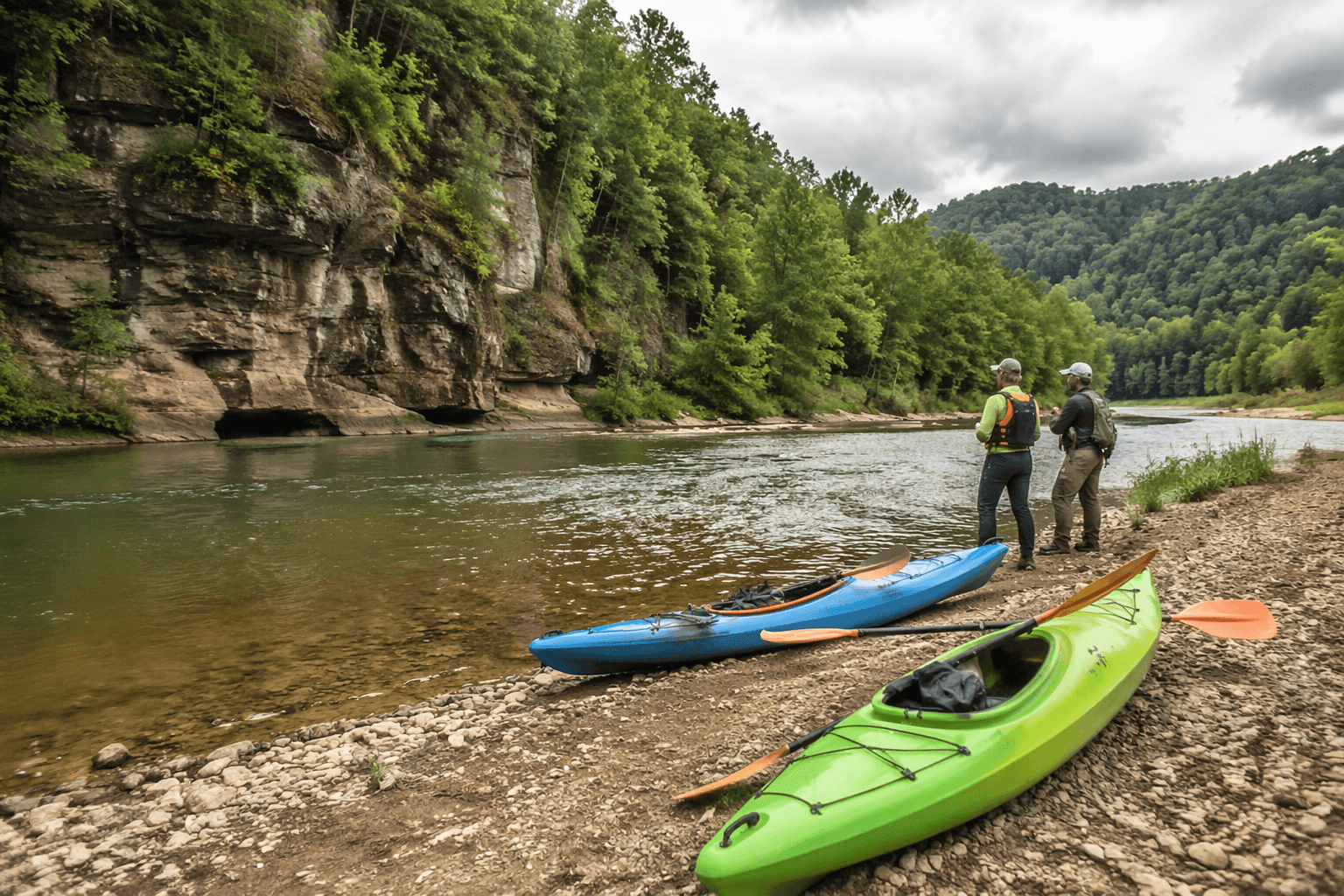
Owsley County is more than a bend in the route on the South Fork of the Kentucky River. At Wolfe Creek Boat Ramp, the county becomes the launch point for a 25-mile kayak-camping trip that ties public river access to a growing regional tourism push, with Booneville, Beattyville, county officials, and conservation partners all in the same frame.
Owsley County’s place on the South Fork
The South Fork of the Kentucky River begins in Clay County, then flows north through Owsley County before meeting the North and Middle Forks in Lee County. That geography matters because the river is not just passing through the county, it is using Owsley as the middle stretch of a corridor that now has a defined visitor experience attached to it.
Tourism materials describe the South Fork as a roughly 45-mile waterway, which makes the Owsley County section part of a much larger paddling system rather than a standalone float. The trip promoted from the Clay and Owsley county line near Wolfe Creek Boat Ramp to Beattyville turns that geography into an itinerary, one that places Owsley County squarely on a regional paddling map.
What the 25-mile trip includes
The kayak-camping outing is built as a two-day river package, not a quick day trip. According to the event schedule, paddlers checked in and set up camp on Friday night, May 29, 2026, shuttled out for Day 1 paddling on Saturday, May 30, and finished Day 2 on Sunday, May 31, 2026, with the route ending in Beattyville.
The experience carries paddlers from the Wolfe Creek launch area all the way into Beattyville with shuttle service built in. Organizers set the price at $50 per person and asked participants to bring their own kayak, canoe, or SUP board, which keeps the trip open to people who already own gear while still packaging the logistics around them.
It is also designed to feel more like a hosted river weekend than a bare-bones float. The listing includes breakfast, a catered dinner, campfire evenings, and storytelling, and a related tourism note says camping gear is transported for participants. Primitive camping is provided at the overnight stop, reinforcing that this is a staged overnight route with set access points and a planned camp, not an improvised backwoods excursion.
Why Wolfe Creek matters as a launch point
The county’s public access role is anchored by the Upper Wolf Creek Ramp, which the Kentucky Department of Fish & Wildlife Resources lists as an Owsley County access site on the South Fork Kentucky River. The ramp is described as a year-round, 24-hour, no-fee boat ramp with capacity for 25 or fewer boats, and it is set up for light trailerable recreational boats.
That combination gives the route a practical base. For paddlers, the ramp’s no-fee status and year-round availability lower the barrier to entry, while the modest boat capacity underscores that this is a small-scale launch rather than a large marina-style facility. For Owsley County, it means the county is hosting a public access point that can feed a multi-county trip and not just a local put-in.
The geography around Wolfe Creek also gives the route its identity. Starting at the Clay and Owsley county line makes the trip feel rooted in a specific place, one where the county line itself becomes a tourism marker. That kind of place-based framing is what turns a river access site into part of a destination story.
Safety, gear, and what paddlers need to know
The event materials set out a few clear rules. Everyone on the water had to wear a life vest, and alcohol was not allowed on the river. Participants also needed to bring their own boat, whether that was a kayak, canoe, or stand-up paddleboard.
Those details matter because the South Fork route is being sold as an organized overnight paddle, not as a casual shuttle. A two-day trip with camping, group meals, and a launch at a state-listed access point requires paddlers to show up prepared, especially with their own watercraft and safety gear.
- $50 per person
- Friday night check-in and camp setup
- Saturday shuttle and Day 1 paddling
- Sunday Day 2 paddling into Beattyville
- Life vest required
- No alcohol on the water
- Bring your own kayak, canoe, or SUP board
The most important logistical features are straightforward:
A regional coalition around river tourism
The event was presented as a partnership that stretches across public, tourism, and conservation groups in both Owsley and Lee counties. Named partners included Lee County Tourism, Beattyville Main Street, the Kentucky River Authority, Owsley and Lee County conservation partners, the Owsley County Fiscal Court, the Lee County Fiscal Court, the City of Booneville, and the City of Beattyville.
That lineup is significant because it suggests the trip is being used as a test case for a broader river economy. Owsley County is not only providing a launch area, it is part of the public-sector coalition trying to frame the South Fork as a destination with access, camping, and downstream spending attached.
Beattyville and Lee County tourism materials already promote multiple river options tied to Beattyville and the confluence area, including the chance to exit at the Beattyville Boat Ramp or keep paddling to see the birthplace of the Kentucky River where the North and South Forks merge. In that context, the Owsley County launch point becomes the upstream half of a longer visitor corridor, one that can connect river users to stopovers, local services, and future overnight business.
For Owsley County, the value is not just that paddlers pass through. The value is that they start there, launch there, and now see the county as part of a mapped outdoor experience with public access, overnight stays, and cross-county tourism built into the route.
This article was produced by Prism’s automated news system from verified source data, official records, and press releases, then run through automated quality and moderation checks before publishing. The system is built and supervised by the people who set the standards it runs under. Read our full AI policy.
Did this article answer your question?