Buck Island WMA offers river-only access and nesting shorebird habitat
Buck Island WMA is a 1,510-acre Mississippi River island you can reach only by boat, where nesting least terns share gravel bars with paddlers.

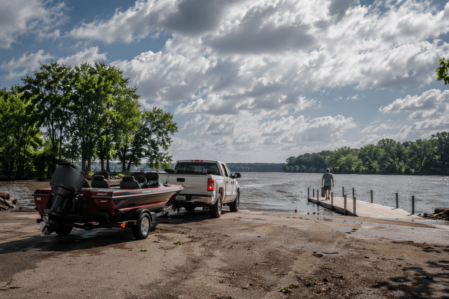
Buck Island WMA is the kind of Phillips County destination that changes the definition of “getting outside.” The 1,510-acre island sits in Mississippi River Zone 078 just north of Helena River Park, and the Arkansas Game and Fish Commission says there is no vehicular or foot access at all. If you want to reach it, you have to launch a boat, which turns a short trip from Helena Harbor into a river crossing with real planning behind it.
A river-only destination in Phillips County
What makes Buck Island unusual is not just that it sits in the Mississippi River, but that the river itself is the front door. From the public ramp at Helena Harbor, the island is about a three-minute boat trip, close enough to fit into a half-day outing, yet separated enough from town to feel isolated once you are on the water. That mix matters in Phillips County, where many outdoor spots are reached by road and parking lot; Buck Island is an access story first and an attraction second.
The island’s setting also means conditions can change fast. AGFC describes the site as bottomland hardwood forest, sandbars, and mud flats that shift with Mississippi River levels, so the landscape a paddler sees one week may not match the next. When the river rises, ground that looks open can disappear, and when levels fall, fresh bars and shallows can alter where you land and how you move around the island.
Why paddlers and birders have the most to gain
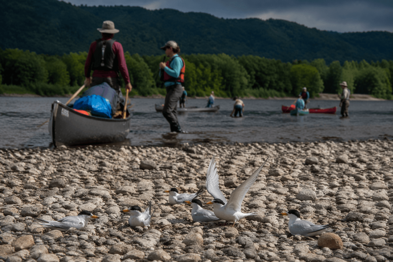
Buck Island is best suited to people who already think in river miles, not trail miles. Advanced paddlers can use it as the starting point for a 106-mile run south to Freddie Black Choctaw Island WMA, which turns one island into part of a much larger water route. That connection makes Buck Island more than a stopover: it is a planning point for canoeists and kayakers who want to map a longer stretch of the Lower Mississippi River Water Trail.
Birders also have a clear reason to pay attention. AGFC biologists have documented least tern nesting habitat on the island’s gravel bars, which means the same exposed edges that attract river travelers also serve as fragile breeding ground for shorebirds. That overlap is what gives Buck Island its edge over easier local outings. It is not a simple picnic destination or a drive-up overlook; it is a place where access, wildlife protection, and river conditions all shape whether a visit makes sense.
Plan around the river, not the calendar
A successful trip starts before you leave town. The Helena gauge should be part of the decision, because river stage affects both how you reach the island and what kind of ground you will find once you arrive. When the Mississippi reaches flood stage, access and usable land can change quickly, and a planned landing spot may not stay usable for long.
AGFC’s georeferenced maps are especially useful here because they show parking, road types, and boundaries before you launch. That matters even more at a boat-only site, where a wrong assumption about where to leave a vehicle or where the WMA begins can cost time on the water. For a short trip, the island’s proximity to Helena Harbor makes it tempting to improvise, but Buck Island rewards the people who check conditions first and bring the right gear for a river landing.
A practical Buck Island checklist looks like this:
- Launch from Helena Harbor if you want the shortest approach.
- Check the Helena gauge before you go.
- Expect sandbars and mud flats to shift with river stage.
- Use the AGFC map layer to understand parking and boundaries.
- Bring the equipment needed for a boat-only outing, not a roadside walk-in.
A conservation story hidden in plain sight
Buck Island’s public access did not happen by accident. The American Land Conservancy bought the property in 2005, opened it to public access through a conservation easement in 2011, and donated it to AGFC in 2012. That chain of ownership matters because it explains why a private patch of river land is now a lasting public asset in Phillips County, with management shaped by wildlife habitat as much as by recreation.
The island’s present value is tied to that history. A place that once could have remained off limits now serves multiple uses at once: river exploration, bird habitat, and a protected slice of bottomland forest in a part of Arkansas where the Mississippi still controls the map. For Phillips County, Buck Island stands out because it is not easy to reach, and that difficulty is part of what keeps it distinctive, usable, and ecologically important.
This article was produced by Prism’s automated news system from verified source data, official records, and press releases, then run through automated quality and moderation checks before publishing. The system is built and supervised by the people who set the standards it runs under. Read our full AI policy.
Did this article answer your question?