Dale Bumpers refuge defines Phillips County as a wildlife stronghold
Phillips County's wildlife economy runs through a 160,000-acre floodplain where access, hunting, fishing, and floodwater shape how the county works.

Dale Bumpers White River National Wildlife Refuge is not a backwoods preserve on the edge of Phillips County. It is a county-shaping floodplain system, carved by the White River and managed as one of the most important blocks of bottomland hardwood forest left in the Mississippi Alluvial Valley. The U.S. Fish and Wildlife Service established the refuge on Sept. 5, 1935 under President Franklin D. Roosevelt, and today its mix of water, timber, and wildlife reaches deep into the daily life of this part of Arkansas.
A refuge that stretches across county lines
The refuge now covers more than 160,000 acres across Arkansas, Desha, Monroe, and Phillips counties. It was first known as White River Migratory Waterfowl Refuge before being renamed in 1940, and its footprint includes about 92 miles of the White River, 300 lakes, and natural bayous. That scale matters in Phillips County because the refuge is not a single attraction to visit and leave behind; it is part of the county’s land use, flood behavior, and outdoor economy.
The designation history also places Phillips County in a larger conservation map. The refuge was recognized as a Wetland of International Importance under the Ramsar Convention in 1989 and as a Globally Important Bird Area in 2001. Those labels reflect the same thing local users already know: this landscape is valuable not just because it is scenic, but because it holds wildlife habitat of international significance inside a working river system.
How water controls access and use
The refuge’s defining feature is floodwater. The annual flood cycle typically runs from December through June, and water depths can range from a few inches to more than 15 feet across more than 95 percent of the refuge. In practical terms, that means access changes constantly, roads can close, and the safest route one week may be impassable the next.
For visitors in Phillips County, this is the first rule of using the refuge: check conditions before going. The Wildlife Drive and the observation tower on the Demonstration Area are open March 1 through Oct. 31, but flooding and safety concerns can still affect where you can travel. The refuge’s land is not static, and that movement is the reason the place supports such a wide range of birds, fish, and game.
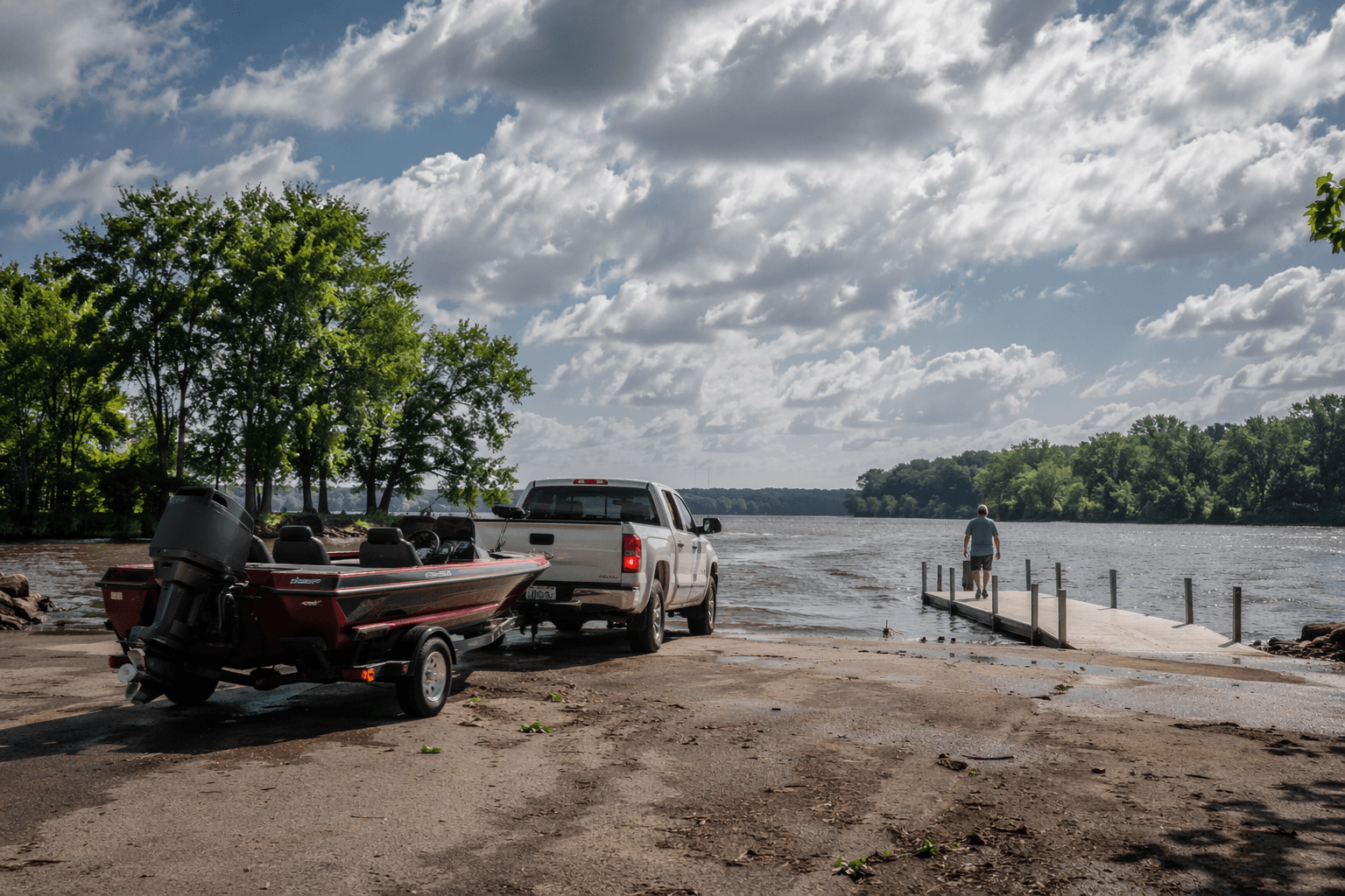
Where people go and what they can do
The refuge draws about 455,000 visits a year from hunters, anglers, bird watchers, and other users. That level of use shows up in Phillips County as more than recreation. It means vehicles on local roads, fuel purchased on the way in, supplies bought in nearby towns, and steady demand for outdoor services tied to seasonal hunting and fishing.
Public use permits are required for hunting, fishing, boat launching, and camping. The annual permit costs $20 for people 16 and older, and permit revenue stays on the refuge to help administer, maintain, and improve recreation. For people who use the refuge regularly, that fee is not just a gatekeeper. It is part of how the landscape is managed for access, upkeep, and safe use.
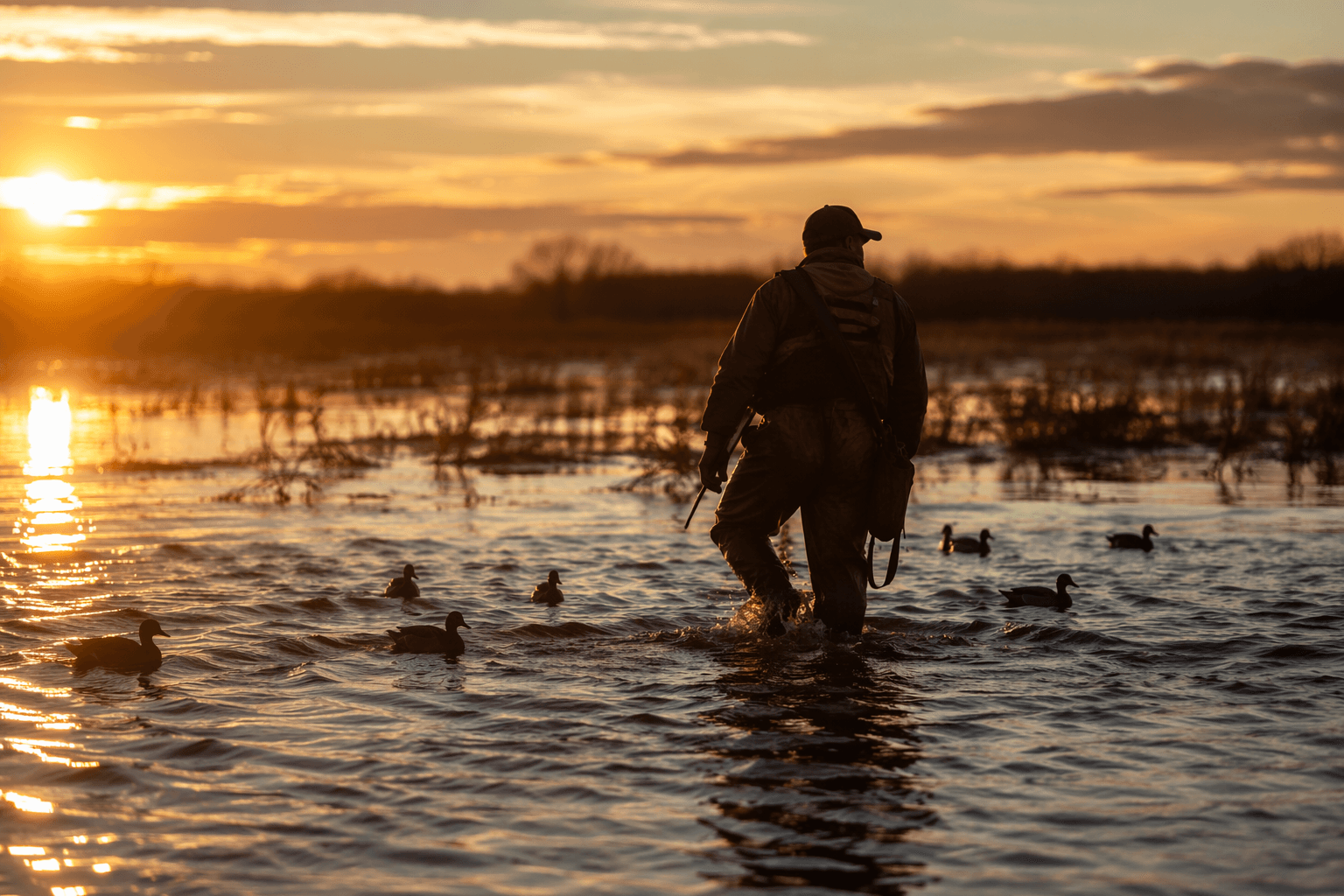
Hunting rules that shape the season
Hunting is allowed only in designated areas, and users must follow both refuge rules and state seasons and bag limits. Waterfowl hunting ends at noon, a detail that matters to duck hunters planning their day around daylight and travel back out of the floodplain. Deer quota hunt applications are accepted during August, giving Phillips County hunters a clear seasonal window to prepare.
The refuge’s outlying tracts open under those season-based rules, which keeps the landscape from being treated as open ground with no restrictions. Instead, the refuge operates as a managed public hunting system where timing, area, and species all matter. That structure helps explain why the refuge remains both heavily used and carefully regulated.
Fishing waters, species, and habitat management
The fishing side of the refuge is built on water in every direction. The Service says the refuge contains about 300 recognizable bodies of water totaling more than 10,000 acres, including more than 200 oxbow lakes and permanent beaver ponds. Those waters hold crappie, bluegill, largemouth bass, and catfish, giving local anglers a broad set of places and species to target without leaving the county’s floodplain system.
Habitat work is not left to chance. Refuge managers use forest thinning, moist-soil impoundments, green-tree reservoirs, and cooperative farming to shape the land for wildlife. The comprehensive conservation plan and supplemental habitat management plan were finalized in 2011, providing the policy framework for how the refuge balances timber, water, and public use. In a county where flooding can quickly redraw the map, active management is part of the infrastructure.
Wildlife that gives Phillips County its identity
The refuge bird list records 273 species observed by refuge personnel and ornithologists. That number helps explain why birding remains one of the refuge’s major uses, especially during the winter flood cycle when water concentrates ducks and other waterfowl across the bottomland. The general brochure identifies mallards, gadwall, and ring-necked ducks among the winter concentrations commonly associated with the refuge.
The mammal list is just as notable. The refuge is home to the only population of native black bears in Arkansas, a fact that gives Phillips County a rare place in the state’s natural history. White-tailed deer, wild turkey, river otters, and beavers are also part of the refuge’s living inventory, making the county’s floodplain one of the most wildlife-rich landscapes in Arkansas.
Why this matters to the county
Phillips County’s connection to the refuge is practical, not ornamental. The water regime affects when roads are passable, when hunters can enter the land, where anglers can launch, and how families plan a day outdoors. It also draws a large flow of visitors into the county each year, creating spending tied to permits, fuel, gear, food, and lodging.
That is why Dale Bumpers White River National Wildlife Refuge defines Phillips County so clearly. It is a federal land system, a floodplain, a public recreation engine, and a wildlife stronghold all at once, and the county’s relationship to it changes with the river season by season.
This article was produced by Prism’s automated news system from verified source data, official records, and press releases, then run through automated quality and moderation checks before publishing. The system is built and supervised by the people who set the standards it runs under. Read our full AI policy.
Did this article answer your question?