Rockwall County alliance links open space, drainage and growth planning
Rockwall County’s open-space alliance now shapes drainage, corridor protection and growth pressure, with property owners already in the planning frame.
Rockwall County is treating open land as more than scenery. The Open Space Alliance sits at the same intersection as drainage, corridor preservation and the county’s next round of growth decisions, and it grew out of the county’s 2011 master-planning effort before being formally created by the Commissioners Court in August 2012. It began as an umbrella forum for representatives from the cities and the unincorporated parts of the county, then produced a Rockwall County Open Space Master Plan in December 2011.
How the alliance took shape
The alliance’s structure matters because it was built to bridge jurisdictions, not to act as a narrow park campaign. Rockwall County says the original group became a 501(c)(3) nonprofit in May 2016 and continues to support the master plan’s implementation, which gives the effort a formal nonprofit arm alongside county policy. That combination lets the county frame open-space work as a long-running part of land-use planning rather than a one-time preservation project.
The county’s own language also shows why the alliance has lasted. Its mission is to preserve land and natural resources for the benefit of all, while encouraging protection of open space with natural, historic or geological significance and support for connecting nature areas. That puts the alliance in the middle of questions local builders, landowners and neighborhoods feel directly: which parcels stay open, which get developed, and which must remain available for links, drainage and future public use.
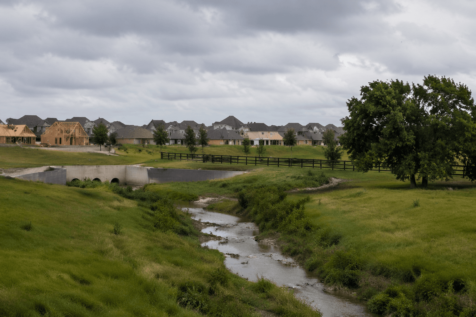
Why hills and creeks matter to growth
Rockwall County does not describe its hills and creeks as backdrops. It says the alliance promotes protection of the natural storm-water drainways formed by those hills and creeks, which turns open-space planning into a drainage strategy as much as a conservation strategy. In a county facing steady suburban pressure, that matters because the shape of the land affects where runoff goes, where roads need to rise or turn, and where development can happen without creating bigger engineering costs later. That is an interpretation of the county’s stated priorities, but it follows directly from the way the alliance links open land, water and connectivity.
The county’s earlier Open Space Goals and Finance Assessment helps explain why that approach found an audience. In the 2009 final report, 36 percent of participants named traffic or roads-related issues as the most important problem facing Rockwall County, and over-development was listed among the central concerns. That context is important for property owners and developers alike: once roads, drainage and subdivision pressure are discussed together, open space stops being a luxury and starts functioning as a tool for managing congestion and utility costs.
Where the county is headed now
The same logic appears in Rockwall County’s Strategic Plan 2050, which says the county is experiencing rapid growth and needs smart, integrated solutions that shape the next 25 years. The plan’s vision explicitly ties livable and innovative growth to conservation of open spaces and the effective use of natural resources and history. It also says the county wants to remain a safe, low-density, family-friendly community and avoid losing its local character to uncontrolled growth.
That is not abstract planning language. The county’s 2027 Thoroughfare Plan update, launched in January 2026 and expected to be completed in spring 2027, says it will guide future roadway connections, preserve needed corridors and support safe, efficient travel across the county. The plan also makes clear that it does not fund or schedule construction right away; instead, it identifies potential locations for future roadway connections so the county can reserve right-of-way over time. It warns that those future corridors may affect property owners, even though the alignments are conceptual and can still change as engineering, environmental review and funding move forward.
The practical takeaway for Rockwall County is that open space, drainage and transportation are being planned as one system. The alliance protects the hills, creeks and open tracts that carry water and shape the county’s look and feel, while the broader growth plans reserve room for roads and development before land values and subdivision patterns harden the map. In a fast-growing county, that is where preservation and property pressure meet first.
This article was produced by Prism’s automated news system from verified source data, official records, and press releases, then run through automated quality and moderation checks before publishing. The system is built and supervised by the people who set the standards it runs under. Read our full AI policy.
Did this article answer your question?
