Popham Beach shows Sagadahoc County's changing shoreline and colonial past
Popham Beach is where Sagadahoc County sees the coast actively reshape itself, with changing sand, tighter access to Fox Island, and history at every turn. Visitors can still pair the beach with Fort Popham, Fort Baldwin, and the Popham Colony site in one trip.
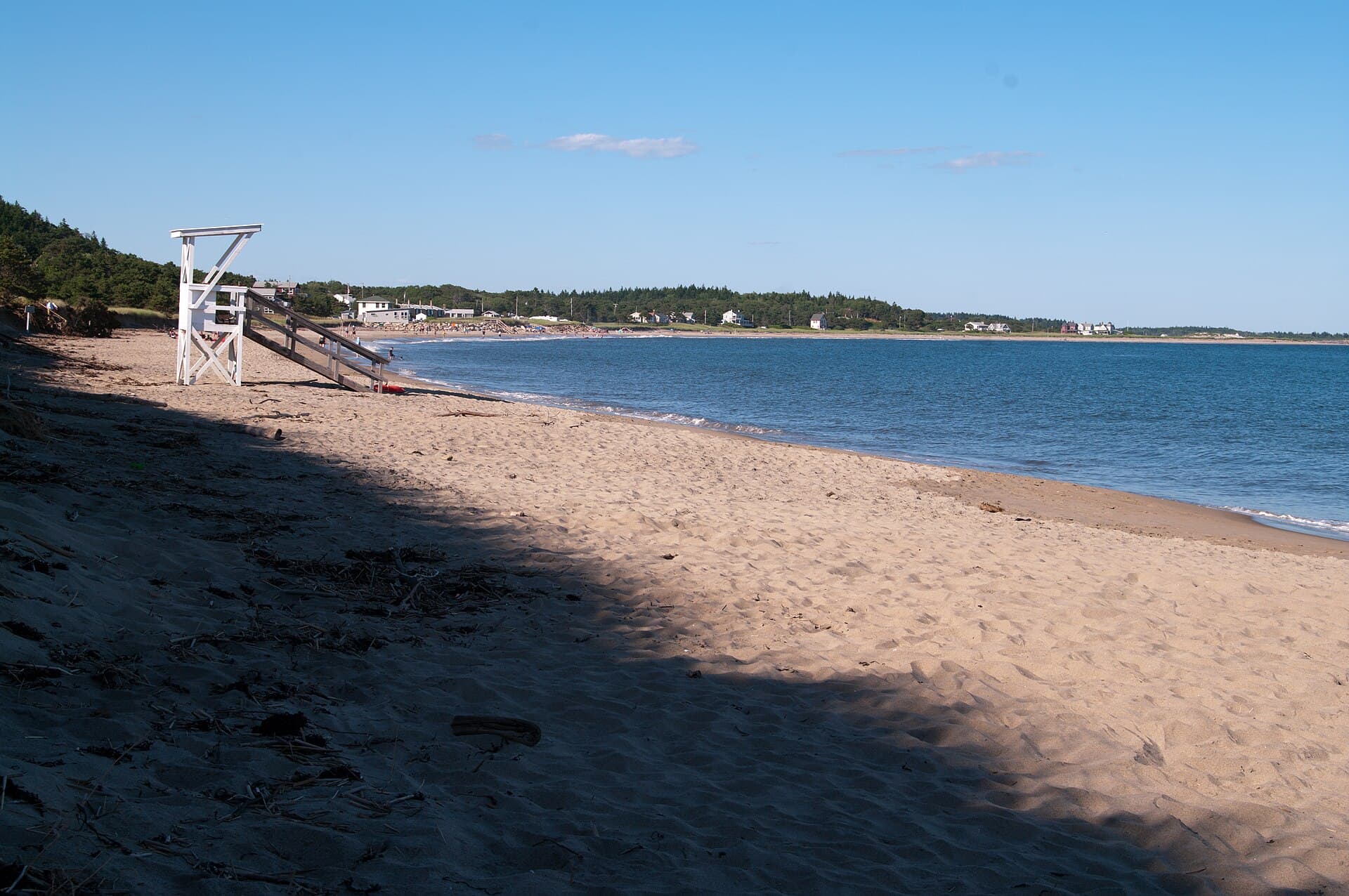
Popham Beach in Phippsburg is one of Sagadahoc County’s clearest examples of a shoreline that never stays still. The sand shifts, dunes erode, and a route that once felt routine has changed: visitors can no longer walk to Fox Island at low tide without crossing the mouth of the Morse River. That makes the beach more than a scenic stop. It is a place where erosion now shapes what people can reach, how long they stay, and what kind of coastal experience they actually get.
Maine’s parks bureau calls Popham Beach State Park the state’s busiest state park beach, and the draw is easy to understand. The park offers bathhouses, fresh-water solar rinse-off showers, and charcoal grills, which makes it a full-service beach day rather than a simple walk on the sand. But the same shoreline that brings crowds also carries the warning that this coast is unstable, with major shoreline change and dune erosion already altering the landscape.
What visitors can still do now
The practical appeal of Popham remains strong because the beach still works as both a day trip and a longer outing. The state notes that parks may be visited year-round from 9 a.m. to sunset unless otherwise posted, so the peninsula is not just for summer crowds. That matters in a county where access to open coastline is itself a public asset, and where the beach’s changing shape is part of the experience instead of a separate issue.
A visit now is best understood as a coastal check-in, not a fixed destination. You can still spread out on the beach, use the park facilities, and build a route that includes the nearby historic sites at the mouth of the Kennebec. The shifting sand means the view and the walk may look different from one season to the next, which is part of why the beach keeps drawing people back.
The colonial story beneath the sand
Long before Popham became one of Maine’s busiest state park beaches, it sat at the center of an early English attempt to establish a settlement in North America. The Popham Colony of 1607 was the first organized attempt by the English to establish a colony on the shores of what is now New England. The colonists there built the Virginia, which Maine’s parks history page describes as the first ship ever built in North America.
The colony lasted only a little over a year, but the story still gives this stretch of shoreline an unusual historical weight. At Popham, the past is not confined to a museum case or a marker on a map. It sits beside a beach where the coast keeps rewriting its own boundaries, and that contrast is part of what makes the area so distinctive for Sagadahoc County. The same stretch of land holds both the fragility of a modern shoreline and the beginnings of one of the earliest English chapters in New England.
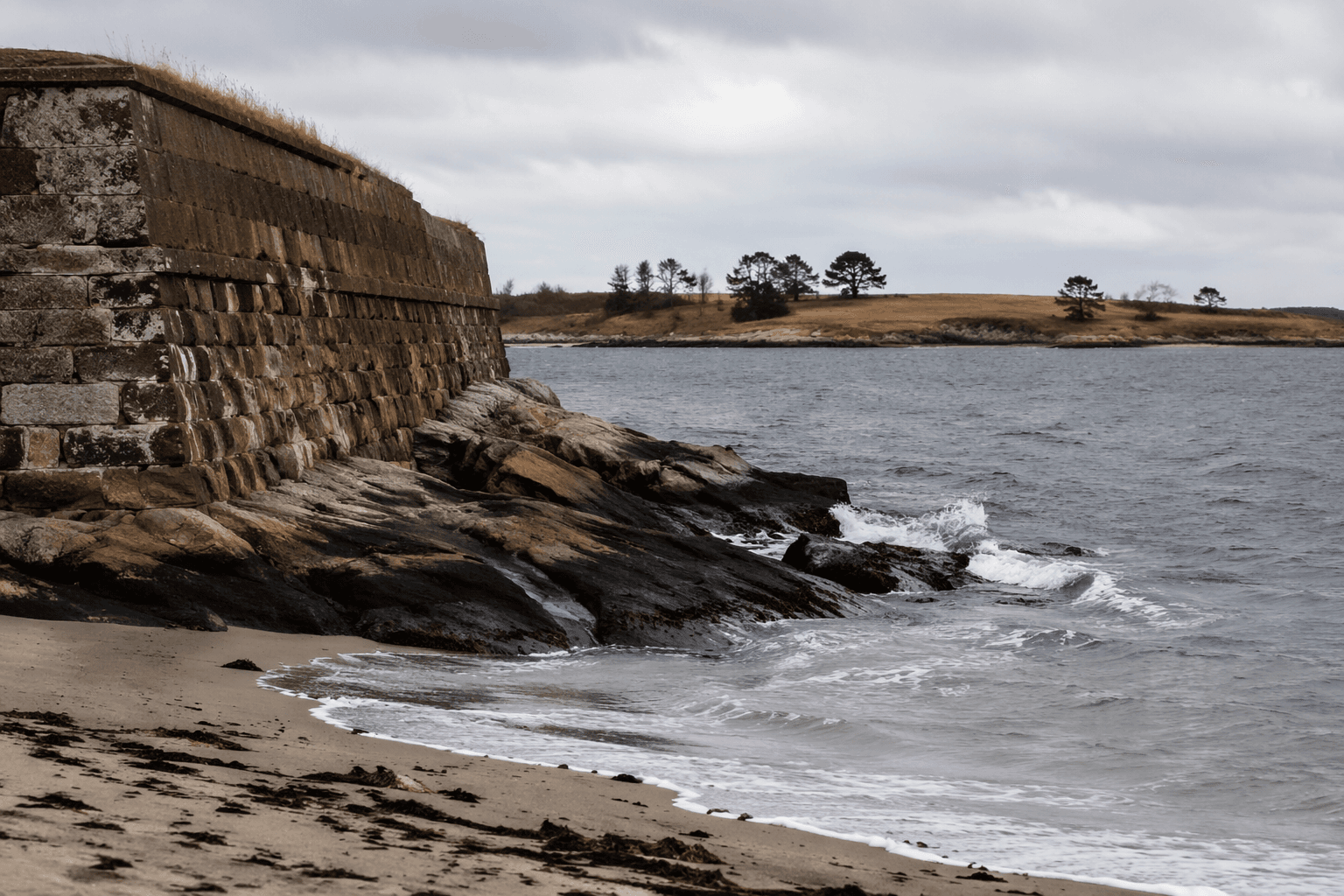
Fort Popham turns the shoreline into military history
A short drive or walk away, Fort Popham adds another layer to the same landscape. Maine’s official forts page describes it as a semi-circular granite fort built in 1861 for the Civil War. The fort was later modified and reused during the Spanish American War and World War I, which shows how the same river mouth kept serving strategic purposes across different eras.
The state’s forts page also says that earlier wooden fortifications probably protected Kennebec settlements during the Revolutionary War and the War of 1812. That detail matters because it shows the mouth of the river was important long before it became a destination for beachgoers and history seekers. The shoreline may now be a place for walking, picnicking, and watching the tides, but its location once made it part of a defensive line.
Fort Baldwin extends the timeline
Across the river on Sabino Hill, Fort Baldwin adds still another chapter. Maine’s Bureau of Parks and Lands says the fort was built between 1905 and 1912 and originally consisted of the Cogan, Hardman, and Hawley batteries. It was garrisoned during both world wars, and the guns were removed in July 1942.
Together, Fort Popham and Fort Baldwin turn one part of Phippsburg into a layered public history corridor. One site connects to Civil War engineering and later wartime reuse. The other ties the same coast to early 20th-century military planning and the global conflicts of the 20th century. Both sit within easy reach of the beach, which means a single outing can move from tide line to fort walls without leaving the peninsula.
How to plan a visit around the changing coast
The easiest way to see Popham is to treat it as a combined beach-and-history trip. Maine’s hiking guide explicitly pairs Fort Popham with a beach walk and a fort visit, and that is still the most efficient way to understand the place. A half-day visit can cover the beach itself, the fort, and a look at the changing mouth of the river. A full day gives enough time to move between Popham Beach, the Popham Colony site, Fort Popham, and Fort Baldwin without rushing.
A practical visit usually includes a few simple priorities:
- Start at the beach to see how the sand and dunes have shifted.
- Walk or drive to Fort Popham to connect the shoreline with military history.
- Add Fort Baldwin for a higher vantage point and a second fortification story.
- Leave time to notice how the river mouth and Fox Island access have changed the shape of the coast.
That itinerary matters because Popham is not just a postcard view. It is one of the few places in Sagadahoc County where erosion, colonial memory, and military history all occupy the same landscape. The beach keeps changing, and that change is now part of what people come to see.
This article was produced by Prism’s automated news system from verified source data, official records, and press releases, then run through automated quality and moderation checks before publishing. The system is built and supervised by the people who set the standards it runs under. Read our full AI policy.
Know something we missed? Have a correction or additional information?
Submit a Tip