NASA Data Shows San Francisco Sinking Fast, Putting Human Lives at Risk
NASA data shows SF is sinking at twice the estimated rate, with regional models off by up to 35% and sea-level rise projected to more than double by 2050.
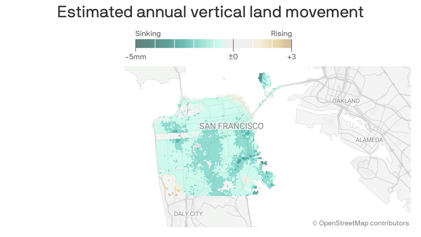
Along the Bay shoreline that residents of the Embarcadero, Mission Bay, and the Sunset watch every day, the ground beneath San Francisco is moving downward far faster than scientists previously understood. NASA satellite data, analyzed across an eight-year window from 2015 to 2023, found the city is subsiding at twice the previously estimated rate, a finding published in the journal Science Advances that researchers say carries direct consequences for human safety.
The numbers driving the alarm are specific. Regional models had underestimated the actual rate of subsidence by up to 35 percent, meaning the planning frameworks local and state agencies have relied on to design flood defenses and sea walls were built on a systematically low foundation. Because land sinking compounds the effect of rising seas, the combined impact is worse than either factor alone. NASA now projects that the San Francisco Bay Area will see more than double the previously expected sea-level rise by 2050, a timeline well within the lifespan of infrastructure being designed and funded today.
"The rate of sinking is so significant that it could put human lives at risk," according to reporting tied to the Science Advances findings. Experts who reviewed the study cautioned that environmental changes and more frequent extreme weather events could accelerate the timeline even further beyond current projections.
The study's scope may extend beyond the Bay Area. In ABC7's coverage of the findings, one analyst noted the research applies not only to San Francisco but also to Los Angeles, suggesting the vertical land motion problem is a statewide concern rather than a localized one.

For the thousands of residents and workers concentrated near the water in neighborhoods like Treasure Island, Pier 39, and the rapidly developed Mission Bay biotech corridor, the implications are immediate. Those areas sit at or near sea level and would be among the first to face inundation if flood defenses are not recalibrated to match the updated subsidence data. Officials, according to the research summary, must update those defenses as a direct response to the new climate threat picture.
The Bay Area 2050 regional planning process, which examines long-range climate impacts across the nine-county region, will face pressure to incorporate the corrected subsidence figures. The gap between what prior models assumed and what NASA's satellite measurements now confirm is not a rounding error; at up to 35 percent, the underestimate is large enough to render existing sea-level rise buffers inadequate.
The full methodology, subsidence rates in millimeters per year, and the geographic mapping of the most vulnerable zones remain available in the Science Advances paper. Names of the lead research authors and the specific satellite instruments used were not released in the initial reporting, details that local emergency planners at the San Francisco Department of Emergency Management and the Bay Conservation and Development Commission will need before they can begin revising coastal defense standards.
This article was produced by Prism’s automated news system from verified source data, official records, and press releases, then run through automated quality and moderation checks before publishing. The system is built and supervised by the people who set the standards it runs under. Read our full AI policy.
Did this article answer your question?


