Aztec Ruins marks Old Spanish Trail crossing linked to Armijo route
A 1-mile walk at Aztec Ruins traces Antonio Armijo’s 1829 crossing and ties San Juan County to a six-state trade corridor.
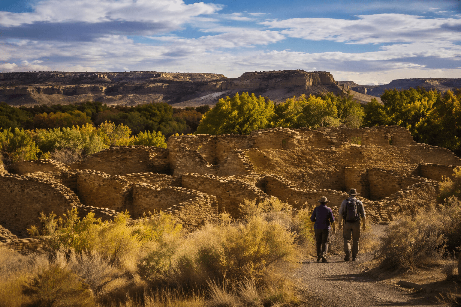
At Aztec Ruins National Monument, a short paved walk follows the same river corridor where Antonio Armijo and about 60 men with 100 pack mules crossed and camped on November 17, 1829. The stop is small, but the story is not: it links San Juan County to the first trade caravan from New Mexico to Los Angeles and gives visitors a concrete reason to spend time in Aztec.
The crossing that put Aztec on the Old Spanish Trail
Antonio Armijo, whom the National Park Service identifies as a Spanish explorer and merchant born in 1804 and died in 1850, led the first trade caravan from Abiquiú, New Mexico, to Los Angeles in late 1829. The route stretched about 2,700 miles, and the caravan included about 60 men and 100 pack mules. When Armijo’s party reached the Las Animas River near what is now Aztec Ruins, they crossed at a shallow point and made camp that evening.
That moment matters because it captures the Old Spanish Trail at its practical start, not as a legend but as a trade route that moved goods, animals, and people across the Southwest. The trail network grew out of older Indigenous footpaths, early trade and exploration routes, and horse-and-mule routes. The name “Old Spanish Trail” itself was rooted in John C. Frémont’s 1844 report, and the route was used for only a couple of decades before its importance faded after the end of the Mexican-American War in 1848, when new overland routes and a wagon route to southern California took business away from the trail.
For San Juan County, that history is more than background. It places Aztec inside a larger map of movement and exchange that predates modern highways and still shapes how the region explains itself to visitors. The crossing near the monument is a fixed point in that story: a date, a river, a caravan, and a route that reached all the way to California.
What the walk covers today
The modern trail at Aztec Ruins is built for an easy visit, not a backcountry expedition. The National Park Service describes it as a paved pathway through the picnic area, across Ruins Road, and to a bridge over the Animas River, with wayside signs along a 1-mile round trip trail. That makes it one of the clearest ways to connect a family stop in Aztec with a nationally significant trade corridor without needing a long hike or special gear.
The bigger geographic frame is just as important. The Old Spanish National Historic Trail traverses six states, California, Nevada, Arizona, Utah, Colorado, and New Mexico, and follows the routes of mule pack trains between Santa Fe and Los Angeles. New Mexican traders used the corridor to move locally produced merchandise west and exchange it for mules and horses, while serapes and other woolen goods moved west and California-bred horses and mules moved back to Santa Fe.
That exchange pattern gives the site a direct economic edge in the story of the Southwest. The trail was not only a line on a map. It was part of a working trade system that connected frontier communities and moved high-value goods over long distances. In Aztec, that larger history becomes tangible in a walk that starts near a picnic area and ends at the river.
Plan a stop at Aztec Ruins National Monument
The visitor center gives the crossing context and makes the stop useful even if you only have an hour. It is open daily from 9:00 a.m. to 5:00 p.m., except Thanksgiving, Christmas, and New Year’s Day. Inside, visitors can pick up trail guides, shop in the Western National Parks Association bookstore, see 900-year-old pottery and jewelry in the museum, and watch the 15-minute film “Aztec Ruins: Footprints of the Past.”

That film adds an important layer to the visit because it includes perspectives from Pueblo people, Navajo tribal members, and archaeologists. The monument is also described by the National Park Service as a deeply sacred place to many Indigenous peoples across the American Southwest, so the visit carries a clear expectation of respect. That context belongs with the trail stop, because the crossing sits inside a living cultural landscape, not a stand-alone roadside sign.
Access is part of the site’s value too. Aztec Ruins National Monument has four accessible parking spaces, and the visitor-center walkway includes a slight incline and a ramp. The monument also distributes the Interagency Access Pass, which makes the site easier to include for more visitors and strengthens its role as a public resource, not just a scenic stop.
Why the site matters for San Juan County
The Old Spanish Trail crossing at Aztec Ruins turns a one-mile walk into a practical question of public stewardship. Federal preservation, clear wayside signs, and accessible pathways determine whether the crossing stays legible to visitors or disappears into the landscape. In a county that depends in part on heritage tourism, that legibility matters because it can help turn a brief stop into a longer stay in Aztec and a fuller day in San Juan County.
The monument also gives the county a stronger claim on Southwest history. Armijo’s 1829 caravan, the 2,700-mile route, and the six-state trail network are not abstract milestones. They are specific, dated pieces of history that tie Aztec to Santa Fe, Los Angeles, and the broader trade corridors that shaped the region. In that sense, the crossing is both a local asset and a public record: one short walk that explains why this place still belongs in the story of the Old Spanish Trail.
This article was produced by Prism’s automated news system from verified source data, official records, and press releases, then run through automated quality and moderation checks before publishing. The system is built and supervised by the people who set the standards it runs under. Read our full AI policy.
Did this article answer your question?