Farmington trail guide helps residents choose the right walk, route
Farmington’s trail guide matches parks to your pace, from easy loops at Los Ninos and Fairview to tougher ground at the Sports Complex and Berg/Animas.
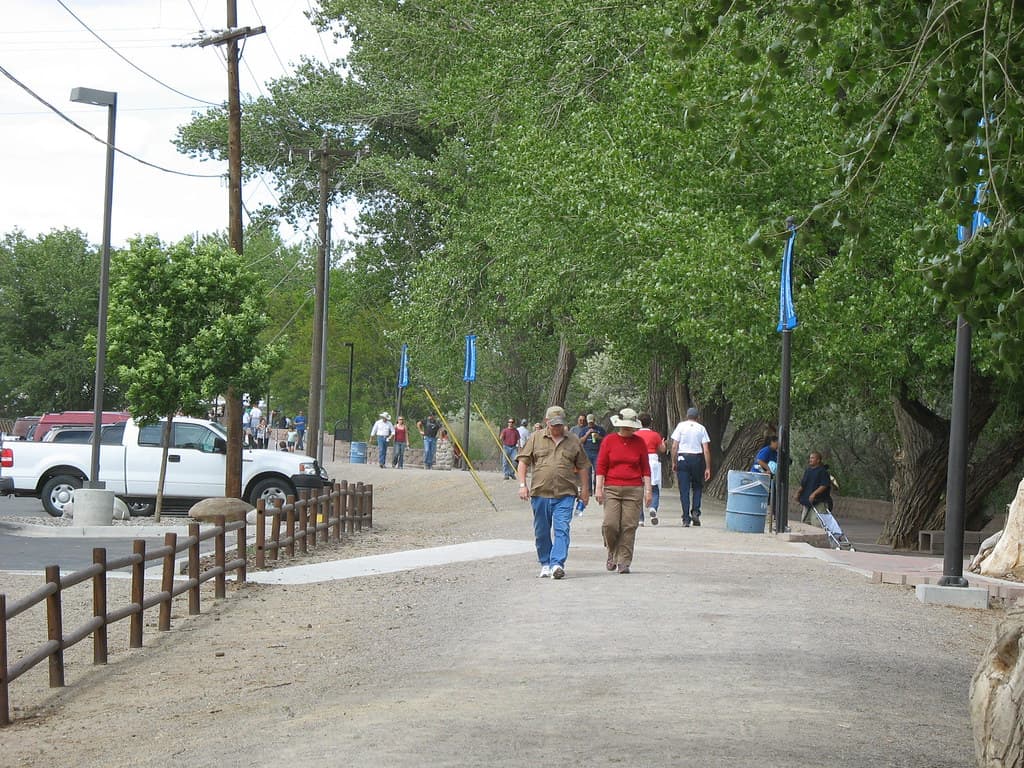
Farmington has turned its park system into something more useful than a map. The city’s walking trail guide lets you compare routes by distance, step count, difficulty, surface, and accessibility, so you can choose a loop that fits a stroller, a senior walk, or a harder fitness outing before you leave home.
How the guide helps you choose
The interactive version of the city’s walking trail guide is searchable, and that matters because it puts practical route details in one place. You can expand it to full screen, enter keywords, and compare trails by the numbers rather than by guesswork. For anyone trying to start a walking program, the guide gives a simple way to match a route to time, ability, and comfort level.
That structure makes the guide more than a park directory. A 0.12-mile neighborhood loop, a half-mile sports-complex circuit, and a river corridor that stretches for miles all appear in the same system, but they serve very different uses. The city’s own trail pages show that Farmington is building a network meant for everyday exercise, not just occasional recreation.
Short loops that work for quick walks
If you want the easiest possible place to begin, Farmington’s shortest fully accessible routes sit in neighborhood parks and community spaces. They are the kind of walks that fit before work, after school, or between errands.
- Los Ninos Park walking trail: 0.29 miles, 638 steps, Grade 1 difficulty, full accessibility. The route includes 5-foot-wide concrete walks and a 4-foot-wide crusher fine path, which makes it one of the smoother options for strollers and casual walkers.
- Fairview Park walking trail: 0.12 miles, 264 steps, full accessibility. The trail uses an 8-foot-wide asphalt walk and a 4-foot-wide concrete sidewalk, making it a compact choice when you want a very short loop.
- Jaycee Park walking trail: 0.2 miles, 440 steps, fully accessible. Its size makes it useful for a brief daily circuit without committing to a longer outing.
- Highland View Park walking trail: 0.25 miles, 550 steps, fully accessible, with a 4-foot-wide concrete sidewalk and a 4-foot-wide asphalt walk.
- Foothills Park walking trail: 0.18 miles, 396 steps. It is another short option for a quick neighborhood walk when you want something simple and contained.
These routes are the clearest fit for beginners, families with small children, and seniors who want a predictable, low-stress walk. Because the city lists accessibility and surface type, you can judge in advance whether you are dealing with concrete, asphalt, or crusher fine rather than finding out at the trailhead.
Routes with more workout value
If you want more effort underfoot, the Farmington Sports Complex trail gives a different kind of walk. The city lists it at 0.5 miles, or 1,100 steps, with Grade 3 difficulty because portions are uneven native dirt trails. The page also notes a 5-foot-wide concrete walk, minimum 8-foot-wide native dirt trail surfaces, and handicap access ramps from the parking lot into the individual complexes.
That mix makes the Sports Complex useful for people who want a shorter route that still feels like exercise. It is also a good reminder that accessibility does not always mean the same surface everywhere on a route, so the guide’s detail on terrain is doing real work. A walk there feels different from a sidewalk loop in a neighborhood park, even when the mileage is still modest.

The Berg and Animas trail system goes further by blending distance with changing surfaces. One city document describes segment distances that include 1.1 miles from Boyd Park to Boardwalk, 0.4 miles from Boardwalk to River Reach Terrace, 0.3 miles from River Reach Terrace to Berg Park, and 0.9 miles from Berg Park to Animas Parklands. The same document lists Grade 2 difficulty and surfaces including 8-foot-wide crusher fine, concrete pavers, and wood-plank bridges.
Those details matter if you want a walk that feels less repetitive than a park loop. The Berg/Animas trail also appears in a National Recreation Trails application record as a 4-mile loop, which underscores how long and connected the system has been on paper as well as on the ground.
The river corridor is the city’s longest everyday trail asset
Farmington’s tourism site describes the Animas River Trails as a system of 8-plus miles along the river, where people can walk, run, and bike and also reach parks, playgrounds, and the Riverside Nature Center. That makes the river corridor the city’s broadest recreation spine, not just a scenic path.
A River Reach Foundation guide adds another layer of convenience by offering a simple reference for area rivers and trails. For residents who like to connect a river walk with a park stop or a longer out-and-back route, that kind of quick guide helps the network feel usable rather than fragmented.
The city’s trail map for the North Trail Connection also shows how much detail is being built into the system. The map identifies existing trails, parcels that still need to be verified with survey, culvert crossings, boardwalk, a proposed park, and nearby destinations including the Farmington Museum and the Farmington Regional Animal Shelter. Those named locations help you picture how the trail network threads through real city landmarks instead of remaining an abstract plan.
What is still being added
The N Animas Trail project shows that the network is still growing. The city says the project will add another 1.66 miles to the River Trail system, starting behind Middle Fork Square and heading upstream to a terminus south of the new Piñon Hills Blvd. Extension. Parking and trail access are planned near the end of Herrera Road.
That matters for anyone trying to think beyond the park nearest home. As the city connects more segments, the trail system becomes more practical for longer walks that can begin at one access point and end at another, instead of forcing you into a simple out-and-back.
Farmington has also been talking about these connections for years. The city’s blog archive includes a post titled River Trails will Connect Farmington from West to East, showing that the idea of linking the city through trails has been part of the public conversation, not a sudden trend.
A city identity built around outdoor access
The trail guide fits a larger outdoor-recreation push in Farmington. The city’s Gatewave surfable whitewater feature page says Gatewave is officially open and calls it the first of its kind in the Four Corners region. That places trails, river access, and outdoor amenities in the same civic picture: Farmington is building recreation as part of how the city presents itself to residents and visitors alike.
Taken together, the trail guide gives you a practical decision tool. A short, fully accessible loop at Los Ninos or Fairview works when you want ease and predictability; the Sports Complex and Berg/Animas routes add distance and terrain; and the Animas River network gives the city room to keep connecting those walks into a larger daily system.
This article was produced by Prism’s automated news system from verified source data, official records, and press releases, then run through automated quality and moderation checks before publishing. The system is built and supervised by the people who set the standards it runs under. Read our full AI policy.
Did this article answer your question?