Smoke haze drifts over Seminole County, reducing I-4 visibility Friday morning
Smoke drifted over Seminole County Friday, cutting visibility on I-4 as an inversion trapped haze near the ground. Officials said a prescribed burn in the Wekiva River Basin and a Lake County fire likely fed the smoky air.
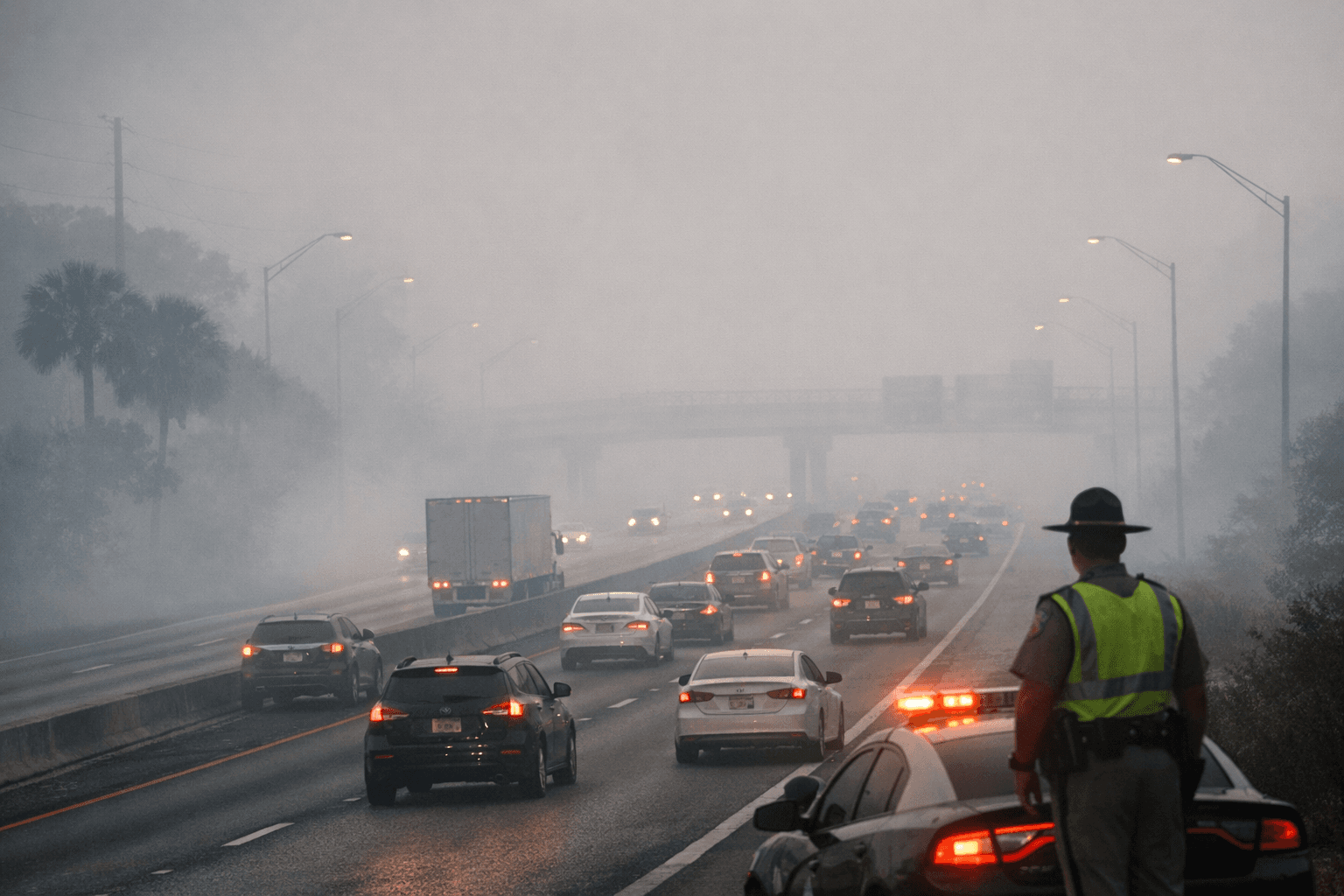
Drivers on Interstate 4 woke up to reduced visibility Friday morning as smoke and haze spread across Seminole County, turning what looked like fog into a smoky commute. The haze was expected to thin as temperatures rose later in the morning, but early travel conditions were uncomfortable and potentially unsafe, especially for anyone already dealing with asthma or other breathing problems.
Seminole County officials said the smoke was likely leftover from a 200-acre prescribed burn in the Wekiva River Basin on Thursday. WESH also reported a 10-acre fire in northern Lake County, with smoke modeled into Orange and Seminole counties, suggesting more than one source may have been contributing to the poor air quality. Meteorologists said a temperature inversion was trapping pollution close to the surface, which helped hold the smoke in place instead of letting it disperse.
The impact was most immediate along commuter routes, especially I-4, where visibility dropped and the haze lingered over the morning drive. Seminole County has seen similar smoke effects before from burns in the Lower Wekiva River Preserve State Park, where county notices said smoke was often most noticeable along S.R. 429 between mile markers 49 and 51 and on S.R. 46. Those corridors, along with the broader western Seminole area, can take on smoke quickly when wind shifts push a burn plume toward populated roadways.
That is part of why prescribed-fire planning matters even when there is no direct threat to homes. The Florida Department of Agriculture and Consumer Services says prescribed-fire managers use wind direction and burn size to estimate smoke plume direction and density, but weather can still trap smoke near the ground. Seminole County says the Wekiva watershed covers about 56.2 square miles, or roughly 36,000 acres, and lies within the St. Johns River Water Management District, underscoring how burns in conservation land can affect nearby neighborhoods and travel lanes far beyond the burn site.
Health officials say wildfire smoke can worsen breathing problems and can be especially dangerous for people with asthma, COPD, heart disease, diabetes, chronic kidney disease, children, pregnant women, and older adults. The Centers for Disease Control and Prevention advises people to check local air quality using the AQI through AirNow or a weather app and to reduce exposure when smoke is present. Seminole County’s wildfire materials also note that burn bans are automatically enacted when the Keetch-Byram Drought Index reaches 500 or higher with no measurable rainfall in the forecast, a reminder that smoke events here are tied to a broader fire-management system that can spill into daily life in a matter of hours.
This article was produced by Prism’s automated news system from verified source data, official records, and press releases, then run through automated quality and moderation checks before publishing. The system is built and supervised by the people who set the standards it runs under. Read our full AI policy.
Did this article answer your question?