Snow, Freezing Rain Grip St. Louis County With More Expected Sunday
Freezing rain hit Hermantown and Lake Superior waves built toward 14 feet Saturday as a Sunday clipper threatens snow squalls across northern St. Louis County.
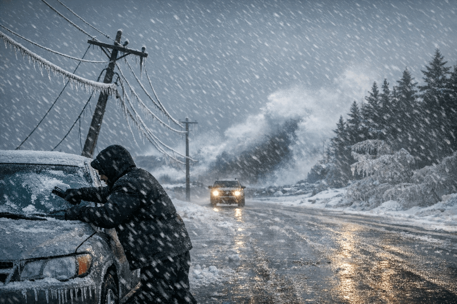
Slippery roads, freezing rain near Hermantown and small craft warnings on Lake Superior marked Saturday in St. Louis County as the region braced for a third winter storm system in less than a week, this one a clipper forecast to push snow squalls through northern parts of the county by Sunday evening.
The National Weather Service office in Duluth tracked snow squall potential tied to the clipper system as highest Sunday evening, with the squall threat concentrated across Lake County and northern St. Louis County. Snow squalls are quick, intense bursts of snow accompanied by strong, gusty winds that are typically short-lived but can rapidly reduce visibility and create treacherous travel conditions.
The clipper's third-round system was expected to move in around 6 p.m. Sunday, with rain chances and snow lingering through much of Monday. Before it arrives, the earlier storm system was forecast to taper off across the northeast by roughly 6 p.m. Saturday, with lighter snow showers lingering through Sunday morning.
Mariners had the most striking numbers to contend with. A small craft advisory covered the Two Harbors to Duluth corridor, with east winds reaching up to 30 knots and gales near 35 knots, waves running 6 to 9 feet and building to 8 to 11 feet toward daybreak, with occasional swells to 14 feet. Those conditions closed Lake Superior to small recreational and commercial vessels through early Sunday.
Snowfall across the region fell within a wide range depending on elevation and proximity to the lake. Duluth and Two Harbors both landed in a general 4-to-8-inch window of expected accumulation from the second storm, with the North Shore receiving the heaviest totals. Forecast snow totals for the earlier system had placed Duluth at 4 to 7 inches, Two Harbors at 5 to 7 inches and Silver Bay at 5 to 8 inches, driven by strong northeasterly winds off Lake Superior producing blowing snow.
Northwestern Wisconsin along the Minnesota border faced the prospect of what NWS Duluth meteorologist Bryan Howell described as a "significant icing event," with potential power impacts and tree damage. "This still can change and ice accumulations can change," Howell said. "It's going to depend on the precise storm track and what our surface temperatures end up being." That uncertainty extended into the Hermantown area, where freezing rain mixed with snow Saturday and surface temperatures remained close to the critical threshold between ice and additional snow accumulation.
A winter weather advisory had been in effect for North St. Louis County as part of the broader regional alert package issued by NWS Duluth. Drivers heading into the range and lake country Saturday faced the combination of packed snow, icy patches and reduced visibility, with conditions expected to briefly improve Saturday night before the Sunday system moves through. Anyone planning travel on Highway 53 north of Virginia or along the North Shore's Highway 61 corridor should monitor the Minnesota 511 system for real-time road condition updates before departing Sunday afternoon.
This article was produced by Prism’s automated news system from verified source data, official records, and press releases, then run through automated quality and moderation checks before publishing. The system is built and supervised by the people who set the standards it runs under. Read our full AI policy.
Did this article answer your question?