Pipestem Dam spillway modification project completed after two years of work
Jamestown's biggest flood-control project is finished, adding a new safeguard at Pipestem Dam for heavy runoff, downstream landowners and the James River system.

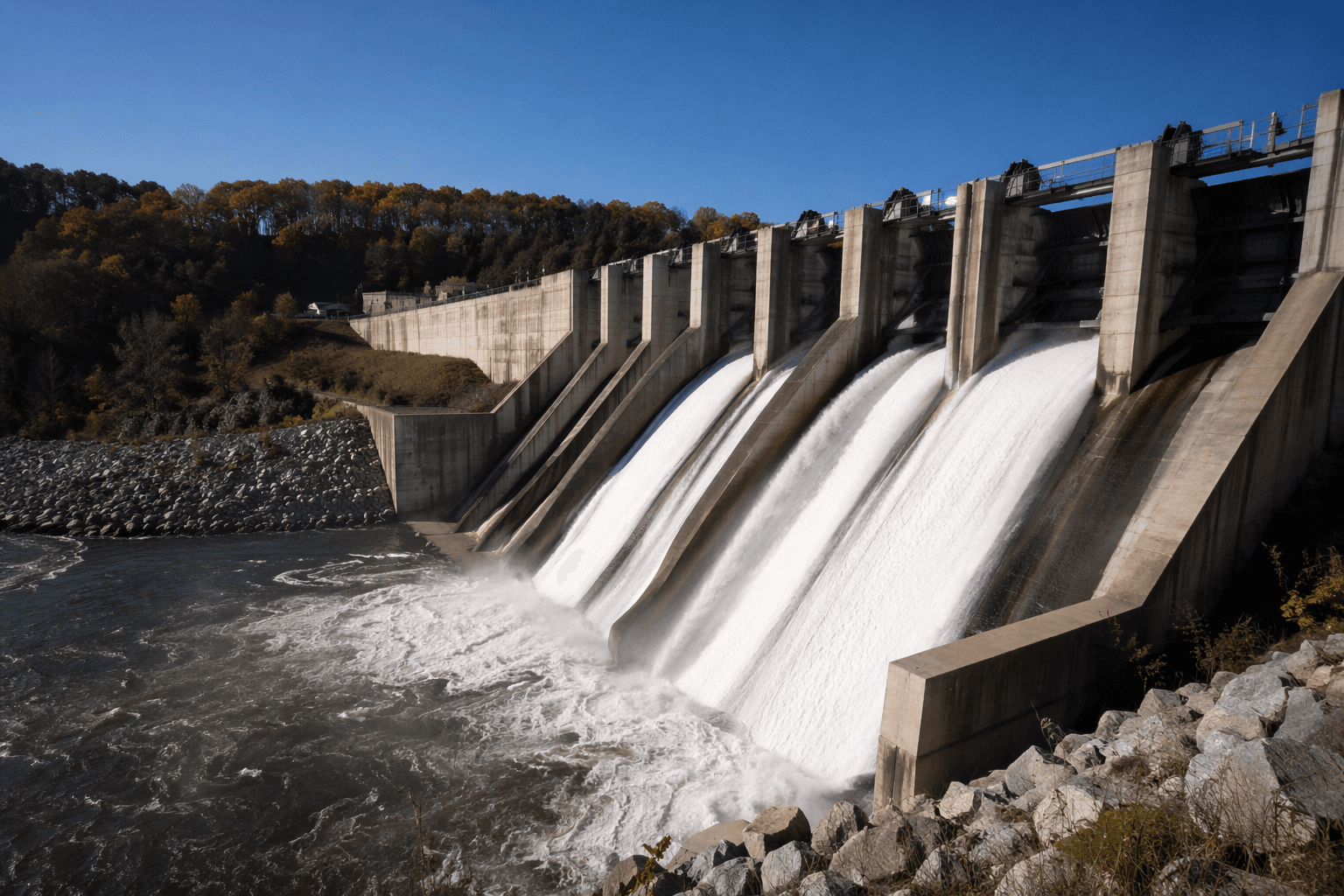
The finished spillway modification at Pipestem Dam gives Jamestown and downstream communities a stronger line of defense before the next big runoff arrives. The $250 million project was marked complete with a ribbon-cutting on May 19 in Jamestown, closing a major upgrade that the U.S. Army Corps of Engineers said fulfilled a three-year commitment to the region.
The practical effect for Stutsman County is not a new look at the lake so much as a safer path for water when the James River basin is under stress. Pipestem Dam was evaluated in 2007 and classified as a moderate urgency dam, and Corps engineers later determined that the spillway sat in glacial till and sand over shale, material that could erode under extreme flood conditions. That risk made the spillway work a dam-safety project first and foremost, aimed at reducing the chance that floodwater could cut into the structure during a major event.
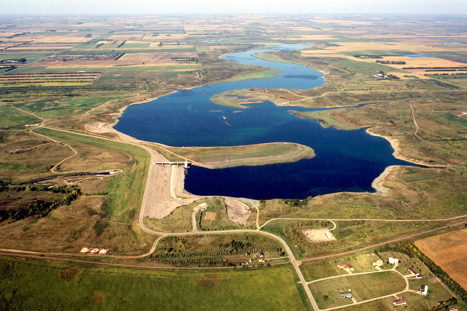
Pipestem Dam itself has been part of the local flood-control picture for more than 50 years. Construction began in June 1971 and was completed in 1973. The dam is about 4,000 feet long and has a maximum height of 107.5 feet. It was built for flood damage reduction, fish and wildlife enhancement, and recreation, and it is owned, operated and maintained by the Corps. Water storage and release from Pipestem Lake are coordinated with the Bureau of Reclamation’s Jamestown Dam, about 6 miles east, as both reservoirs sit in the same system immediately north of Jamestown.
That system matters because the James River basin covers about 22,000 square miles, and the river runs about 710 miles with one of the flattest gradients in North America. The Corps says the Pipestem spillway is designed to pass up to 110,000 cubic feet per second, while the outlet structure is designed to release up to 2,300 cfs. The largest release through the outlet came in April 2009, when it reached about 1,420 cfs. Since the dams were completed, flooding along the James River in North Dakota has generally been less severe, but officials have long treated the spillway as a key backstop when water rises fast.
At the ribbon-cutting, Jamestown Mayor Dwayne Heinrich said he sees the project as an insurance policy. “I see it as an insurance policy under which I hope we never have a claim,” Heinrich said. He joined North Dakota Lt. Gov. Michelle Strinden, Corps leaders and contractor partners in marking the milestone, which leaves Stutsman County with a stronger, more reliable flood-control system heading into future high-water seasons.
This article was produced by Prism’s automated news system from verified source data, official records, and press releases, then run through automated quality and moderation checks before publishing. The system is built and supervised by the people who set the standards it runs under. Read our full AI policy.
Know something we missed? Have a correction or additional information?
Submit a Tip