Second Winter Storm Threatens Stutsman County With Up to 14 Inches of Snow
A second storm bearing up to 14 inches hits Stutsman County Friday after 5 crashes marred a weaker system that dropped only 2 to 3 inches.
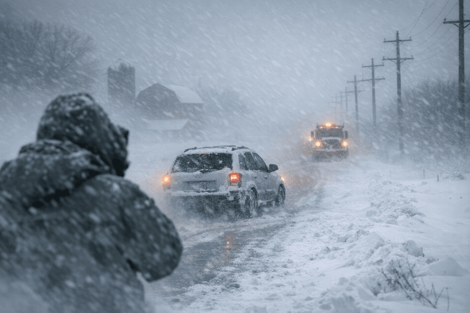
Sgt. Nathan King of the North Dakota Highway Patrol counted five crashes around Jamestown when the first spring storm delivered barely two to three inches of snow; the second system moving in Friday morning carries a forecast of 7 to 14 inches.
The National Weather Service in Bismarck placed Stutsman County under a winter storm warning effective 7 a.m. Friday, April 3, through 4 p.m. Saturday, April 4. Meteorologist Matt Johnson described it as "a pretty dynamic system bringing some heavy snowfall at times," with the heaviest accumulations expected to reach the Jamestown area by midday Friday and taper into early Saturday. The warning's official accumulation range for affected counties sits at 8 to 12 inches, with some model tracks pushing Jamestown-area totals to 14 inches.
King said the earlier crashes involved vehicles leaving the roadway, overturning, or rear-ending other vehicles, though no serious injuries were reported. The incoming storm carries significantly greater travel risk: wind gusts up to 35 mph are expected to generate widespread blowing snow and sharply reduced visibility on top of the heavy accumulations.
The mid-spring timing amplifies the hazard. Wet, heavy snow compacts quickly on pavement and refreezes overnight, producing icy surfaces that outlast the storm itself, a dynamic King identified as a factor in the week's earlier incidents. Road crews were in preparation mode Thursday as schools, employers, and event organizers watched forecasts closely given the Easter weekend overlap.
Drivers who must travel can monitor live plow-camera feeds and road conditions through the North Dakota Department of Transportation travel map. With the heaviest snow still bearing down on Jamestown by midday and an Easter weekend in the balance, Friday morning is the window to prepare.
This article was produced by Prism’s automated news system from verified source data, official records, and press releases, then run through automated quality and moderation checks before publishing. The system is built and supervised by the people who set the standards it runs under. Read our full AI policy.
Did this article answer your question?