Severe thunderstorms threaten Stutsman County with hail, wind and flooding
Streeter, Pingree, Kensal and nearby towns faced severe thunderstorm warnings with 60 mph winds, hail and flash-flood risk as storms swept Stutsman County.

Streeter, Pingree, Kensal and other Stutsman County communities were under severe thunderstorm warnings Tuesday evening as storms threatened damaging wind, hail and flash flooding from southwest and north-central parts of the county.
The National Weather Service in Bismarck said one storm near Streeter, about 36 miles southwest of Jamestown, was moving north at 35 mph at 7:24 p.m. CDT. A second storm near Pingree was reported at 8:12 p.m. CDT, moving northeast at 30 mph and affecting Kensal, Buchanan, Bordulac, Pingree and Edmunds. Forecasters said both storms were capable of producing 60 mph wind gusts and small hail.
The warning for southwestern Stutsman County and southeastern Kidder County was in effect until 8:15 p.m. CDT, while a later warning covered southeastern Foster County and north-central Stutsman County until 9:00 p.m. CDT. NWS said the main threats included torrential rainfall and possible flash flooding, with damage possible to roofs, siding and trees.
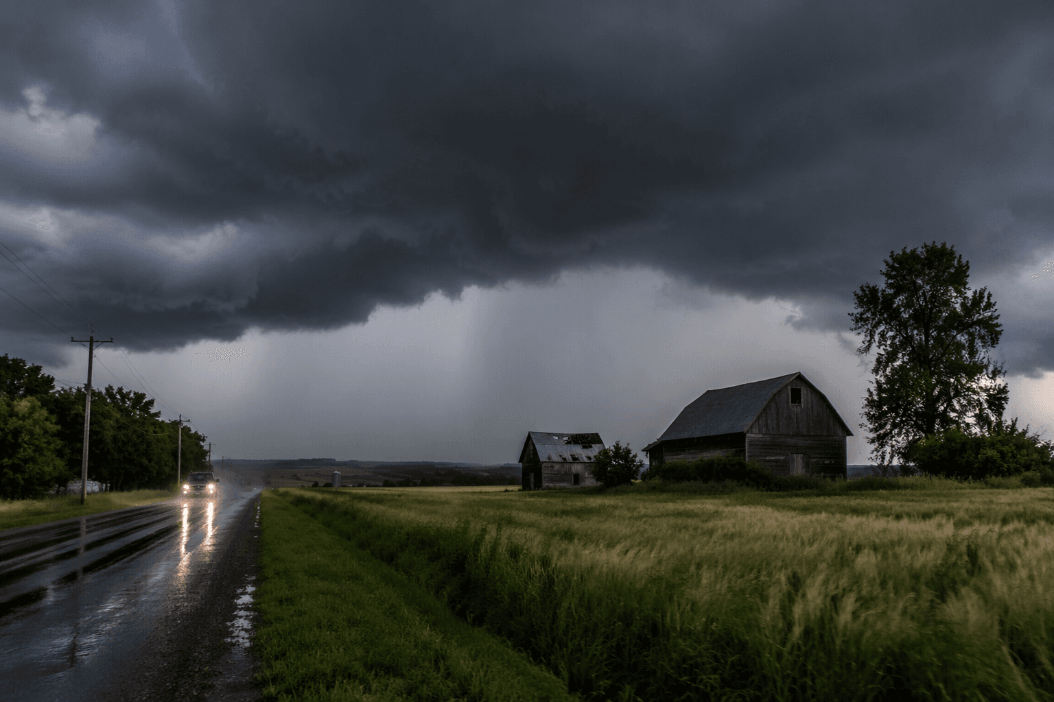
The broader setup across central North Dakota carried a level 2 of 5 severe thunderstorm risk through the night. The Weather Service said storms could bring hail up to the size of golf balls, wind gusts up to 70 mph and an isolated tornado. That meant travelers, outdoor events and farm operations across the county faced a late-day window of fast-changing conditions and poor visibility on already wet roads.
Stutsman County, organized in 1873, is the second-largest county in North Dakota by land area. It covers 2,298 square miles and had a population of 21,593, with Jamestown as the county seat. The county also uses its Stutsman Alerts system for safety notifications during severe weather and other emergencies.
For people looking to sharpen their storm response, Bismarck SKYWARN had scheduled severe weather safety training for June 3 at 6:30 p.m. CDT at the Bismarck Veterans Memorial Library. The timing underscored how quickly a quiet evening across central North Dakota could turn into a hail, wind and flooding threat for towns from Medina and Crystal Springs to Streeter and Jamestown.
This article was produced by Prism’s automated news system from verified source data, official records, and press releases, then run through automated quality and moderation checks before publishing. The system is built and supervised by the people who set the standards it runs under. Read our full AI policy.
Know something we missed? Have a correction or additional information?
Submit a Tip