How Fire Island’s no-car rules shape life and travel in Suffolk County
No paved roads mean Fire Island runs on ferries, water taxis and foot traffic, with 17 communities, one school and 292 year-round residents.
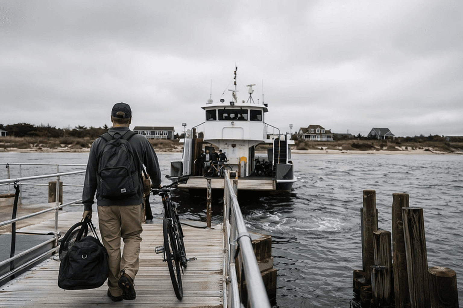
The first thing that shapes Fire Island is not the beach, but the absence of a road. Inside Fire Island National Seashore, there are no paved public roads, so movement depends on ferries, water taxis and walking, which is why the island feels like a chain of neighborhoods rather than one long strand of sand.
How you actually move from place to place
If you are coming from Suffolk County’s mainland, the practical entry points are Bay Shore, Sayville and Patchogue, where many visitors drive or take the Long Island Rail Road before boarding passenger ferries. That pattern matters most from mid-May through mid-October, when the island’s visitor traffic is heaviest and the ferry timetable becomes part of daily life.
Once on Fire Island, people get around on foot or by water taxi. Fire Island Water Taxi is authorized to provide lateral ferry service between communities and destination points, which fills the gap left by the lack of roads. Bicycles are allowed in some communities, but not on National Park Service boardwalks, and the rules are stricter there than many first-time visitors expect: bicycles, scooters, rollerskates and rollerblades are prohibited on all park boardwalks.
The small-print logistics shape how long you stay and where you stop. Many communities do not provide public restrooms. Transient slips are limited, with examples such as Watch Hill and Sailors Haven, so arriving by boat requires more planning than a typical coastal outing. Wheelchairs, strollers and wagons are permitted, though not every trail and facility is fully accessible, which makes the island’s car-free design feel both welcoming and exacting at the same time.
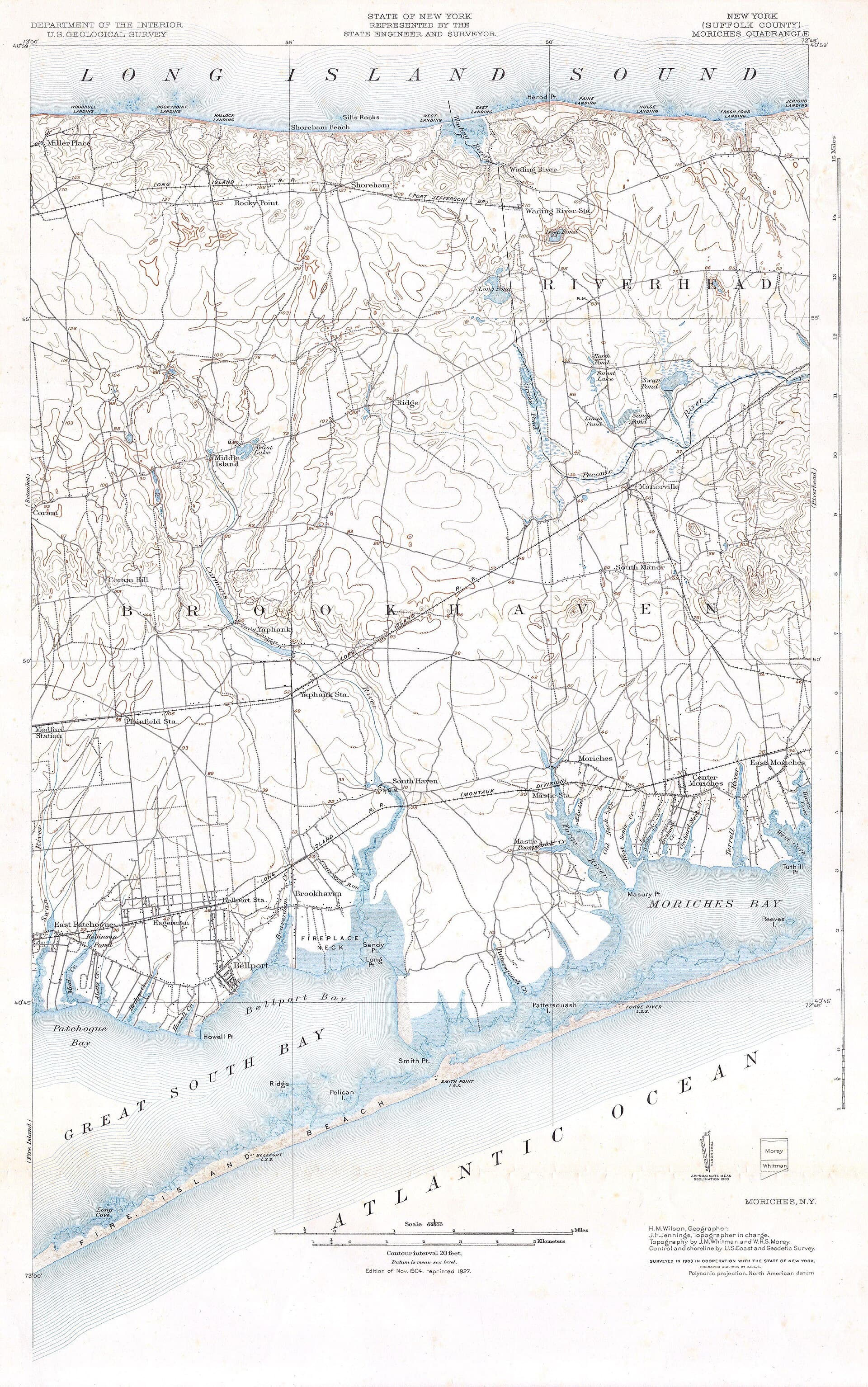
A chain of neighborhoods, not one beach town
Fire Island National Seashore includes 17 residential communities spread across 26 miles of dynamic ocean and bay shoreline. The island is also commonly described as a 32-mile-long barrier island off Suffolk County’s south shore, and that geography helps explain why each community has its own rhythm. Some places hold only a few homes; others have hundreds of houses, plus restaurants, grocery stores and retail businesses.
The park also counts one elementary school on the island, a reminder that Fire Island is not just a summer destination. Rental properties, summer homes and year-round residences sit side by side, and the seasonal swing is dramatic. The Fire Island Association cites a permanent population of 292 year-round residents in the 2010 census, while summer can bring hundreds of thousands of seasonal residents and tourists. That shift changes everything from ferry loads to the quiet of the off-season streets and boardwalks.
That split between resident life and visitor life is what gives the island its local identity. Each community has to function on its own terms because there is no road network to smooth out the differences. Daily life is built around water access, walkability and the limits of what can be moved from one settlement to the next.
Why the island still works this way
Fire Island National Seashore was established by Congress on September 11, 1964, but the island’s current shape was not imposed all at once. The enabling legislation allowed communities and preexisting commercial uses to remain, as long as development followed zoning ordinances established by the Secretary of the Interior. That framework preserved inhabited places instead of wiping them away, which is unusual for a national seashore and central to understanding Fire Island today.
The preservation story also goes back to New York State. In 1908, land near the Fire Island Lighthouse was preserved for public use, later expanding into what became Robert Moses State Park. The National Park Service describes Fire Island’s preservation as the result of both 1960s conservation activism and grassroots local resistance to overdevelopment, including opposition to a road that would have changed the island’s character. The absence of that road is not an accident of geography, it is part of the island’s civic history.
Federal zoning remains part of the equation. The park’s management framework uses zoning standards to guide local ordinances on use, location and size of structures. That is one reason Fire Island can feel protected and inhabited at the same time: the rules were built to let communities stay, but not to let the barrier island turn into something else.
Storms, wilderness and a wider cultural history
The island’s fragility became impossible to ignore when Hurricane Sandy made landfall on October 29, 2012. Sandy created breaches on Fire Island, including one in the Otis Pike Fire Island High Dune Wilderness, and it remains one of the hardest-hit events in the park’s modern history. After the storm, the National Park Service invested more than $273 million in federal recovery funding across coastal parks.
That recovery history matters because Fire Island is both a residential place and an active lesson in barrier-island dynamics. The park’s general management plan recognizes the island’s dynamic environment and the role of its developed communities, and its education materials frame the seashore as a living laboratory for climate and coastal change. On Fire Island, preservation and everyday use are tied directly to the storm cycle.
The wilderness piece is part of that same story. Congress designated the Otis Pike Fire Island High Dune Wilderness in 1980, and the park’s wilderness materials describe it as 1,363 acres. The island’s protected interior is not separate from its inhabited communities, but another layer in a landscape that is constantly being shaped by wind, tide and policy.
Fire Island’s cultural history runs just as deep. Cherry Grove’s community house and theater helped shape what became known as America’s First Gay and Lesbian Town, and the community became a popular destination for LGB New Yorkers in the 1930s. The Pines Resort opened in 1952 as a more discreet option for visitors worried about being outed, and the island’s heritage materials also connect its LGBTQ history to Oscar Wilde’s 1882 visit. Those chapters made Fire Island a nationally significant social landscape, not just a beach destination.
The mainland story still matters
The island’s history reaches back across the water to Suffolk County. The Fire Island Lighthouse, the Wilderness Visitor Center and the William Floyd Estate in Mastic Beach tie the seashore to more than 250 years of local history. The estate preserves the legacy of William Floyd and Nicoll Floyd, linking the island’s protected shoreline to the broader county story of settlement, land use and public memory.
That is the real Fire Island: a place where no-car rules are not a novelty, but the operating system. Ferries, footpaths and water taxis keep the communities connected, while the preservation rules keep the island recognizably itself.
This article was produced by Prism’s automated news system from verified source data, official records, and press releases, then run through automated quality and moderation checks before publishing. The system is built and supervised by the people who set the standards it runs under. Read our full AI policy.
Did this article answer your question?