1.6 Magnitude Quake, 7 km Deep, 18 km North of Henefer
USGS reviewed a magnitude 1.6 earthquake recorded at 02:05:38 UTC March 4, 2026, listed as "M 1.6 - 18 km N of Henefer, Utah," with a reported depth of 7.0 km and no public reports.
A small earthquake, magnitude 1.6, was recorded at 02:05:38 UTC on March 4, 2026 and reviewed by the U.S. Geological Survey, the agency’s event listing shows. The event is listed on the referenced USGS page as "M 1.6 - 18 km N of Henefer, Utah" and has a reported depth of 7.0 km, with no reports of injuries or damage in the supplied feed.
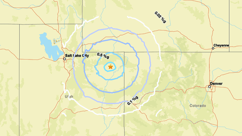
Location details in the aggregated feed include two different representations: Earthquaketrack’s header reads "1.6 Magnitude Earthquake 0.0 km from Henefer, Utah, United States" while the same feed repeats the USGS title "M 1.6 - 18 km N of Henefer, Utah" and provides coordinates listed as "Epicenter at 41.1840, -111.5270." The materials supplied do not explain the discrepancy between "18 km N of Henefer" and "0.0 km from Henefer," and official USGS event detail confirmation is recommended to reconcile the distance and coordinates.
Technical parameters in the aggregated listing specify a magnitude type of ml and a depth entry noted verbatim as "Depth: 7.0 km." The feed timestamp lines consistently give the UTC time as "2026-03-04T02:05:38Z" and the human-readable line "UTC time: Wednesday, March 04, 2026 02:05 AM." Earthquaketrack’s page also shows "USGS status: Reviewed by a seismologist," "No tsunami statement issued," and "Reports from the public: 0 persons," and the page age indicator appears as "#### 5 days ago."
Local context for Summit County-area readers: the Earthquaketrack nearby-places list attached to the event labels broader regions including "Wasatch Front Urban Area, Utah" and other Western states, but the supplied data show no community reports tied to Henefer or surrounding towns. Because the feed lists zero public reports, there is no recorded evidence in these materials of felt shaking in Henefer or nearby communities, and no emergency declarations or tsunami advisories are contained in the supplied lines.
Public health and preparedness implications for people who live or work in the region are procedural at this stage: a reviewed M1.6 at 7.0 km depth is unlikely to cause structural damage, but discrepancies in epicenter reporting affect mapping for emergency planners and can shape which neighborhoods or critical facilities warrant inspection. Confirming the official USGS event page, including the event ID, final coordinates, and distance from Henefer, is the immediate next step for county emergency management and public health partners to determine whether any targeted outreach, inspections, or sheltering guidance is needed.
This article was produced by Prism’s automated news system from verified source data, official records, and press releases, then run through automated quality and moderation checks before publishing. The system is built and supervised by the people who set the standards it runs under. Read our full AI policy.
Did this article answer your question?