May tornado activity slows, drought conditions worsen in Oklahoma Mesonet update
May brought only two tornadoes statewide, but drought tightened across the Panhandle and more than 4% of Oklahoma slipped back into exceptional drought.

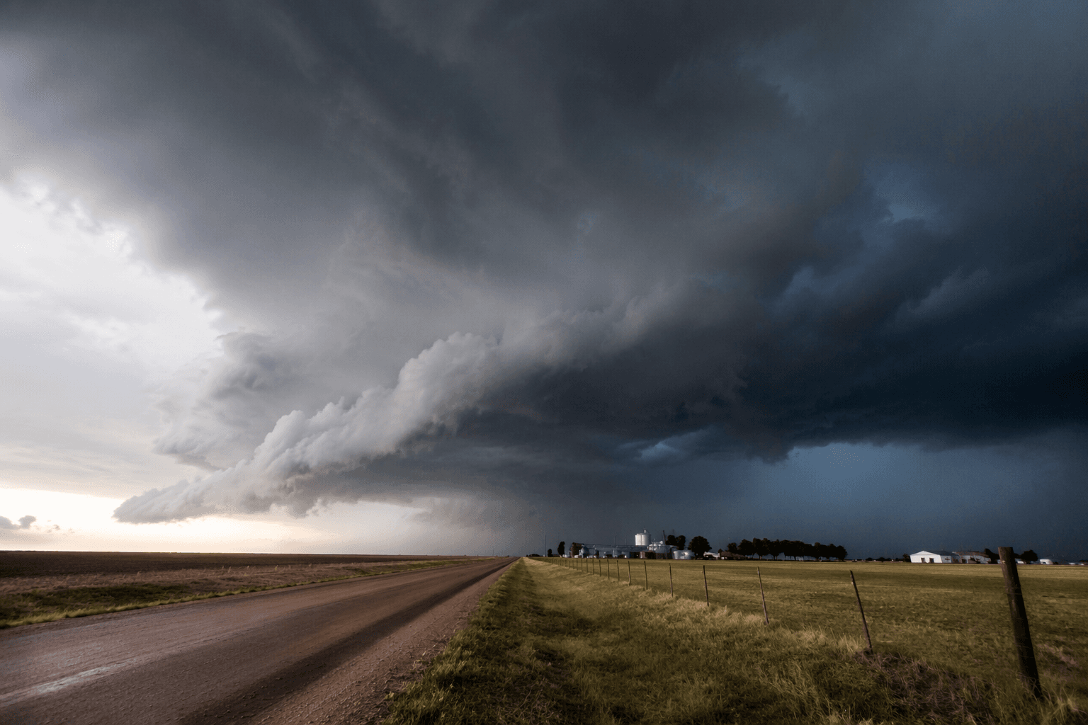
Texas County is heading into summer with a quieter tornado pattern but a harder moisture problem. The Oklahoma Mesonet’s June 1 update shows May tornado activity fell sharply even as drought worsened, a combination that leaves the Panhandle facing more fire danger, more stress on dryland farms and ranches, and a tougher outlook for town water systems across the region.
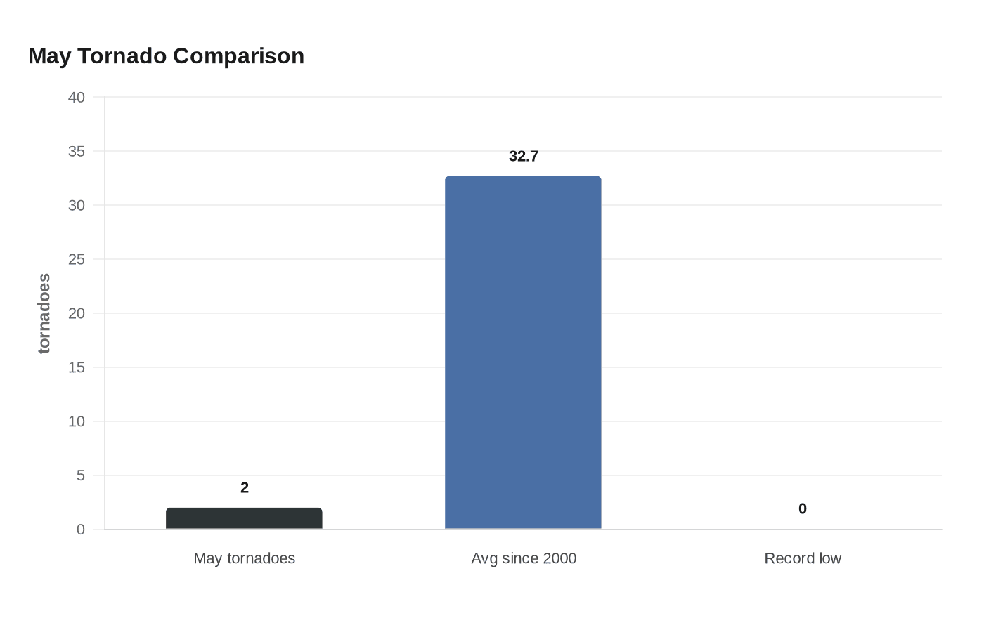
Statewide, Oklahoma logged only two official tornadoes in May, both on May 27 in southeastern Oklahoma, with a possible tornado near Hobart still under review. That is a steep drop in the state’s most active tornado month, which has averaged 32.7 tornadoes since 2000. The record fewest May tornadoes in Oklahoma is zero, set in 2005. The slowdown does not erase the year’s volatility, either: January tied the state’s monthly tornado record, March set a new March record, and the annual count had reached 57 by the end of April.

The bigger story for Texas County is what happened to moisture. Oklahoma’s statewide average rainfall in May was 3.25 inches, 1.68 inches below normal, making it the 34th-driest May on record since 1895. Parts of west-central Oklahoma took less than 25% of normal rainfall. At the same time, about 81% of the state remained in drought at the end of the month. Severe-to-exceptional drought rose from 44% to 47%, and extreme-to-exceptional drought climbed from 30% to 37%. Exceptional drought, the hardest category, returned to Oklahoma for the first time since July 11, 2023, covering more than 4% of the state.
That dry turn comes on top of a warm spring. Climatological spring, March through May, finished as the second-warmest on record, and January through May ranked as the second-warmest such stretch since records began in 1895. January had already left more than two-thirds of Oklahoma in drought after a major winter storm and a Jan. 8 tornado outbreak, and the pattern never fully reset.
For Texas County, the Mesonet’s drought tools now matter as much as the tornado numbers. Its network tracks the U.S. Drought Monitor, relative greenness, consecutive dry-day maps, rainfall summaries, KBDI, Palmer Drought Index, QuickDRI, VegDRI, reservoir levels and storage, burn bans and water resources dashboards, along with state and federal links from the Oklahoma Water Resources Board, the U.S. Department of Agriculture, the U.S. Army Corps of Engineers and the National Drought Mitigation Center. In the Panhandle, where wind and heat can turn dry ground into a fast-moving hazard, the whiplash is clear: fewer tornadoes did not mean lower risk.
This article was produced by Prism’s automated news system from verified source data, official records, and press releases, then run through automated quality and moderation checks before publishing. The system is built and supervised by the people who set the standards it runs under. Read our full AI policy.
Know something we missed? Have a correction or additional information?
Submit a Tip