Thunderstorms possible across Texas County, strong winds and hail main threats
Thunderstorms carried a small but real risk for Texas County, with the weather service warning of damaging wind and hail that could disrupt Guymon pickup and travel.

A narrow but serious thunderstorm threat hung over Texas County, where the National Weather Service in Amarillo put the chance of storms at 10% to 20% and warned that damaging wind gusts and hail were the main hazards for Guymon and nearby towns. The biggest concern was not just rain, but how quickly a brief storm could complicate school pickup, travel, outdoor work and evening sports across the county.
The weather service said the southern Plains were in an active spring pattern, with several rounds of severe thunderstorms in the forecast and nearby areas also facing critical fire weather concerns from dry, breezy conditions. For Texas County, that meant a low-probability setup still carried enough punch to merit close attention, especially as storms moved across the central Texas and Oklahoma Panhandles.
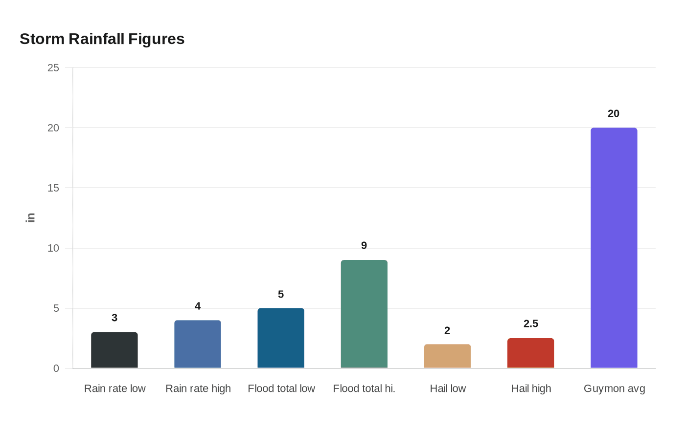
That caution was sharpened by what happened during the June 18-19, 2024 flooding event from Texhoma to Guymon. The weather service said rainfall rates reached 3 to 4 inches per hour at times, with totals of 5 to 9 inches across parts of the north central Texas Panhandle and the Oklahoma Panhandle. The event led to road closures, washed-out roads and high-water rescues, while some hail reached 2 to potentially 2.5 inches in diameter. Local reporting said the Hooker, Oklahoma, mesonet site measured more than 5 inches of rain in just over two hours, a reminder of how fast conditions can turn in this part of the Panhandle.
That storm also underscored how vulnerable Texas County remains. Guymon averages only about 20 inches of rain in a year, but a large share can fall in just a few hours when slow-moving storms develop. In June 2024, residents across Texas County saw roads, highways and power poles damaged as floodwater and severe weather hit the area hard.
The weather service’s tornado statistics page also shows how deep the severe-weather record runs in the Texas and Oklahoma Panhandles, with tornadoes compiled from 1950 through 2022. For Texas County, the immediate concern remained more familiar and more common: strong straight-line winds, large hail and the potential for sudden disruption before the storm line moved on.
This article was produced by Prism’s automated news system from verified source data, official records, and press releases, then run through automated quality and moderation checks before publishing. The system is built and supervised by the people who set the standards it runs under. Read our full AI policy.
Did this article answer your question?