Special weather statement issued for Val Verde County, heavy rain possible
Val Verde County stayed under a special weather statement through 9 p.m. as Del Rio faced slow-moving storms, heavy rain, gusty winds and lightning.
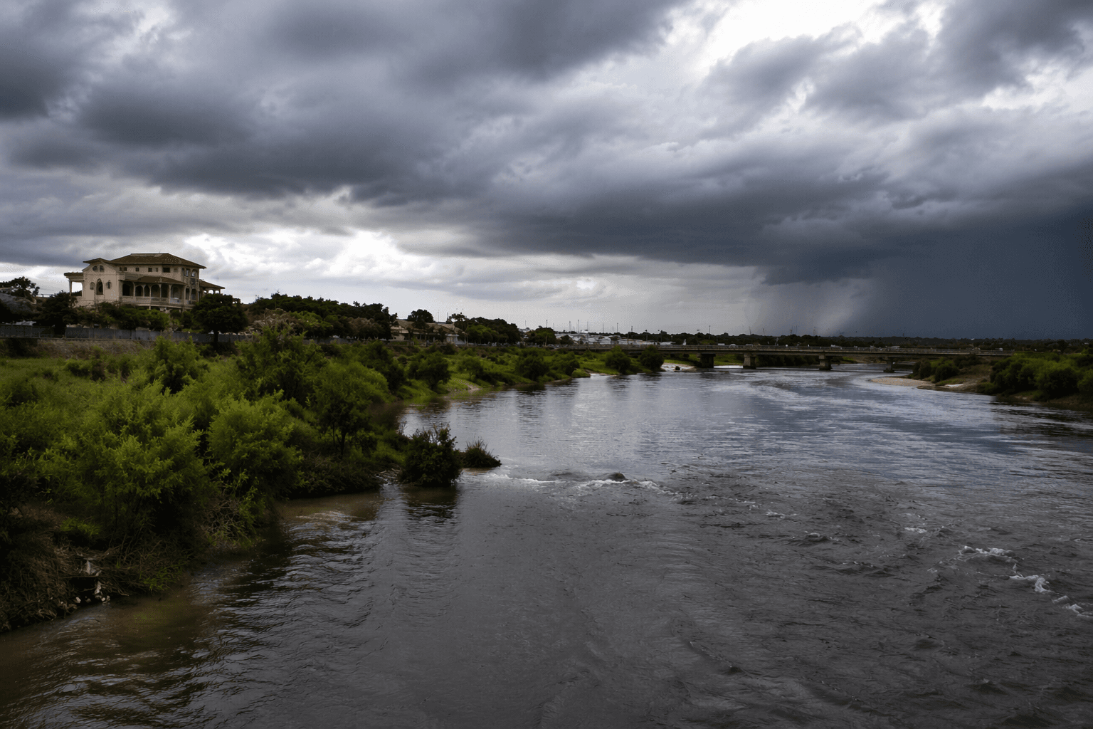
Val Verde County was under a special weather statement from the National Weather Service Austin/San Antonio through 9 p.m. CDT, with Del Rio included in the area where heavy rain could quickly turn roads slick and low-water crossings dangerous. Forecasters said the threat was tied to slow-moving thunderstorms capable of producing locally heavy rainfall, gusty winds and lightning strikes.
The strongest rain potential was expected late Thursday into early Friday across the Rio Grande plains and the southern Edwards Plateau, the same corridor that includes western South Texas communities watching storm bands drift through with little warning. NWS officials warned that rainfall rates could become intense enough to cause localized flooding, especially where storms repeatedly track over the same area.
The concern extended well beyond Val Verde County. A Flood Watch remained active for South-Central Texas, including the I-35 Corridor, through 1 a.m. Saturday. Forecast totals of 2 to 4 inches were possible, with isolated spots reaching up to 8 inches, a level that can overwhelm drainage systems and flood roads, yards and normally dry arroyos. Residents heading out in Del Rio and surrounding parts of the county were being asked to treat any flooded roadway as a hard stop and to adjust plans if storms strengthened this evening.
The weather service also placed the alert in a broader seasonal pattern that matters for local decision-making. June in South-Central Texas is a transition month between spring and a drier summer, but heavy rain and flash flooding remain common threats, even as temperatures climb into the 90s and, later in the month, above 100. That mix of heat, humidity and unstable air has already produced severe weather this season. The Austin/San Antonio office recently confirmed a short-lived EF-1 tornado from the May 26 line of thunderstorms in southern Guadalupe County, a reminder that storm threats across the region can escalate fast once thunderstorms build.
This article was produced by Prism’s automated news system from verified source data, official records, and press releases, then run through automated quality and moderation checks before publishing. The system is built and supervised by the people who set the standards it runs under. Read our full AI policy.
Know something we missed? Have a correction or additional information?
Submit a Tip