Vinton County's Historic Covered Bridges Draw Visitors Across Rural Ohio
More than 60 covered bridges once crossed Vinton County's creeks; today only four survive, one was burned by an arsonist in 2013, and just one still carries vehicle traffic.
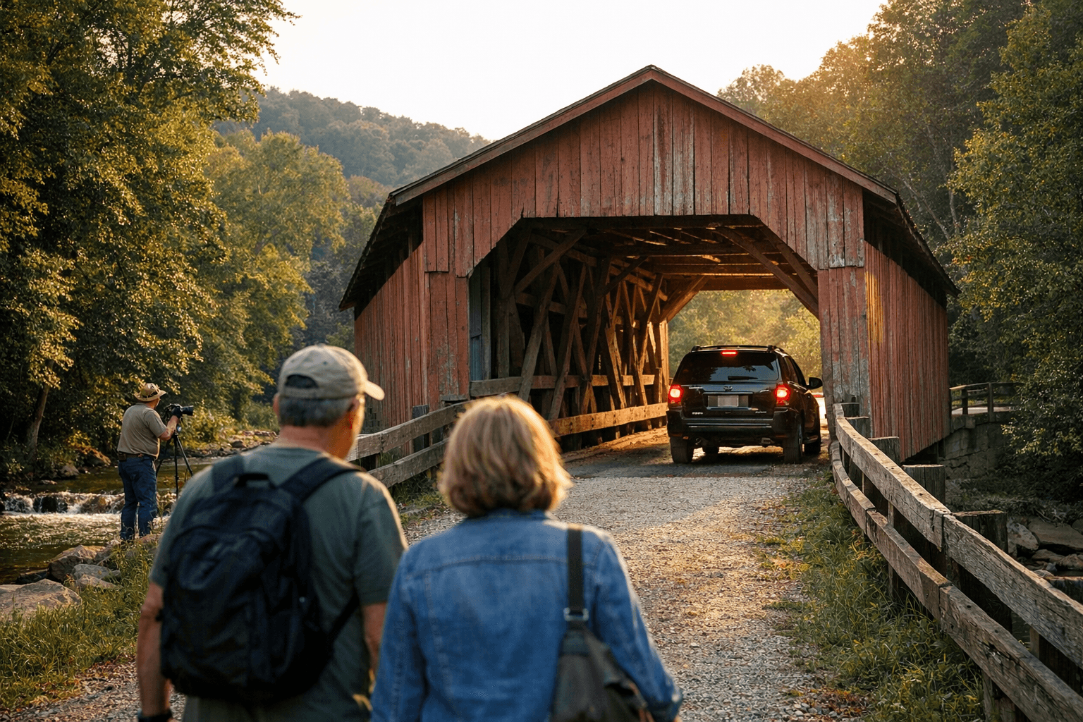
More than 60 covered bridges once carried Vinton County's farmers, loggers, and mill workers across its creeks and hollows. Today four remain. The most visited of them all, the Ponn Bridge, was deliberately set on fire in June 2013 and reduced to its sandstone abutments. A second, the Arbaugh, spent 30 years closed to traffic after overloaded trucks damaged its timbers, and only a grant saved it from permanent shutdown. What's left is a fragile quartet of 19th-century wooden structures that depend on grant funding, county stewardship, and public respect to survive — and the difference between four bridges and three is a single act of negligence away.
From 60 Bridges to Four
At their peak, more than 60 covered wooden spans dotted the Vinton County landscape. The covering wasn't decorative; it was a practical engineering decision that shielded structural timbers from rain and rot, extending a bridge's useful life by decades beyond what an open wooden span could endure. As paved roads and concrete replacements arrived through the 20th century, most of those bridges disappeared. Some were demolished outright. Others were relocated rather than lost: the Bay Covered Bridge was moved several miles from its original site over Little Raccoon Creek to the Vinton County Fairgrounds in 1967, a relocation forced by the construction of Lake Rupert. The Cox Bridge was shifted 20 feet north in late August 1992 by workers from the Vinton County Engineer's office, an operation that involved jacking up the bridge's ends, laying greased plywood strips along both creek banks, and pulling the structure by steel cables onto new concrete foundations. What couldn't be saved by relocation or restoration was eventually lost to neglect, road projects, or worse.
The Four Surviving Bridges: Access, Condition, and Stewardship
*Arbaugh (Eakin Mill) Bridge* — The oldest surviving covered bridge in Vinton County was built in 1870/71 by McArthur contractors Gilman and Ward for $2,200. It spans Big Raccoon Creek on Mound Hill Road near the community of Arbaugh, southeast of McArthur, and carries GPS coordinates N39°10.288′, W82°20.201′. Also known historically as the McLaughlin Bridge and Geer's Mill Bridge, the Arbaugh is the only covered bridge in Vinton County currently open to vehicle traffic. That status was not guaranteed: damage from overloaded trucks forced the bridge out of service for 30 years before grant funding covered the rehabilitation needed to reopen it. The lesson from that closure is direct — posted weight limits exist for structural reasons, and ignoring them already cost this bridge three decades of access.
*Mount Olive Road Covered Bridge* — Built in 1875 by Civil War veteran George Washington Pilcher, the Mt. Olive Bridge crosses Middle Fork Salt Creek and is listed on the National Register of Historic Places. Pilcher used a multiple-kingpost truss configuration suited to short rural crossings, a design practical enough that it outlasted most of the county's other spans. The bridge is pedestrian-only and sits at approximately N39°17.179′, W82°35.324′. Its NRHP listing provides a layer of federal recognition that supports preservation funding applications.
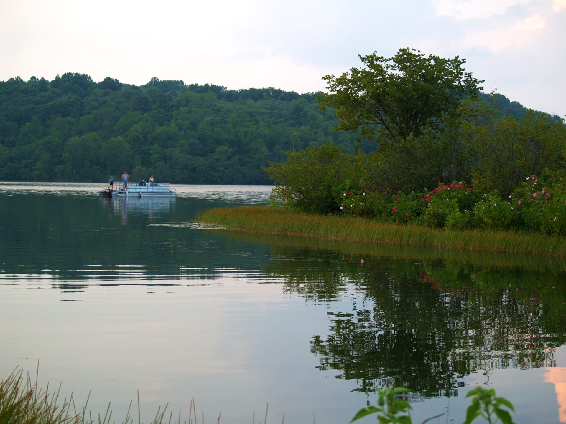
*Bay Covered Bridge* — A 63-foot multiple-kingpost truss structure, the Bay Bridge now sits on the Vinton County Fairgrounds on State Route 93 North, roughly one mile from McArthur's town square (N39°16′10.71″, W82°28′29.556″). It is open to pedestrians and visible from the highway when the fairgrounds are closed. The fairgrounds relocation preserved a bridge that would otherwise have been submerged or demolished when Lake Rupert was created, making the fairgrounds setting an unusual but effective form of structural conservation.
*Cox Covered Bridge* — Built in 1884 over Brushy Fork Creek, the Cox Bridge is a 46-foot queen-post through truss that is pedestrian-only and features a small picnic area near its relocated position. In 2004, the Vinton County Convention and Visitors Bureau secured a Make a Difference Day grant to fund a substantial renovation. That grant history matters: it illustrates that routine county maintenance budgets have not been the primary financial mechanism keeping these structures intact. External grants and CVB-led initiatives have repeatedly filled the gap.
The Ponn (Humpback) Bridge: A Permanent Warning
The Ponn Bridge, also known as the Humpback Bridge, Gheers Mill Bridge, and Barnes Mill Bridge, was built in 1874 and was the longest covered bridge Vinton County ever had. Its unusual arched profile made it the most-visited and most-photographed span in the county. In June 2013, it was destroyed by arson. Its sandstone abutments still stand close to the Arbaugh Bridge and are worth visiting, but the structure itself is gone. One hundred and thirty-nine years of craftsmanship and local history was eliminated in a single night. The Ponn Bridge's fate is the clearest possible argument for why the remaining four bridges require active protection, not passive appreciation.
Engineering, Builders, and the Cost of Construction
George Washington Pilcher, who built the Mt. Olive Bridge in 1875, was a Civil War veteran and a documented bridge contractor in southern Ohio. The truss configurations used across Vinton County's surviving bridges, multiple-kingpost at the Bay and Mt. Olive spans, queen-post at the Cox, represent practical solutions for the short crossings and heavy agricultural loads these structures were designed to carry. The $2,200 cost of the Arbaugh Bridge in 1871 put these structures within reach of 19th-century county budgets. Their survival into the 21st century is the result of active intervention, not passive endurance.
Tourism, Farm Access, and What These Bridges Actually Do
The Vinton County CVB packages a self-guided covered-bridge driving tour that links all four surviving bridges into a single itinerary, pairing naturally with visits to Hocking Hills State Park, the Moonville Rail Trail, and scenic drives through the county's small communities. For the county's tourism economy, these bridges are efficient, low-cost assets: no admission fee, no dedicated visitor infrastructure, and a compelling reason for out-of-county visitors to spend time in McArthur, Allensville, and Hamden.
The Arbaugh Bridge, however, is not just a tourism asset. It functions as active road infrastructure on Mound Hill Road, used by farm vehicles, emergency responders, and everyday drivers. Its continued open status depends directly on structural maintenance and weight limit compliance. The CVB offers GPS coordinates for each bridge site as part of its driving tour materials, making navigation straightforward even on county roads without reliable signage.
What You Need to Know Before You Go
- Driving access: The Arbaugh Bridge is the only covered bridge open to vehicle traffic. Obey posted weight limits — exceeding them already caused a 30-year closure and could do so again.
- Pedestrian-only sites: The Mt. Olive, Bay, and Cox bridges are open to foot traffic only. Do not attempt to drive across them.
- Seasonal hazards: County roads approaching these bridges can become muddy and slippery in early spring. Plan visits for dry-weather windows if you're driving a low-clearance vehicle.
- Fairgrounds access: The Bay Bridge is on the Vinton County Fairgrounds property. It is visible from State Route 93 North year-round but only fully accessible on foot when the fairgrounds are open.
- Picnic stop: The Cox Bridge has a designated picnic area. The full driving tour makes for a comfortable half-day outing.
- Report damage: Graffiti, structural concerns, or vandalism should be reported to the Vinton County Engineer's office or the Vinton County Convention and Visitors Bureau. The loss of the Ponn Bridge is a reminder that delayed response to threats can be permanent.
- Respect the structure: Do not climb truss timbers, carve into structural members, or block maintenance access. Compliance is not optional; it is the difference between four bridges and three.
The CVB's covered-bridge driving tour map, available through the visitors bureau, includes GPS coordinates for each site. It is the most practical starting point for a visit and a direct connection to what was once a network of more than 60 bridges — now four, each one irreplaceable.
This article was produced by Prism’s automated news system from verified source data, official records, and press releases, then run through automated quality and moderation checks before publishing. The system is built and supervised by the people who set the standards it runs under. Read our full AI policy.
Did this article answer your question?