Wake County greenways and parks: biggest trails, access points, safety tips
Wake County offers more than 250 miles of greenways and nine county parks (plus three preserves); know the biggest trails, exact access addresses, planned expansions, and the limited official safety guidance.
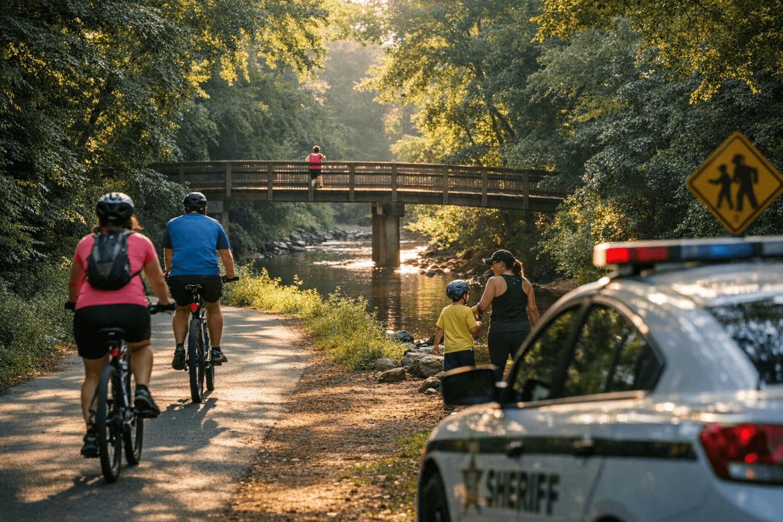
1. Wake County greenways at a glance
Wake County "has more than 250 miles of completed greenways to enjoy," forming a network used for commuting, recreation, and wildlife habitat across Raleigh and the county’s 12 municipalities. The Wake County Greenway System Plan (original 2017 plan, with Appendix D updated September 2018) frames the system as extensive but in need of better connectivity between trails, town centers and destinations to make walking and bicycling "more accessible, practical, and enjoyable for more people."
2. American Tobacco Trail, largest regional spine and a primary access point
The American Tobacco Trail (ATT) is listed in the county parks inventory with an access address at 1309 New Hill‑Olive Chapel Road, Apex, NC 27502, and figures prominently in county and town plans as a trail priority. Wake County’s 2008 Parks and Recreation Master Plan identified an "extension of the American Tobacco Trail South" as one of three major trail projects; the Town of Apex’s 2015 plan adds specific ATT connection projects, Jaycee Park to Downtown (1,500 LF), Kelly Road Park to Apex Nature Park (1.2 miles), and Apex Nature Park to American Tobacco Trail (2.3 miles), underscoring ongoing local efforts to knot neighborhoods into the ATT corridor.
3. White Oak Creek Greenway, East Coast Greenway link through Cary and Apex
White Oak Creek Greenway in Cary is explicitly called out as "a key part of the East Coast Greenway," and Apex’s 2015 plan prioritizes routing White Oak Creek Greenway "through Apex and to the ATT, working in collaboration with the Town of Cary." Local features and multimedia (including a UNC‑TV piece referenced by regional trail resources) highlight this corridor as both a recreational amenity and a longer-distance pedestrian/bicycle route connecting communities.
4. Neuse River Greenway, identified long‑term county priority
The Neuse River Greenway appears among the three major trail projects listed in Wake County's 2008 master plan, alongside Swift Creek and the ATT South extension, signaling county-level priority for river corridor trail development and conservation. The Wake County plan materials place these projects in the same category of strategic long-range investments intended to increase regional trail mileage and access.
5. Swift Creek Greenway, planned river‑valley trail corridor
Swift Creek Greenway is the third of the 2008 plan’s named major trail projects, listed with the Neuse and ATT South extension as a core focus for improving regional walking and hiking opportunities. While the 2008 plan names the project, the Wake County Greenway System Plan and Appendix D focus future work on connectivity and system updates rather than detailed construction timelines for each corridor in the excerpted materials.
- American Tobacco Trail, 1309 New Hill‑Olive Chapel Road, Apex, NC 27502
- Beech Bluff County Park, 3321 NC Highway 42, Willow Spring, NC 27592
- Blue Jay Point County Park, 3200 Pleasant Union Church Road, Raleigh, NC 27614
- Crowder County Park, 4709 Ten‑Ten Road, Apex, NC 27539
- Green Hills County Park, 9300 Deponie Drive, Raleigh, NC 27614
- Harris Lake County Park, 2112 County Park Drive, New Hill, NC 27562
- Historic Oak View County Park, 4028 Carya Drive, Raleigh, NC 27610
- Historic Yates Mill County Park, 4620 Lake Wheeler Road, Raleigh, NC 27603
- Lake Crabtree County Park, 1400 Aviation Parkway, Morrisville, NC 27560
- Robertson Millpond Preserve, 6333 Robertson Pond Road, Wendell, NC 27591
- Sandy Pines Preserve, 7201 Doc Procter Road, Wendell, NC 27591
- Turnipseed Nature Preserve, 7100 Hunt Valley Trail, Wendell, NC 27591
6. County parks and preserves, nine parks and three preserves with access addresses
"Wake County Parks, Recreation & Open Space operates nine parks and three preserves. Select a park location to learn more!" The county list of parks and preserves with addresses is:
The county’s 2008 citizen survey specifically named Lake Crabtree County Park as "the most visited park," and the same survey found "walking and hiking trails were the highest rated new facilities that citizens want," explaining why trail access at these park addresses matters for daily use.
7. Planned county parks and long‑range facility priorities
Wake County’s 2008 master plan also identified four potential future county park facilities by name: Lake Myra County Park, Little River County Park, Southeast Wake County Park, and the Brady Jefcoat Property. These site names indicate where the county once prioritized land for future acquisition or development; the 2017/2018 greenway planning process continues to layer connectivity goals on top of those long‑range park priorities.
8. System updates and the Triangle Bikeway addition (2017–2018)
The Wake County Greenway System Plan (original 2017 plan) includes appendices used to track updates: "This appendix is used to track changes from the original 2017 Wake County System Greenway Plan." The September 2018 updates "were centered around the addition and inclusion of the proposed Triangle Bikeway, which provides a direct connection between the vast existing bikeway and greenway systems in Raleigh, Cary, and Durham," referencing the Triangle Bikeway Preliminary Feasibility Report (2017) as the underlying study. That change highlights a shift from single‑municipality trail work toward regional linkage projects.
9. Design guidance: Raleigh standards and Alta Planning + Design
The county plan explicitly points readers to Raleigh for design examples: "As Wake County's largest municipality, and as the city with the most miles of greenways on the ground in North Carolina, the City of Raleigh is a natural leader to look to for example trail design guidance." Appendix C of the Wake plan reproduces images developed by Alta Planning + Design for the City of Raleigh's Capital Area Greenway Planning and Design Guide, signaling that recommended "Standard Trail Cross Sections" and categorizations, "Cross City Greenway Trails," "Greenway Connector Trails," "Neighborhood Greenway Trails", should inform local trail design and safety features.
10. Safety basics and official guidance
Wake County’s explicit safety direction for visitors is succinct: "Help ensure everyone has a safe and pleasant visit at our parks, preserves and recreational areas by adhering to each location's rules and regulations." The original guide fragment notes its intent to include "safety basics," but the excerpted materials do not provide a full checklist; instead, the plan and design guides (e.g., the City of Raleigh Capital Area Greenway Planning and Design Guide) are the primary sources for trail cross‑section standards and design elements that affect user safety (clearances, separation, signage) and should be consulted for technical safety details.
11. Maps, pocket guides and multimedia resources
For maps and updates, regional trail pages recommend the Wake County "All Parks & Trails" and "Open Space & Greenways" tabs for an overview; Triangle regional resources underscore multimedia features, "Later this week, we'll feature video footage of some of these trails!", and external features like the VisitRaleigh "Best Trails" piece and a UNC‑TV feature on White Oak Creek Greenway. A printed "Trails and Greenways of Wake County" pocket guide was once available and, while "currently out of print," retains high demand among users seeking hardcopy maps.
12. Gaps to watch: transit, connectivity, and local implementation
Across the planning documents there is a clear gap worth noting: Wake County’s 2008 master plan references transit ambitions, "rail line and enhanced bus service, connecting all 12 municipalities, expanding the network and BRT service", but explicitly states "There is no mention of connecting transit service to greenways or trails, although the plan prioritizes enhancing transit service in urban cores and employment centers." At the same time, the Wake County Greenway System Plan stresses there is "much room for improvement in terms of connectivity between trails and between town centers and other destinations." Those two facts together identify a policy opportunity where tying transit and trail planning could unlock more practical, multimodal daily trips.
13. What to check before you go and final takeaway
Before visiting, use the Wake County Park Locator to confirm park hours and site rules for each address above; county notices (for example, a past public notice stated the Wake County Public Health Center would "reopen on Monday, Feb. 23, at our new address") show that operational details can change and official pages are the authoritative source for closures and regulations. The practical takeaway: Wake County offers a network of more than 250 miles of greenways and a county system of nine parks and three preserves with named access points, but the county’s planning materials emphasize that future value depends on completing planned corridors (Swift Creek, Neuse, ATT South), advancing regional connections like the Triangle Bikeway, and explicitly linking transit and trail planning so those miles serve everyday trips as well as weekend recreation.
This article was produced by Prism’s automated news system from verified source data, official records, and press releases, then run through automated quality and moderation checks before publishing. The system is built and supervised by the people who set the standards it runs under. Read our full AI policy.
Did this article answer your question?