Wake County preserves 1,425 historical maps for land records research
Wake County’s 1,425 restored historical maps can help settle lot lines, trace roads, and track land-use changes, with survey maps online free since 1885.
Wake County’s Register of Deeds has professionally restored, preserved in clear portfolios, and scanned more than 1,425 historical maps for online viewing, giving Raleigh homeowners a practical land-record tool when they need to check whether a fence, driveway, or side yard sits on the right side of an old boundary.
How the map archive works
The historical maps in this collection date from the late 1800s into 1926. The official maps on record were generated as tracings from the original maps so they could be recorded in standard map sizes. That helps connect an old plat, a subdivision line, or a road corridor to a current parcel.
Restored for preservation and viewing by the Wake County land records community, the maps can help bridge the gap between historic property boundaries and today’s real-estate records. They can answer questions about a lot line, a long-vanished road, or how a neighborhood was divided over time.
Where to begin a search
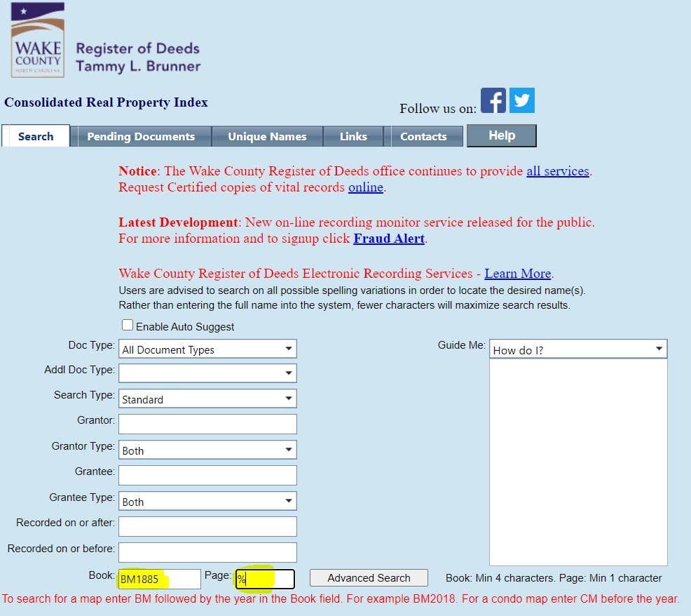
The most direct starting point is Wake County’s Online Real Estate Search. Survey or subdivision maps recorded since 1885 are available there free of charge, which makes the archive accessible before anyone pays for a certified copy or makes a trip to a records office.
Wake County’s Historical Maps page also points users to named collections that narrow the search quickly:
- C.L. Mann & Tax Maps
- Fred Davis Maps
- Highway Maps
- NC Maps and Sanborn Maps through the University of North Carolina
Those categories let a search begin with a map type instead of a blind archive hunt. A homeowner trying to understand an old parcel split may need a subdivision map; a small developer examining access or frontage may want highway maps; a house-history researcher may find Sanborn-style or town-focused material more useful than a broad county sheet.
Why these maps still matter for property questions
A property owner can compare an 1885-or-later subdivision map with a modern parcel record to see whether a boundary moved, whether an alley was later closed, or whether a road once crossed a lot that now looks solid on paper. Attorneys and surveyors can use the same material to trace how a recorded tract changed shape as Wake County grew around it.
The 1914 Wake County Soil Survey in UNC’s North Carolina Maps Historic Overlay Maps collection adds another layer of context for land-use work. Soil maps can help explain why certain areas were farmed, built, or left open, which is useful when a buyer, planner, or developer needs to understand the physical conditions that shaped older decisions. Historical land records are often most useful when they are read together: a tax map, a highway map, a soil map, and a recorded subdivision can show the same place from different angles.
East Carolina University’s Digital Collections include an 1870 Wake County map by Fendol Bevers, drawn from actual surveys and showing townships, roads, railroads, households, and natural features. The collection also includes an 1887 map by A.W. Shaffer that shows cities and towns, principal roads, post offices, churches, schools, voting places, and natural features. For anyone tracing neighborhood change, those details can help explain why one corridor developed early, why another stayed rural, or how civic life was organized before modern zoning and subdivision patterns took hold.
How the archive was brought back into public view
Wake County’s public release of the maps grew out of a restoration effort begun in 2019 by then-Register of Deeds Charles Gilliam. A Wake County news release dated September 10, 2020, outlined a project to rescue, restore, protect, and make the maps accessible to the public after they had been recorded from the late 1800s into 1926.
Gilliam put the reason for the work bluntly: “These maps have been seen by only a few since they were put away years ago.” The maps were preserved and made available for people working on land records, neighborhood history, and property ownership.
What to look for in practice
A useful search often starts with a specific question and the narrowest likely map type. For example, a buyer in Raleigh, Cary, Knightdale, or Apex who wants to know how a lot was first recorded may start with a subdivision map from the Online Real Estate Search. Someone studying an older downtown block may move to C.L. Mann or Fred Davis maps. A project that involves a road alignment or right-of-way issue may benefit from the county’s highway maps, while a house-history file may point toward the Sanborn and UNC collections.
The archive also gives Wake County residents a way to document change without relying on memory alone. A century-old map can show where a road once ran, where schools and churches sat, or how a township line was drawn long before today’s subdivisions and commercial corridors.
This article was produced by Prism’s automated news system from verified source data, official records, and press releases, then run through automated quality and moderation checks before publishing. The system is built and supervised by the people who set the standards it runs under. Read our full AI policy.
Did this article answer your question?