South Point Fire Contained in Cibola Refuge After Burning 116 Acres
A wildfire that burned in the Cibola National Wildlife Refuge near the Imperial and La Paz county line was managed by the U.S. Fish and Wildlife Service with support from the Bureau of Land Management and reached about 116 acres before containment. BLM reported no further growth was expected, an outcome that limits immediate risk but raises questions about federal land management, interagency coordination, and local preparedness.

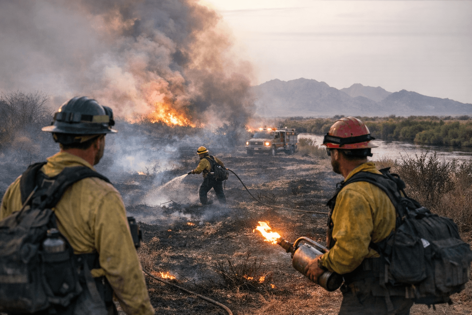
On January 5, 2026, a wildfire dubbed the South Point fire burned within the Cibola National Wildlife Refuge in the area between Imperial County and La Paz County. Federal land managers reported the blaze ultimately reached about 116 acres. The U.S. Fish and Wildlife Service led the response with support from the Bureau of Land Management, and the BLM stated no further growth was expected.
Because the fire occurred on refuge land, federal agencies assumed direct management of suppression and containment. That jurisdictional arrangement shaped the operational response and the allocation of personnel and equipment. Interagency cooperation between U.S. Fish and Wildlife Service and BLM limited the need for immediate county-led suppression, but local emergency services typically remain involved in perimeter monitoring, public safety notifications, and any access or road impacts.
For Yuma County residents, the most direct concerns are public safety, air quality and access to recreation areas. With containment reported and further growth not expected, immediate threats to homes and infrastructure appear limited based on current information. Nonetheless, smoke from even modest fires can affect visibility and respiratory health in downwind communities, and local officials should continue real-time monitoring and communicate with state and federal partners should conditions change.
The incident also highlights policy and budgeting issues for federal land management that carry local implications. Wildfires on refuges and other federal lands draw on U.S. Fish and Wildlife Service and BLM resources, and sustained increases in fire frequency or intensity can strain those agencies and prompt requests for additional appropriations or reallocation of staff. Decisions about fuel management, prescribed burns, invasive species control and cross-boundary preparedness are made at the federal level but have tangible effects for county emergency planning and taxpayer exposure to costs.
Institutional accountability and transparency matter when federal lands intersect with county communities. Yuma County officials and residents have channels to seek updates and demand after-action reviews that clarify cause, containment tactics and cost accounting. Those outcomes inform future engagement at the ballot box and during public meetings, since land management priorities and emergency funding are topics voters and elected officials revisit at county and state levels.
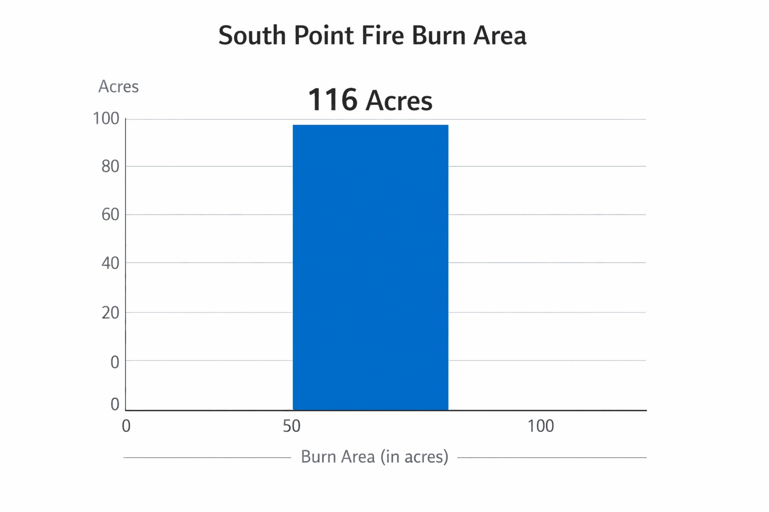
While the South Point fire did not grow beyond the reported 116 acres, the episode is a reminder that cross-jurisdictional fire incidents require clear lines of communication, sustained funding for prevention and suppression, and active civic engagement to ensure local voices are part of decisions that affect safety and land use. Local emergency managers will continue coordinating with federal partners to monitor conditions and report any changes to the public.
This article was produced by Prism’s automated news system from verified source data, official records, and press releases, then run through automated quality and moderation checks before publishing. The system is built and supervised by the people who set the standards it runs under. Read our full AI policy.
Did this article answer your question?


