4.2 Magnitude Quake Shakes Great Falls at 12:41 p.m. Jan. 29
A USGS-confirmed 4.2 magnitude earthquake struck near Great Falls at 12:41 p.m., rattling central Montana and prompting aftershocks; local residents should check for minor damage and stay alert.
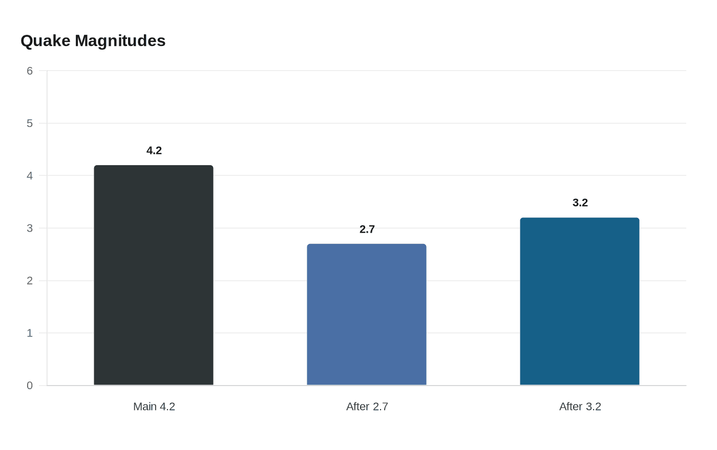
A U.S. Geological Survey-confirmed 4.2 magnitude earthquake struck near Great Falls at 12:41 p.m. on Thursday, Jan. 29, rattling residents across central Montana while causing only minimal damage, officials and residents said. The quake was felt as far north as Kalispell and as far south as Butte, and it prompted at least one small aftershock the same evening and another separate event over the weekend.
KRTV reported the most precise location data available, placing the epicenter about 4.9 miles northeast of Great Falls with a hypocentral depth of about 13.6 miles. KTVH used a rounded figure, saying the quake occurred about seven miles northeast of the city and was close enough to downtown that many residents felt shaking that lasted for up to 10 seconds. Both outlets and the USGS confirmed the 4.2 magnitude measurement.
Damage appeared limited. KTVH noted minimal damage, citing examples such as pictures falling off walls. Malmstrom Air Force Base released a statement confirming that the base and its nuclear missile operations "experienced no impact or damage." City of Great Falls updates and Fairfield Sun-Times reporting likewise indicated no reports of serious injury or structural failure tied to the initial temblor.

Did You Feel It? submissions compiled by the USGS showed reports across a broad area. MTN and KTVH described shaking reported "from Kalispell, Cut Bank, and Shelby in the north to Helena and Butte the south." Residents in Helena, the Lewis and Clark County seat, reported they felt the jolt, underscoring how seismic waves in this part of the state can radiate across long distances.
Seismic activity continued after the initial event. KTVH and MTN reported a 2.7 magnitude aftershock recorded near the same area just before 6:00 p.m. on Thursday. Fairfield Sun-Times and City of Great Falls updates recorded a separate 3.2 magnitude quake on Saturday evening, which the USGS confirmed; no injuries or damage had been reported for that event at the time of the update.
Regional geology provides context for the activity. Andrew Laskowski, associate professor of structural geology at Montana State University, said, "Although earthquakes of that magnitude are quite rare in the Great Falls area, it’s actually a pretty seismically active region in western Montana." Laskowski added that within the Intermountain Seismic Belt, "scientists record an average of eight to ten earthquakes every day, though most are too small to be felt." The USGS noted that "as seismic waves pass through the Earth's crust, they can trigger other quakes hundreds of miles away. This process is known as dynamic stress transfer." The Yellowstone Volcano Observatory reported in early January that Yellowstone Caldera activity "remains at background levels."
For Lewis and Clark County residents, the episode is a reminder that seismic hazards can arrive without warning and that low-level damage such as fallen pictures and unsecured items is the most likely immediate impact from moderate events. Officials and the USGS continue to track aftershocks and provide updates, and local emergency managers will post any new safety guidance as needed.
Know something we missed? Have a correction or additional information?
Submit a Tip